 Old Cumbria Gazetteer
 |
 |
|
| Isel Old Park, Blindcrake | ||
| Isel Old Park | ||
| locality:- | Isel | |
| civil parish:- | Blindcrake (formerly Cumberland) | |
| county:- | Cumbria | |
| locality type:- | park | |
| locality type:- | buildings | |
| coordinates:- | NY19373435 | |
| 1Km square:- | NY1934 | |
| 10Km square:- | NY13 | |
|
|
||
| evidence:- | old map:- OS County Series (Cmd 46 11) placename:- Harrisongate |
|
| source data:- | Maps, County Series maps of Great Britain, scales 6 and 25
inches to 1 mile, published by the Ordnance Survey, Southampton,
Hampshire, from about 1863 to 1948. |
|
|
|
||
| evidence:- | old map:- Donald 1774 (Cmd) placename:- Old Park |
|
| source data:- | Map, hand coloured engraving, 3x2 sheets, The County of Cumberland, scale about 1
inch to 1 mile, by Thomas Donald, engraved and published by Joseph Hodskinson, 29
Arundel Street, Strand, London, 1774.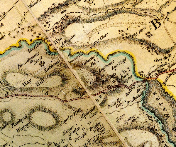 D4NY13SE.jpg "Old Park" block or blocks, labelled in lowercase; a hamlet or just a house item:- Carlisle Library : Map 2 Image © Carlisle Library |
|
|
|
||
| evidence:- | old map:- Crosthwaite 1783-94 (Bas) placename:- Old Park |
|
| source data:- | Map, uncoloured engraving, An Accurate Map of Broadwater or
Bassenthwaite Lake, scale about 3 inches to 1 mile, by Peter
Crosthwaite, Keswick, Cumberland, 1783, version published 1800.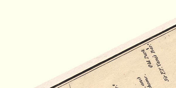 CT6NY13X.jpg "Old Park / Sir F. F. Vane's Bart." item:- Armitt Library : 1959.191.4 Image © see bottom of page |
|
|
|
||
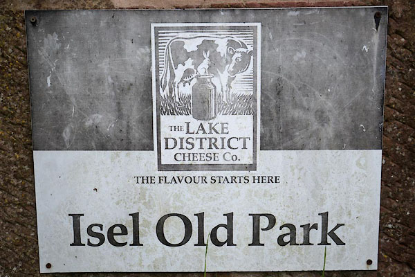 CBJ95.jpg Sign:- "THE LAKE DISTRICT CHEESE Co. / [cow, milk churn and hare] / THE FLAVOUR STARTS HERE / Isel Old Park" (taken 15.8.2014) |
||
|
|
||
 Lakes Guides menu.