 Old Cumbria Gazetteer
 |
 |
|
| Iron Band, Stainmore | ||
| Iron Band | ||
| civil parish:- | Stainmore (formerly Westmorland) | |
| county:- | Cumbria | |
| locality type:- | hill | |
| coordinates:- | NY833186 | |
| 1Km square:- | NY8318 | |
| 10Km square:- | NY81 | |
| altitude:- | 1844 feet | |
| altitude:- | 562m | |
|
|
||
| evidence:- | possibly old map:- Simpson 1746 map (Wmd) placename:- Banderkarth Hill |
|
| source data:- | Map, uncoloured engraving, Westmorland, scale about 8 miles to 1
inch, printed by R Walker, Fleet Lane, London, 1746.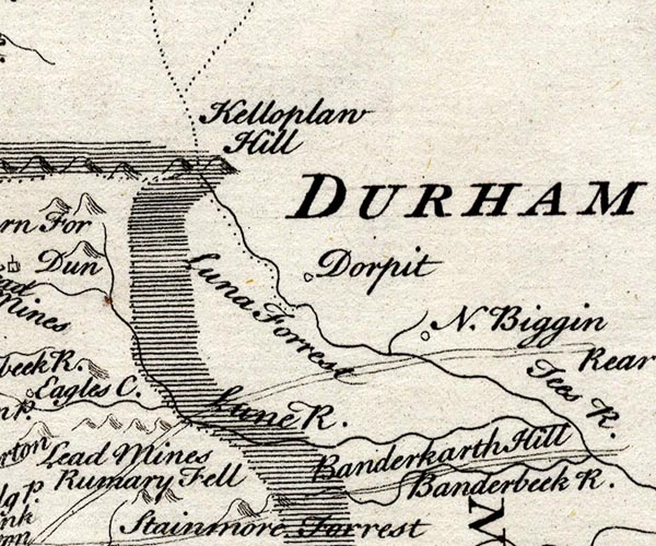 SMP2NYW.jpg "Banderkarth Hill" Drawn along the road. item:- Dove Cottage : 2007.38.59 Image © see bottom of page |
|
|
|
||
 Lakes Guides menu.