 |
 |
|
|
|
|
Hycemoor |
| civil parish:- |
Bootle (formerly Cumberland) |
| county:- |
Cumbria |
| locality type:- |
locality |
| locality type:- |
buildings |
| coordinates:- |
SD09428933 (etc) |
| 1Km square:- |
SD0989 |
| 10Km square:- |
SD08 |
|
|
| evidence:- |
probably old map:- Ford 1839 map
placename:- Highton
|
| source data:- |
Map, uncoloured engraving, Map of the Lake District of
Cumberland, Westmoreland and Lancashire, scale about 3.5 miles
to 1 inch, published by Charles Thurnam, Carlisle, and by R
Groombridge, 5 Paternoster Row, London, 3rd edn 1843.
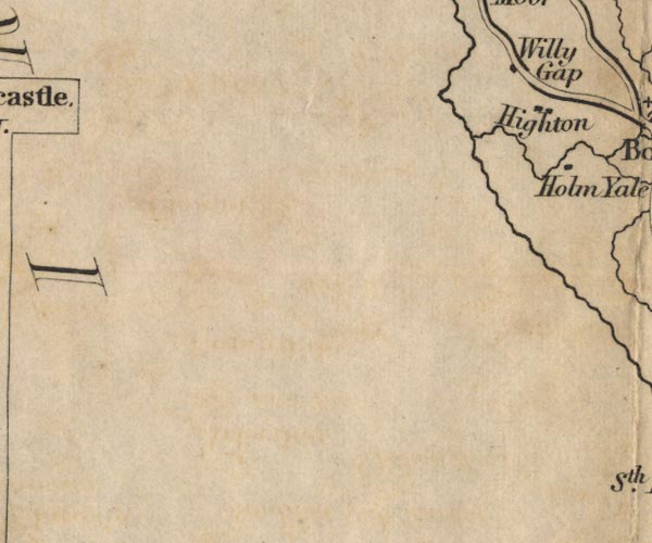
FD02SD08.jpg
"Highton"
item:- JandMN : 100.1
Image © see bottom of page
|
|
|
| places:- |
 |
SD08768919 Ashes (Bootle) |
|
|
|
SD09628958 Beeby Gate (Bootle) once |
|
|
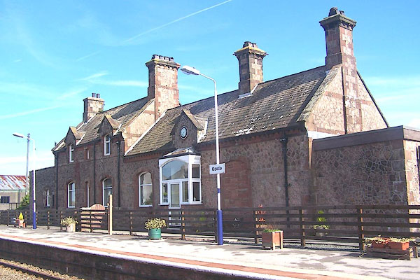 |
SD09368928 Bootle Station (Bootle) |
|
|
|
SD08958892 Craigbank Tarn (Bootle) |
|
|
 |
SD09448931 house, Hycemoor (Bootle) |
|
|
|
SD09088976 Hycemoor House (Bootle) |
|
|
|
SD09278927 Hycemoor School (Bootle) |
|
|
|
SD08628883 Hycemoor Side (Bootle) |
|
|
|
SD09548907 Lane End (Bootle) |
|
|
|
SD09018920 Willy Gap (Bootle) |
|
|
 |
SD09418931 (Bootle) |
|
