 Old Cumbria Gazetteer
 |
 |
|
| Holmrook, Drigg and Carleton | ||
| Holmrook | ||
| civil parish:- | Drigg and Carleton (formerly Cumberland) | |
| civil parish:- | Irton with Santon (formerly Cumberland) | |
| county:- | Cumbria | |
| locality type:- | buildings | |
| coordinates:- | SD07859959 (etc) | |
| 1Km square:- | SD0799 | |
| 10Km square:- | SD09 | |
|
|
||
| evidence:- | old map:- OS County Series (Cmd 82 2) placename:- Holmrook |
|
| source data:- | Maps, County Series maps of Great Britain, scales 6 and 25
inches to 1 mile, published by the Ordnance Survey, Southampton,
Hampshire, from about 1863 to 1948. |
|
|
|
||
| evidence:- | old map:- Ford 1839 map placename:- Holm Rook |
|
| source data:- | Map, uncoloured engraving, Map of the Lake District of
Cumberland, Westmoreland and Lancashire, scale about 3.5 miles
to 1 inch, published by Charles Thurnam, Carlisle, and by R
Groombridge, 5 Paternoster Row, London, 3rd edn 1843.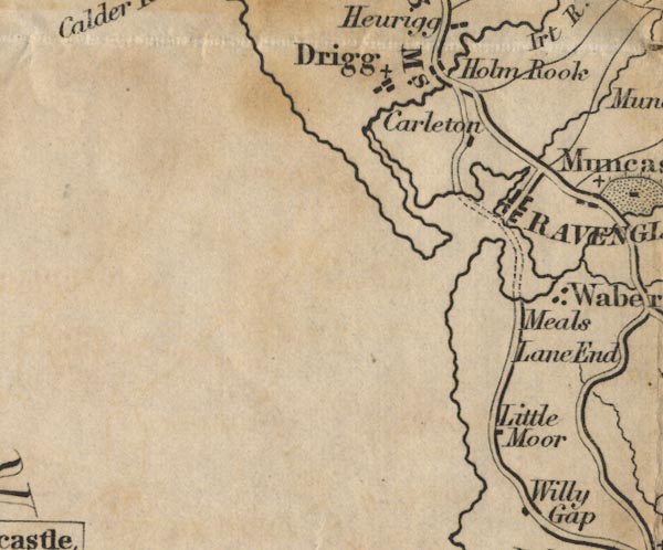 FD02SD09.jpg "Holm Rook" item:- JandMN : 100.1 Image © see bottom of page |
|
|
|
||
| evidence:- | old map:- Post Office 1850s-1900s placename:- Holmrook |
|
| source data:- | Post road maps, General Post Office Circulation Map for England
and Wales, for the General Post Office, London, 1850s-1900s. click to enlarge click to enlargePOF7Cm.jpg "Holmrook" map date 1909 |
|
|
|
||
| evidence:- | old map:- Post Office 1850s-1900s placename:- Holm Rook |
|
| source data:- | Post road maps, General Post Office Circulation Map for England
and Wales, for the General Post Office, London, 1850s-1900s. click to enlarge click to enlargePOF2Cm.jpg "Holm Rook" map date 1890 |
|
|
|
||
| evidence:- | old map:- Post Office 1850s-1900s placename:- Holm Rook |
|
| source data:- | Post road maps, General Post Office Circulation Map for England
and Wales, for the General Post Office, London, 1850s-1900s. click to enlarge click to enlargePOF8Cm.jpg "Holm Rook" map date 1873 |
|
|
|
||
| evidence:- | old map:- Post Office 1850s-1900s placename:- Holm Rook |
|
| source data:- | Post road maps, General Post Office Circulation Map for England
and Wales, for the General Post Office, London, 1850s-1900s. click to enlarge click to enlargePOF9Cm.jpg "Holm Rook" map date 1863 |
|
|
|
||
| :- |
images courtesy of the British Postal Museum and Hampshire CC Museums |
|
|
|
||
| evidence:- | old print:- Rumney 1899 placename:- Holmrook |
|
| source data:- | Print, halftone photograph, Avenue near Holmrook, Great Gable in Distance, Cumberland,
published by George Philip and Son, 32 Fleet Street, London, and Liverpool, 1899.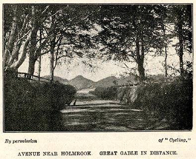 click to enlarge click to enlargeRUM125.jpg On p.72 of the Cyclist's Guide to the English Lake District, by A W Rumney. printed at bottom:- "By permission of "Cyclist." / AVENUE NEAR HOLMROOK. GREAT GABLE IN DISTANCE." item:- JandMN : 147.26 Image © see bottom of page |
|
|
|
||
| evidence:- | old print:- Rumney 1899 |
|
| source data:- | Print, halftone photograph, Holmrook, Cumberland, published by George Philip and Son,
32 Fleet Street, London, and Liverpool, 1899.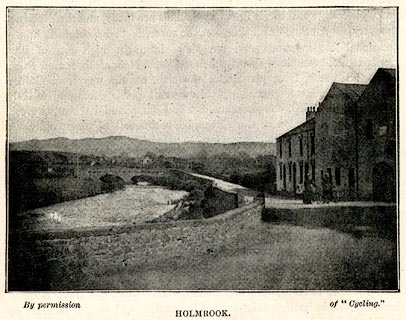 click to enlarge click to enlargeRUM133.jpg On p.86 of the Cyclist's Guide to the English Lake District, by A W Rumney. printed at bottom:- "By permission of "Cycling." / HOLMROOK." item:- JandMN : 147.34 Image © see bottom of page |
|
|
|
||
 Lakes Guides menu.