 Old Cumbria Gazetteer
 |
 |
|
| Holme Fell, Coniston | ||
| Holme Fell | ||
| Holm Fell | ||
| civil parish:- | Coniston (formerly Lancashire) | |
| civil parish:- | Skelwith (formerly Lancashire) (?) | |
| county:- | Cumbria | |
| locality type:- | hill | |
| locality type:- | fell | |
| coordinates:- | NY315006 (etc) | |
| 1Km square:- | NY3100 | |
| 10Km square:- | NY30 | |
| altitude:- | 994 feet | |
| altitude:- | 317m | |
|
|
||
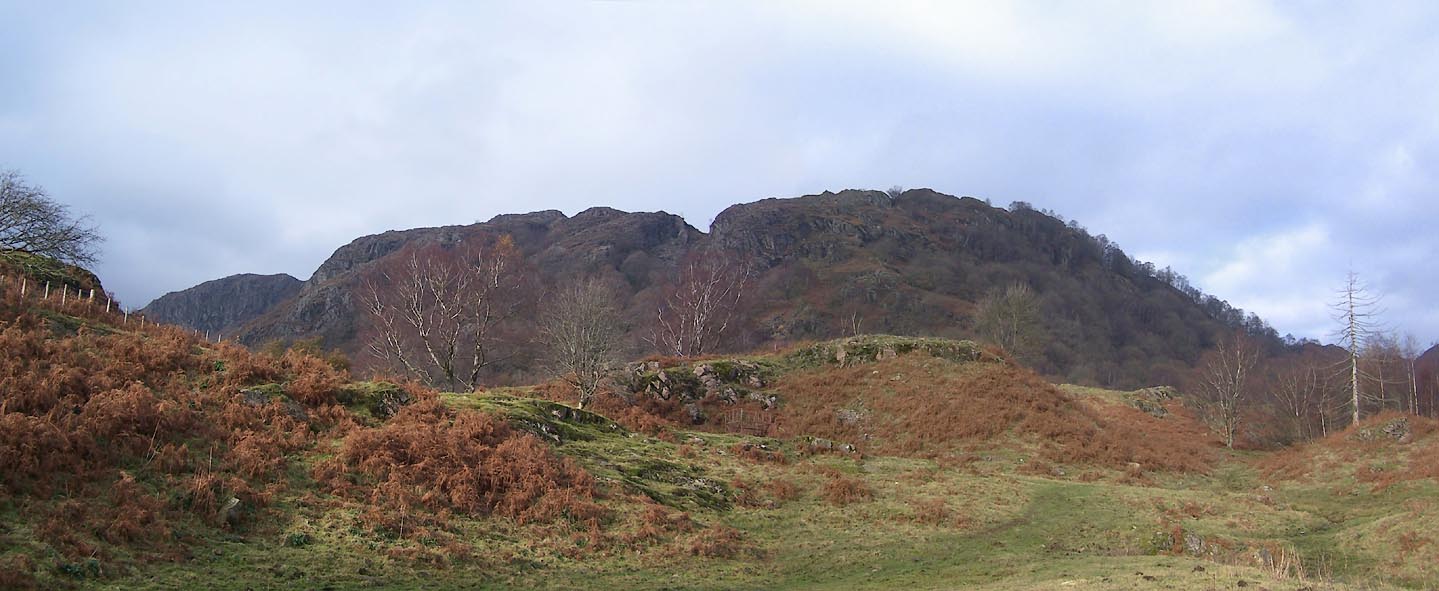
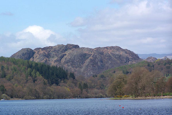 BLZ72.jpg (taken 28.4.2006) 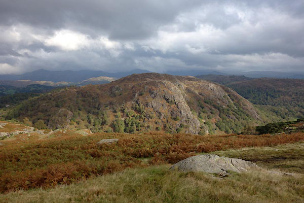 BZN32.jpg (taken 15.10.2103) |
||
|
|
||
| evidence:- | old map:- OS County Series (Lan 1 12) placename:- Holme Fell |
|
| source data:- | Maps, County Series maps of Great Britain, scales 6 and 25
inches to 1 mile, published by the Ordnance Survey, Southampton,
Hampshire, from about 1863 to 1948. |
|
|
|
||
| evidence:- | outline view:- Otley 1823 (8th edn 1849) placename:- Holm Fell |
|
| source data:- | Engraving, outline view of mountains, Coniston Water from near Bank Ground, drawn
by T Binns, engraved by O Jewitt, opposite p.8 of A Descriptive Guide of the English
Lakes, by Jonathan Otley, 8th edition, 1849.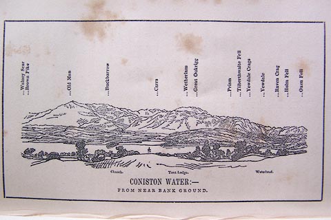 click to enlarge click to enlargeO80E05.jpg item:- Armitt Library : A1180.6 Image © see bottom of page |
|
|
|
||
| evidence:- | outline view:- Otley 1823 (5th edn 1834) placename:- Holm Fell |
|
| source data:- | Print, woodcut outline view, A Group of Mountains, seen from
Helvellyn, by Jonathan Otley, Keswick, Cumberland, 1830.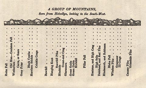 click to enlarge click to enlargeOT2E09.jpg Printed on p.63 of A Concise Description of the English Lakes, by Jonathan Otley, 5th edition, 1834. "A GROUP OF MOUNTAINS, Seen from Helvellyn, looking to the South-West." "Holm Fell / Old Man - Coniston Fell / Wetherlam / Carrs, or Scars / Gray Friar / Black Combe / Harrison Stickle / Crinkle Crags / Bowfell / Hanging Knot / Scawfell Pike / Hindside / Great-end Crag / Glaramara / Great Gable / Green Gable / Kirkfell / Pillar Fell / Honister, and High Crag / High Stile / Dalehead, and Red Pike / Hindscarth, and Robinson / Blake Fell / Witeless Pike / Grasmoor / Ill Crags / Causey Pike / Grisedale Pike" item:- JandMN : 48.10 Image © see bottom of page |
|
|
|
||
 Click to enlarge BVR66.jpg From near Tarn Hows. (taken 15.11.2011) |
||
|
|
||
 Lakes Guides menu.