 Old Cumbria Gazetteer
 |
 |
|
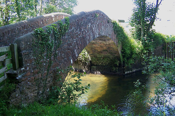
| Holme Bridge, Drigg and Carleton | ||
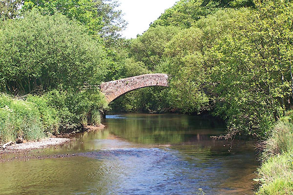
| Holme Bridge | ||
| site name:- | Irt, River | |
| civil parish:- | Drigg and Carleton (formerly Cumberland) | |
| county:- | Cumbria | |
| locality type:- | packhorse bridge | |
| locality type:- | bridge | |
| coordinates:- | SD07709872 | |
| 1Km square:- | SD0798 | |
| 10Km square:- | SD09 | |
|
|
||
 BNT98.jpg (taken 5.6.2007) 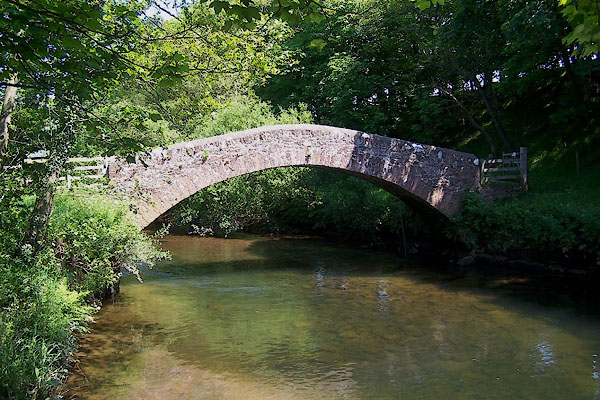 BNU01.jpg (taken 5.6.2007) |
||
|
|
||
| evidence:- | old map:- OS County Series (Cmd 82) placename:- Holme Bridge item:- tide |
|
| source data:- | Maps, County Series maps of Great Britain, scales 6 and 25
inches to 1 mile, published by the Ordnance Survey, Southampton,
Hampshire, from about 1863 to 1948. "Holme Bridge / Foot Bridge / Ordinary Spring tides flow to this bridge" |
|
|
|
||
| evidence:- | probably old map:- Saxton 1579 |
|
| source data:- | Map, hand coloured engraving, Westmorlandiae et Cumberlandiae Comitatus ie Westmorland
and Cumberland, scale about 5 miles to 1 inch, by Christopher Saxton, London, engraved
by Augustinus Ryther, 1576, published 1579-1645.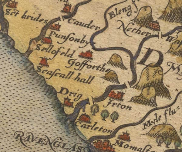 Sax9NY00.jpg By Drig. item:- private collection : 2 Image © see bottom of page |
|
|
|
||
| evidence:- | possibly old map:- Mercator 1595 (edn?) placename:- |
|
| source data:- | Map, hand coloured engraving, Northumbria, Cumberlandia, et
Dunelmensis Episcopatus, ie Northumberland, Cumberland and
Durham etc, scale about 6.5 miles to 1 inch, by Gerard Mercator,
Duisberg, Germany, about 1595. MER8CumE.jpg "" double across a stream; bridge, over the Irt??? item:- JandMN : 169 Image © see bottom of page |
|
|
|
||
| evidence:- | probably old map:- Speed 1611 (Cmd) |
|
| source data:- | Map, hand coloured engraving, Cumberland and the Ancient Citie
Carlile Described, scale about 4 miles to 1 inch, by John Speed,
1610, published by J Sudbury and George Humble, Popes Head
Alley, London, 1611-12.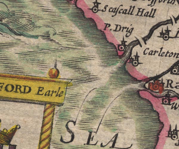 SP11SD09.jpg double line across the Irt item:- private collection : 16 Image © see bottom of page |
|
|
|
||
| evidence:- | probably old map:- Jansson 1646 |
|
| source data:- | Map, hand coloured engraving, Cumbria and Westmoria, ie
Cumberland and Westmorland, scale about 3.5 miles to 1 inch, by
John Jansson, Amsterdam, Netherlands, 1646.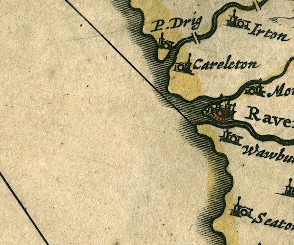 JAN3SD09.jpg Double line crossing the stream. item:- JandMN : 88 Image © see bottom of page |
|
|
|
||
| evidence:- | probably old map:- Sanson 1679 |
|
| source data:- | Map, hand coloured engraving, Ancien Royaume de Northumberland
aujourdhuy Provinces de Nort, ie the Ancient Kingdom of
Northumberland or the Northern Provinces, scale about 9.5 miles
to 1 inch, by Nicholas Sanson, Paris, France, 1679. click to enlarge click to enlargeSAN2Cm.jpg double line over a stream; bridge item:- Dove Cottage : 2007.38.15 Image © see bottom of page |
|
|
|
||
| evidence:- | probably old map:- Morden 1695 (Cmd) |
|
| source data:- | Map, uncoloured engraving, Cumberland, scale about 4 miles to 1
inch, by Robert Morden, 1695, published by Abel Swale, the
Unicorn, St Paul's Churchyard, Awnsham, and John Churchill, the
Black Swan, Paternoster Row, London, 1695-1715.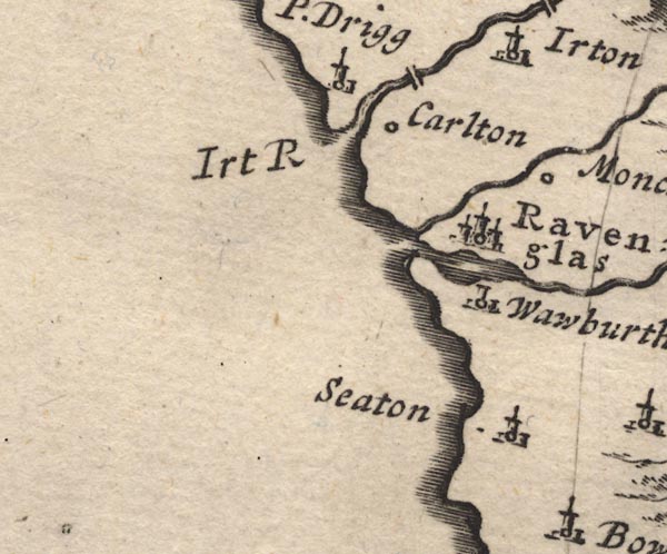 MD12SD09.jpg Double line over a stream, over the Irt. item:- JandMN : 90 Image © see bottom of page |
|
|
|
||
| evidence:- | probably old map:- Badeslade 1742 placename:- |
|
| source data:- | Map, uncoloured engraving, A Map of Cumberland North from
London, scale about 11 miles to 1 inch, with descriptive text,
by Thomas Badeslade, London, engraved and published by William
Henry Toms, Union Court, Holborn, London, 1742. click to enlarge click to enlargeBD10.jpg "" double line across a stream at Drigg item:- JandMN : 115 Image © see bottom of page |
|
|
|
||
| evidence:- | probably old map:- Bowen and Kitchin 1760 |
|
| source data:- | Map, hand coloured engraving, A New Map of the Counties of
Cumberland and Westmoreland Divided into their Respective Wards,
scale about 4 miles to 1 inch, by Emanuel Bowen and Thomas
Kitchin et al, published by T Bowles, Robert Sayer, and John
Bowles, London, 1760.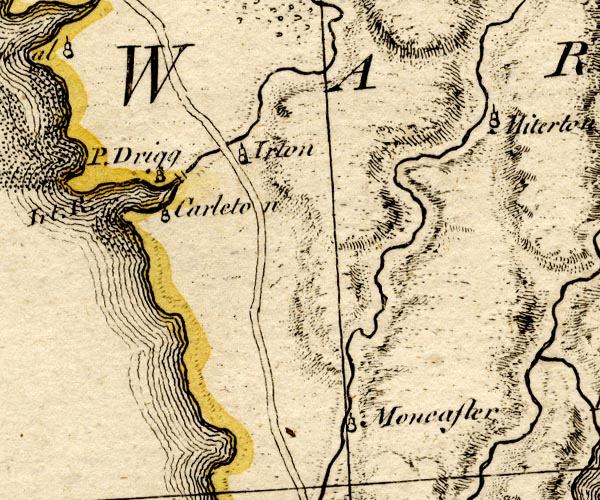 BO18SD09.jpg road across the Irt item:- Armitt Library : 2008.14.10 Image © see bottom of page |
|
|
|
||
 BNU02.jpg (taken 5.6.2007) |
||
|
|
||
| :- |
39 foot span, 70 ins between parapets. On packhorse route from Ravenglass to Drigg
and north. |
|
| Hinchcliffe, Ernest: 1994: Packhorse Bridges of England: Cicerone Press (Milnthorpe,
Cumbria) |
||
|
|
||
 Lakes Guides menu.