 |
 |
   |
|
|
|
High Water Head |
|
|
| civil parish:- |
Coniston (formerly Lancashire) |
| county:- |
Cumbria |
| locality type:- |
buildings |
| locality type:- |
locality |
| coordinates:- |
SD31659828 |
| 1Km square:- |
SD3198 |
| 10Km square:- |
SD39 |
|
|
|

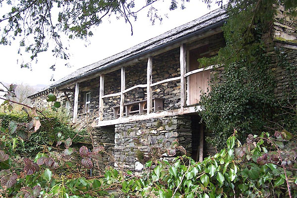
BLV66.jpg 'Spinning gallery'.
(taken 13.4.2006)

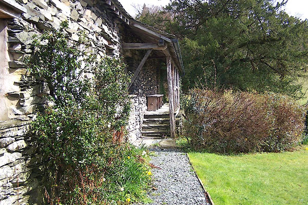
BLV67.jpg 'Spinning gallery'.
(taken 13.4.2006)
|
|
|
| evidence:- |
old map:- OS County Series (Lan 4 4)
placename:- Low Water Head Cottages
|
| source data:- |
Maps, County Series maps of Great Britain, scales 6 and 25
inches to 1 mile, published by the Ordnance Survey, Southampton,
Hampshire, from about 1863 to 1948.
|
|
|
| evidence:- |
old map:- OS County Series (Lan 4)
placename:- Low Water Head
|
| source data:- |
Maps, County Series maps of Great Britain, scales 6 and 25
inches to 1 mile, published by the Ordnance Survey, Southampton,
Hampshire, from about 1863 to 1948.
|
|
|
| evidence:- |
probably old text:- Green 1810
placename:- Coniston Waterhead
|
| source data:- |
Set of prints, soft ground etchings, Sixty Studies from Nature,
by William Green, Ambleside, Westmorland, drawn 1808-10,
published 1810.
 goto source goto source
page 4:- "..."
"BUILDINGS AT CONISTON WATERHEAD."
"The New Inn at Waterhead stands near the head of the lake, and this scene is upon
the road from the church and"
page 5:- "village of Coniston, by that inn to Ambleside; it is about two or three hundred yards
from the inn, and that distance from the mansion house, called Waterhead, the property
of --- Knott, Esq. and which is still nearer Ambleside."
"An artist will make various useful selections from these buildings, under different
points of view, and he may gain advantage from studies of the local colouring."
|
|
|
| evidence:- |
outline view:- Otley 1823 (8th edn 1849)
placename:- Waterhead
|
| source data:- |
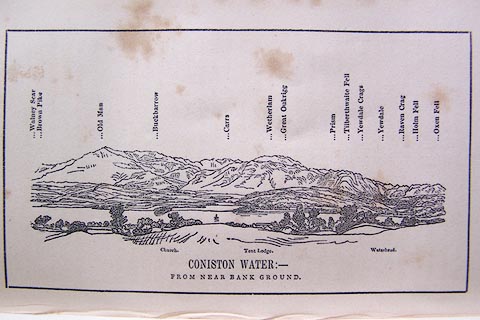
Engraving, outline view of mountains, Coniston Water from near Bank Ground, drawn
by T Binns, engraved by O Jewitt, opposite p.8 of A Descriptive Guide of the English
Lakes, by Jonathan Otley, 8th edition, 1849.
 click to enlarge click to enlarge
O80E05.jpg
item:- Armitt Library : A1180.6
Image © see bottom of page
|
|
|
| evidence:- |
database:- Listed Buildings 2010
|
| source data:- |
courtesy of English Heritage
"BARN TO EAST OF HIGH WATERHEAD / / B 5285 / CONISTON / SOUTH LAKELAND / CUMBRIA /
II / 76795 / SD3165098285"
|
|
|


 goto source
 click to enlarge