 Old Cumbria Gazetteer
 |
 |
|
| Headless Cross, Cartmel | ||
| Headless Cross | ||
| locality:- | Cartmel | |
| civil parish:- | Lower Allithwaite (formerly Lancashire) | |
| county:- | Cumbria | |
| locality type:- | buildings | |
| locality type:- | locality | |
| locality type:- | road junction (?) | |
| coordinates:- | SD379783 | |
| 1Km square:- | SD3778 | |
| 10Km square:- | SD37 | |
|
|
||
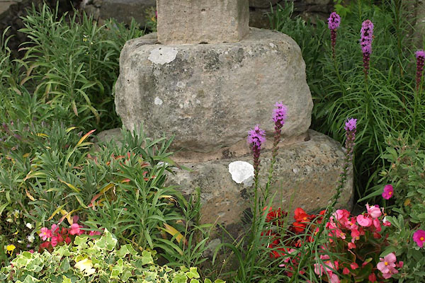 BZB27.jpg The medieval cross base. (taken 9.8.2013) 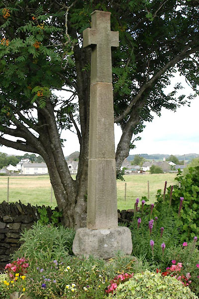 BZB26.jpg (taken 9.8.2013) |
||
|
|
||
| evidence:- | old map:- OS County Series (Lan 17 3) placename:- Headless Cross |
|
| source data:- | Maps, County Series maps of Great Britain, scales 6 and 25
inches to 1 mile, published by the Ordnance Survey, Southampton,
Hampshire, from about 1863 to 1948. |
|
|
|
||
| evidence:- | database:- Listed Buildings 2010 |
|
| source data:- | courtesy of English Heritage "CROSS AT HEADLESS CROSS TO NORTH OF JUNCTION / / / LOWER ALLITHWAITE / SOUTH LAKELAND / CUMBRIA / II / 76969 / SD3799378386" |
|
| source data:- | courtesy of English Heritage "Cross. Medieval base and C19 cross. Stone. Square base and plinth of 3 steps with chamfered angles. Cross has short arms." |
|
|
|
||
 Lakes Guides menu.