 Old Cumbria Gazetteer
 |
 |
|
| Hayton Castle, Hayton | ||
| Hayton Castle | ||
| locality:- | Hayton | |
| civil parish:- | Hayton and Mealo (formerly Cumberland) | |
| county:- | Cumbria | |
| locality type:- | castle | |
| coordinates:- | NY11004175 | |
| 1Km square:- | NY1141 | |
| 10Km square:- | NY14 | |
|
|
||
| evidence:- | old map:- OS County Series (Cmd 35 7) placename:- Hayton Castle |
|
| source data:- | Maps, County Series maps of Great Britain, scales 6 and 25
inches to 1 mile, published by the Ordnance Survey, Southampton,
Hampshire, from about 1863 to 1948. |
|
|
|
||
| evidence:- | old map:- Saxton 1579 placename:- Haton Castle |
|
| source data:- | Map, hand coloured engraving, Westmorlandiae et Cumberlandiae Comitatus ie Westmorland
and Cumberland, scale about 5 miles to 1 inch, by Christopher Saxton, London, engraved
by Augustinus Ryther, 1576, published 1579-1645.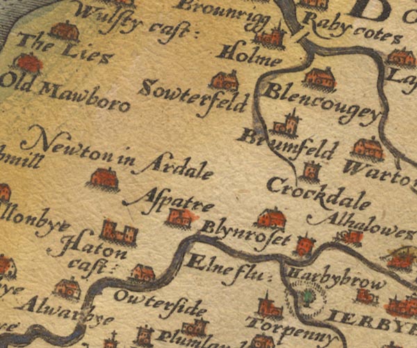 Sax9NY14.jpg Building with two towers, symbol for a castle. "Haton cast:" item:- private collection : 2 Image © see bottom of page |
|
|
|
||
| evidence:- | old map:- Mercator 1595 (edn?) placename:- Haton Castle |
|
| source data:- | Map, hand coloured engraving, Northumbria, Cumberlandia, et
Dunelmensis Episcopatus, ie Northumberland, Cumberland and
Durham etc, scale about 6.5 miles to 1 inch, by Gerard Mercator,
Duisberg, Germany, about 1595.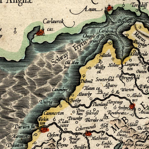 MER8CumB.jpg "Haton ca." circle, building and tower item:- JandMN : 169 Image © see bottom of page |
|
|
|
||
| evidence:- | old map:- Speed 1611 (Cmd) placename:- Haton Castle |
|
| source data:- | Map, hand coloured engraving, Cumberland and the Ancient Citie
Carlile Described, scale about 4 miles to 1 inch, by John Speed,
1610, published by J Sudbury and George Humble, Popes Head
Alley, London, 1611-12. SP11NY13.jpg "Haton cast" circle, building, towers item:- private collection : 16 Image © see bottom of page |
|
|
|
||
| evidence:- | old map:- Jenner 1643 placename:- Hatton Castle |
|
| source data:- | Tables of distances with a maps, Westmerland, scale about 16
miles to 1 inch, and Cumberland, scale about 21 miles to 1 inch,
published by Thomas Jenner, London, 1643; published 1643-80. JEN4Sq.jpg "Hatton ca" circle |
|
|
|
||
| evidence:- | old map:- Jansson 1646 placename:- Haton Castle |
|
| source data:- | Map, hand coloured engraving, Cumbria and Westmoria, ie
Cumberland and Westmorland, scale about 3.5 miles to 1 inch, by
John Jansson, Amsterdam, Netherlands, 1646.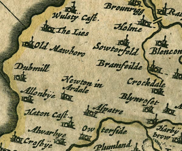 JAN3NY14.jpg "Haton Cast." Buildings and tower with flag. item:- JandMN : 88 Image © see bottom of page |
|
|
|
||
| evidence:- | old map:- Sanson 1679 placename:- Haton Castle |
|
| source data:- | Map, hand coloured engraving, Ancien Royaume de Northumberland
aujourdhuy Provinces de Nort, ie the Ancient Kingdom of
Northumberland or the Northern Provinces, scale about 9.5 miles
to 1 inch, by Nicholas Sanson, Paris, France, 1679. click to enlarge click to enlargeSAN2Cm.jpg "Haton C." circle, building and tower, flag; town? item:- Dove Cottage : 2007.38.15 Image © see bottom of page |
|
|
|
||
| evidence:- | old map:- Morden 1695 (Cmd) placename:- Hayton Castle |
|
| source data:- | Map, uncoloured engraving, Cumberland, scale about 4 miles to 1
inch, by Robert Morden, 1695, published by Abel Swale, the
Unicorn, St Paul's Churchyard, Awnsham, and John Churchill, the
Black Swan, Paternoster Row, London, 1695-1715.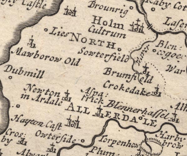 MD12NY14.jpg "Hayton Cast" Circle, building with two towers. item:- JandMN : 90 Image © see bottom of page |
|
|
|
||
| evidence:- | descriptive text:- Simpson 1746 placename:- Hayton Castle |
|
| source data:- | Atlas, three volumes of maps and descriptive text published as
'The Agreeable Historian, or the Compleat English Traveller
...', by Samuel Simpson, 1746. goto source goto source"... Hayton Castle, Sir Richard Musgave's. ..." |
|
|
|
||
| evidence:- | old map:- Bowen and Kitchin 1760 placename:- Hatton Castle |
|
| source data:- | Map, hand coloured engraving, A New Map of the Counties of
Cumberland and Westmoreland Divided into their Respective Wards,
scale about 4 miles to 1 inch, by Emanuel Bowen and Thomas
Kitchin et al, published by T Bowles, Robert Sayer, and John
Bowles, London, 1760.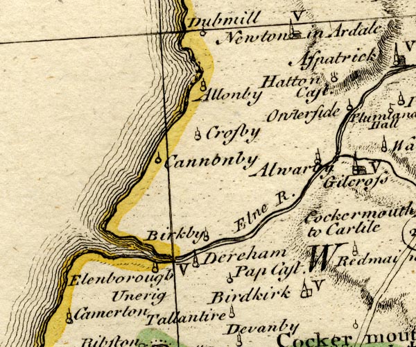 BO18NY03.jpg "Hatton Cast." circle and line or flag? item:- Armitt Library : 2008.14.10 Image © see bottom of page |
|
|
|
||
| evidence:- | old map:- Donald 1774 (Cmd) |
|
| source data:- | Map, hand coloured engraving, 3x2 sheets, The County of Cumberland, scale about 1
inch to 1 mile, by Thomas Donald, engraved and published by Joseph Hodskinson, 29
Arundel Street, Strand, London, 1774.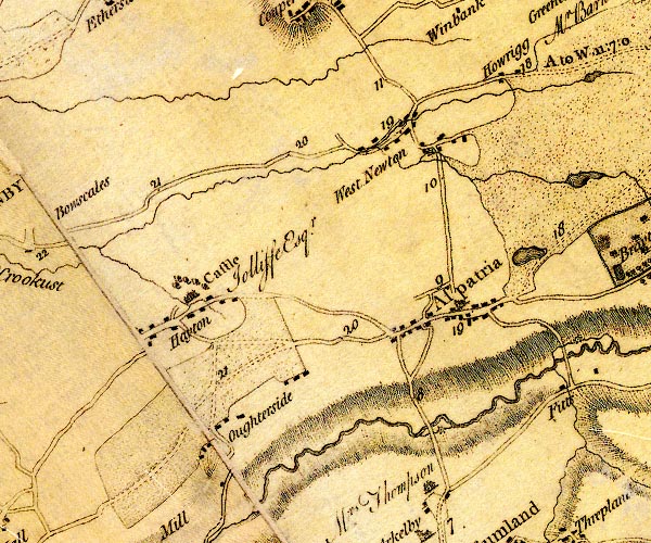 D4NY14SW.jpg "Castle / Jolliffe Esqr." house at Hayton item:- Carlisle Library : Map 2 Image © Carlisle Library |
|
|
|
||
| evidence:- | road book:- Cary 1798 (2nd edn 1802) placename:- Hayton Castle |
|
| source data:- | Road book, itineraries, Cary's New Itinerary, by John Cary, 181
Strand, London, 2nd edn 1802. goto source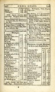 click to enlarge click to enlargeC38557.jpg page 557-558 "Between Aspatria and Crosby, on r. is Hayton Castle, - Joliffe, Esq." item:- JandMN : 228.2 Image © see bottom of page |
|
|
|
||
| evidence:- | old text:- Gents Mag |
|
| source data:- | Magazine, The Gentleman's Magazine or Monthly Intelligencer or
Historical Chronicle, published by Edward Cave under the
pseudonym Sylvanus Urban, and by other publishers, London,
monthly from 1731 to 1922. goto source Gentleman's Magazine 1819 part 1 p.507 From the Compendium of County History:- "Musgrave, Sir William, 6th bart. antiquary and collector, Hayton castle, 1735." |
|
|
|
||
| evidence:- | database:- Listed Buildings 2010 placename:- Hayton Castle |
|
| source data:- | courtesy of English Heritage "HAYTON CASTLE / / / HAYTON AND MEALO / ALLERDALE / CUMBRIA / I / 411489 / NY1103441730" |
|
| source data:- | courtesy of English Heritage "Castle now house. C14 or C15 tower, with C16 and C17 additions for the Musgrave family. Large blocks of dressed red sandstone, with stone parapet, on chamfered plinth. Graduated greenslate roof with sandstone chimney stacks. 2 storeys with attic, 8 bays of double span. Core of tower to rear with flanking C16 extensions in an L-shape; the angle of the L infilled in C17 to form large rectangular building. C19 top-glazed panelled door in late C17 bolection architrave under segmental pediment containing carved heads and urn with shaped finials. Left bays have C16 double-chamfered cross-mullioned windows with glazing bars under hoodmoulds, and smaller 3-light attic windows. Right bays have sash windows in late C17 architraves. Left return has plank door within C20 wooden porch, this and the windows in C16 surrounds under hoodmoulds; some windows have cross mullions and glazing bars. Right return has sash windows in late C17 architraves. Rear of 4 gables,the oldest part supported by 2 large wedge-shaped buttresses. C15-C17 windows at different levels, some under hoodmoulds. Coat-of-arms on left side wall and internal armorial panel on stairs dated 1609 and both to Musgrave family. Thick internal walls containing many medieval and C16 features fully described and planned in Transactions of Cumberland & Westmorland Antiquarian &Archaeological Society, new series, xiii, pp.234-243." |
|
|
|
||
| evidence:- | database:- Listed Buildings 2010 |
|
| source data:- | courtesy of English Heritage "STABLE BLOCK NORTH OF HAYTON CASTLE / / / HAYTON AND MEALO / ALLERDALE / CUMBRIA / II / 411490 / NY1100341768" |
|
|
|
||
| evidence:- | database:- Listed Buildings 2010 |
|
| source data:- | courtesy of English Heritage "GARDEN STEPS WEST OF HAYTON CASTLE / / / HAYTON AND MEALO / ALLERDALE / CUMBRIA / II / 411492 / NY1099241725" |
|
|
|
||
 sundial sundial |
||
|
|
||
| hearsay:- |
Beware confusion, there are two sites. There is a mansion of 17th-18th century inclosing
a 15th century building. And there is another site, north of the village, with the
remains of a large motte, double ramparts, and ditch, from the 11th century. |
|
|
|
||
Lakes Guides menu.