 Old Cumbria Gazetteer
 |
 |
|
| Hawcoat, Barrow-in-Furness | ||
| Hawcoat | ||
| locality:- | Barrow-in-Furness | |
| civil parish:- | Barrow-in-Furness (formerly Lancashire) | |
| county:- | Cumbria | |
| locality type:- | buildings | |
| coordinates:- | SD207720 (etc) | |
| 1Km square:- | SD2072 | |
| 10Km square:- | SD27 | |
|
|
||
| evidence:- | old map:- OS County Series (Lan 21 4) placename:- Hawcoat |
|
| source data:- | Maps, County Series maps of Great Britain, scales 6 and 25
inches to 1 mile, published by the Ordnance Survey, Southampton,
Hampshire, from about 1863 to 1948. |
|
|
|
||
| evidence:- | old map:- Otley 1818 placename:- Hawcoat |
|
| source data:- | Map, uncoloured engraving, The District of the Lakes,
Cumberland, Westmorland, and Lancashire, scale about 4 miles to
1 inch, by Jonathan Otley, 1818, engraved by J and G Menzies,
Edinburgh, Scotland, published by Jonathan Otley, Keswick,
Cumberland, et al, 1833.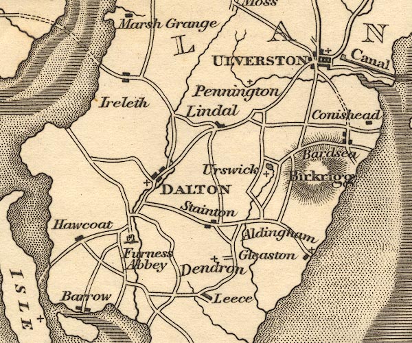 OT02SD27.jpg item:- JandMN : 48.1 Image © see bottom of page |
|
|
|
||
| evidence:- | perhaps old map:- Hydrographic Office 1850s onwards placename:- Hawcoat Highlands |
|
| source data:- | Chart, uncoloured engraving, England West Coast sheet XI,
Fleetwood to the Firth of Solway, scale about 2.5 miles to 1
inch, by H Denham and G Williams, 1846, engraved by J and C
Walker, published by the Hydrographic Office, 1850 corrected to
1863 coast view on Admiralty chart 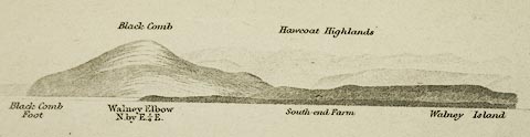 click to enlarge click to enlargeHY01P4.jpg "Hawcoat Highlands" item:- Carlisle Library : Map 93 Image © Carlisle Library |
|
|
|
||
| evidence:- | old map:- Garnett 1850s-60s H placename:- Hawcoat |
|
| source data:- | Map of the English Lakes, in Cumberland, Westmorland and
Lancashire, scale about 3.5 miles to 1 inch, published by John
Garnett, Windermere, Westmorland, 1850s-60s.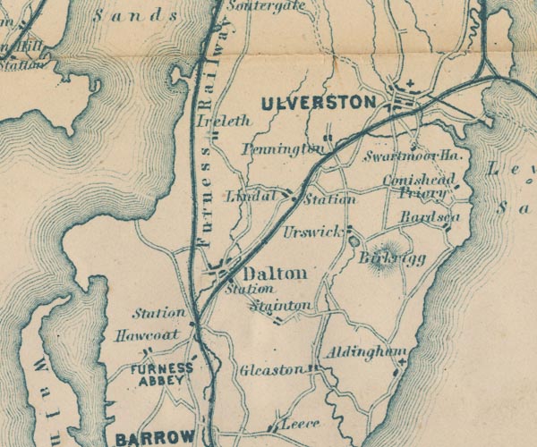 GAR2SD27.jpg "Hawcoat" blocks, settlement item:- JandMN : 82.1 Image © see bottom of page |
|
|
|
||
| Paley and Austin series | ||
| person:- | architect : Paley, Edward G |
|
| person:- | architect : Austin, Hubert J |
|
| place:- | Dale Ghyll / buildings | |
| date:- | ||
| New house; since demolished. |
||
|
|
||
 Lakes Guides menu.