 Old Cumbria Gazetteer
 |
 |
|
| Morland Hall, Morland | ||
| Morland Hall | ||
| locality:- | Morland | |
| civil parish:- | Morland (formerly Westmorland) | |
| county:- | Cumbria | |
| locality type:- | buildings | |
| coordinates:- | NY606228 | |
| 1Km square:- | NY6022 | |
| 10Km square:- | NY62 | |
|
|
||
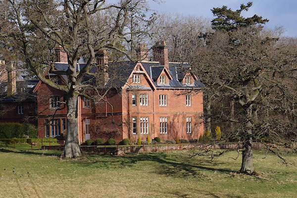 CCM75.jpg (taken 27.2.2015) |
||
|
|
||
| evidence:- | old map:- Jefferys 1770 (Wmd) |
|
| source data:- | Map, 4 sheets, The County of Westmoreland, scale 1 inch to 1
mile, surveyed 1768, and engraved and published by Thomas
Jefferys, London, 1770.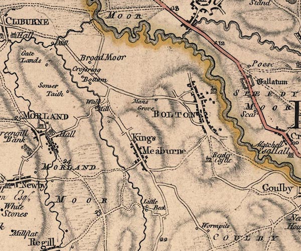 J5NY62SW.jpg "Hall" house item:- National Library of Scotland : EME.s.47 Image © National Library of Scotland |
|
|
|
||
| evidence:- | old map:- Post Office 1850s-1900s placename:- Morland Hall |
|
| source data:- | Post road maps, General Post Office Circulation Map for England
and Wales, for the General Post Office, London, 1850s-1900s.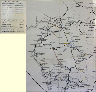 click to enlarge click to enlargePOF8Cm.jpg "Morland Hall" map date 1873 |
|
|
|
||
| :- |
images courtesy of the British Postal Museum and Hampshire CC Museums |
|
|
|
||
| hearsay:- |
A victorian house, about 1870, just outside the village on the way to Appleby. This
was built with Lancashire cotton money, but was soon acquired by the Torbock family
of Crossrigg Hall who had made their money as ships' chandlers in Sunderland, and
did particularly well out of the Great War. The somewhat eccentric Dick Torbock allowed
the place to fall into complete ruination after World War II. During the World War
II it was a convalescent home for soldiers, including Harry Secombe. Much more recently,
it was totally rebuilt to its original design. |
|
|
|
||
 Lakes Guides menu.