 Old Cumbria Gazetteer
 |
 |
|
| hall, Ambleside | ||
| Ambleside Hall | ||
| locality:- | Ambleside | |
| civil parish:- | Lakes (formerly Westmorland) | |
| county:- | Cumbria | |
| locality type:- | buildings | |
| 1Km square:- | NY3704 (?) | |
| 10Km square:- | NY30 | |
| references:- | Bowen 1720 |
|
|
|
||
| evidence:- | probably old map:- Bowen and Kitchin 1760 |
|
| source data:- | Map, hand coloured engraving, A New Map of the Counties of
Cumberland and Westmoreland Divided into their Respective Wards,
scale about 4 miles to 1 inch, by Emanuel Bowen and Thomas
Kitchin et al, published by T Bowles, Robert Sayer, and John
Bowles, London, 1760.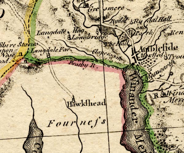 BO18SD29.jpg "The Hall" circle item:- Armitt Library : 2008.14.10 Image © see bottom of page |
|
|
|
||
| evidence:- | old map:- Jefferys 1770 (Wmd) |
|
| source data:- | Map, 4 sheets, The County of Westmoreland, scale 1 inch to 1
mile, surveyed 1768, and engraved and published by Thomas
Jefferys, London, 1770.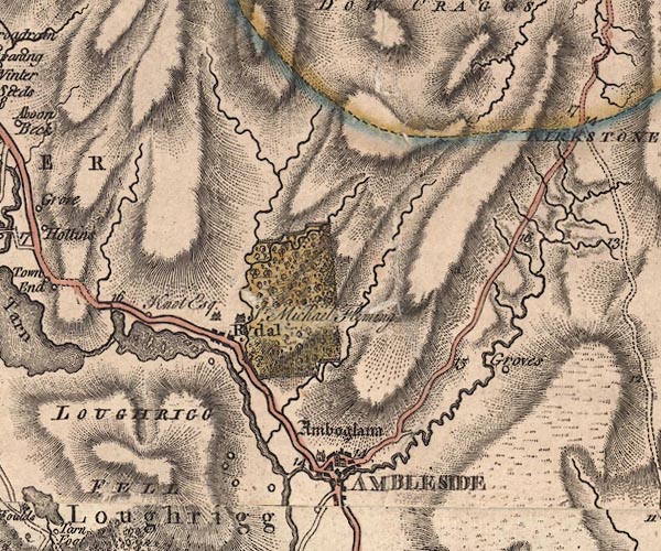 J5NY30NE.jpg house item:- National Library of Scotland : EME.s.47 Image © National Library of Scotland |
|
|
|
||
| notes:- |
site of hall etc |
|
| Perriam, D R &Robinson, J: 1998: Medieval Fortified Buildings of Cumbria: CWAAS::
ISBN 1 873124 23 6 |
||
|
|
||
 Lakes Guides menu.