 Old Cumbria Gazetteer
 |
 |
|
| Greenburn Bottom, Lakes | ||
| Greenburn Bottom | ||
| site name:- | Green Burn (2) | |
| locality:- | Greenburn | |
| civil parish:- | Lakes (formerly Westmorland) | |
| county:- | Cumbria | |
| locality type:- | locality | |
| locality type:- | coomb | |
| coordinates:- | NY31681058 (etc) | |
| 1Km square:- | NY3110 | |
| 10Km square:- | NY31 | |
|
|
||
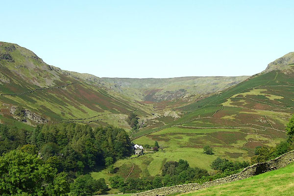 BOE37.jpg (taken 11.9.2007) 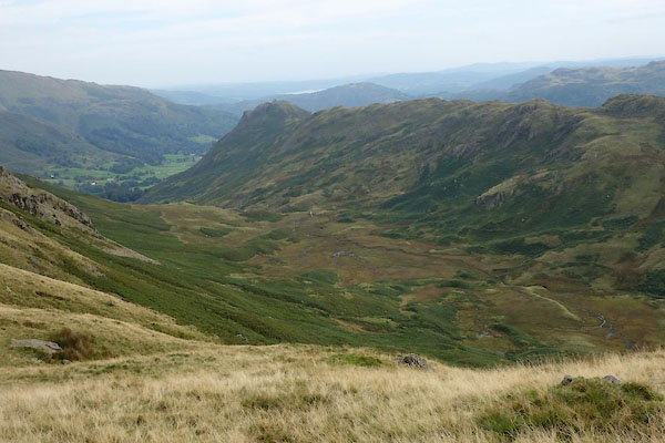 CBQ04.jpg (taken 8.9.2014) |
||
|
|
||
| evidence:- | old map:- OS County Series (Wmd 18 12) placename:- Greenburn Bottom |
|
| source data:- | Maps, County Series maps of Great Britain, scales 6 and 25
inches to 1 mile, published by the Ordnance Survey, Southampton,
Hampshire, from about 1863 to 1948. |
|
|
|
||
| evidence:- | old drawing:- Brockbank 1870s |
|
| source data:- | Drawing, pencil and ink wash, glacial moraines, Greenburn Bottom, Westmorland, by
WH, July 1871, used by William Brockbank.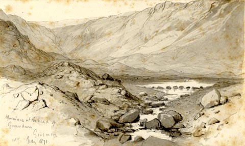 click to enlarge click to enlargePR1927.jpg "Morianes at the head of / Greenburn / Grasmere / WH. July 1871." "Moraines / Greenburn. Grasmere / Wm. Bockbank. [FGS] / 22" "Greenburn beck runs down to near Dunmail raise, between Helm Crag & Steel Fell / to the right of Steel Fell. / to the left the ridge separating it from Easedale being part of Helm Crag / at the head of the valley is Whitestones whence several vallies radiate at / the head of Borrowdale / There are here several lines of moraines & and there has evidently been / a large tarn, formed by a moraine at its foot, now broken through / leaving a perfectly flat [ ] valley beyond & peat is worked / from it [at pleasure.]" item:- Armitt Library : 1959.68.22 Image © see bottom of page |
|
|
|
||
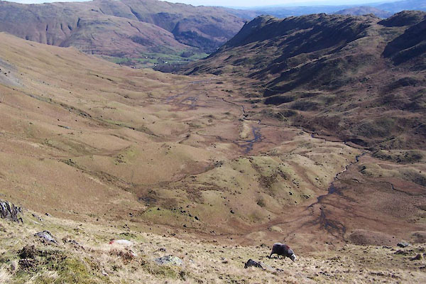 BUF74.jpg (taken 14.3.2011) 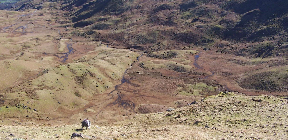 Click to enlarge BUF75.jpg (taken 14.3.2011) |
||
|
|
||
 Lakes Guides menu.