 Old Cumbria Gazetteer
 |
 |
|
||
| Fell Beck | ||||
| county:- | North Yorkshire | |||
| locality type:- | river | |||
| coordinates:- | SD75107270 | |||
| 1Km square:- | SD7572 | |||
| 10Km square:- | SD77 | |||
|
|
||||
| evidence:- | descriptive text:- Balderston c1890 placename:- Fell Beck |
|||
| source data:- | Book, Ingleton, Bygone and Present, by Robert R and Margaret
Balderston, published by Simpkin, Marshall and Co, London, and
by Edmndson and Co, 24 High Street, Skipton, Yorkshire, about
1890. goto source goto sourcepage 49:- "... A capital little stream for trouting with the fly during a summer freshet is the one called Fell Beck, which is here [Gaping Gill Hole] engulfed in the gaping jaws of this stupendous abysmal orifice, to appear, it is supposed, close to the mouth of Clapham Cave, with which, no doubt, it has direct connection; indeed, it is affirmed that such is the case." |
|||
|
|
||||
| evidence:- | old map:- Balderston c1890 map placename:- Fell Beck |
|||
| source data:- | Map, the hills in the Ingleton area, probably by Robert R
Balderston, engraved by Goodall and Suddick, Leeds, West
Yorkshire, about 1890.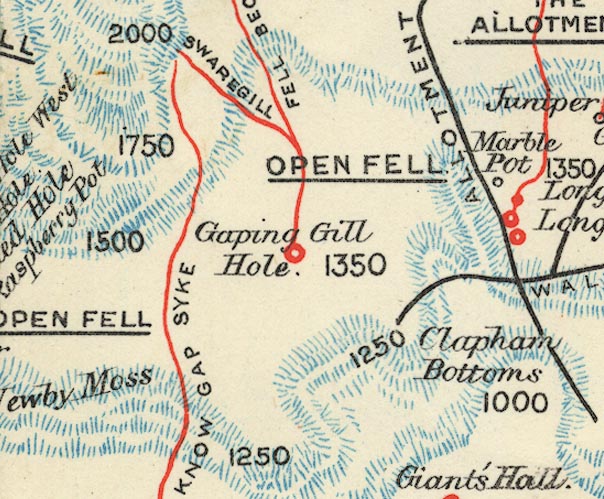 BS1SD77L.jpg "Fell Beck" item:- private collection : 27.1 Image © see bottom of page |
|||
|
|
||||
| places:- |
|
|||
Lakes Guides menu.