 Old Cumbria Gazetteer
 |
 |
|
||||||||||||||||||||||||
| Esthwaite Water | ||||||||||||||||||||||||||
| runs into:- |  Cunsey Beck Cunsey Beck |
|||||||||||||||||||||||||
|
|
||||||||||||||||||||||||||
| civil parish:- | Hawkshead (formerly Lancashire) | |||||||||||||||||||||||||
| county:- | Cumbria | |||||||||||||||||||||||||
| locality type:- | lake | |||||||||||||||||||||||||
| coordinates:- | SD36159636 (etc) | |||||||||||||||||||||||||
| 1Km square:- | SD3696 | |||||||||||||||||||||||||
| 10Km square:- | SD39 | |||||||||||||||||||||||||
|
|
||||||||||||||||||||||||||
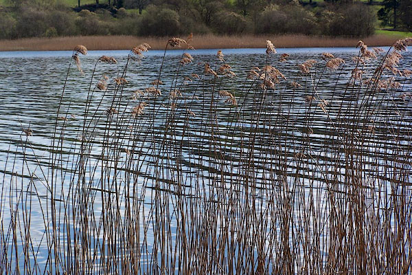
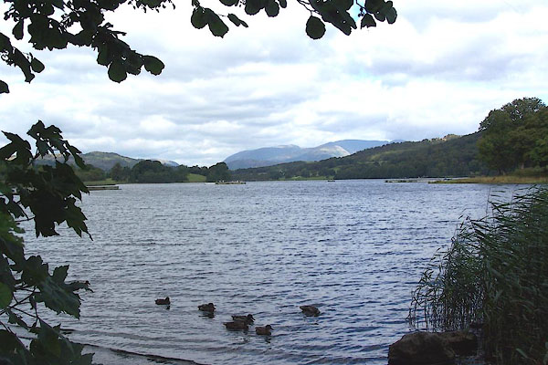 BJV20.jpg (Photo avoiding several ugly commercial fish farming units.) (taken 16.9.2005) 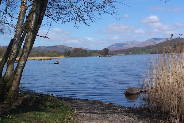 BLZ52.jpg (taken 28.4.3006) |
||||||||||||||||||||||||||
|
|
||||||||||||||||||||||||||
| evidence:- | old map:- OS County Series (Lan 5 2) placename:- Esthwaite Water |
|||||||||||||||||||||||||
| source data:- | Maps, County Series maps of Great Britain, scales 6 and 25
inches to 1 mile, published by the Ordnance Survey, Southampton,
Hampshire, from about 1863 to 1948. OS County Series (Lan 5 6) "Sur: of Water 214.3 / 24th. Sepr. 1888" |
|||||||||||||||||||||||||
| source data:- | Maps, County Series maps of Great Britain, scales 6 and 25
inches to 1 mile, published by the Ordnance Survey, Southampton,
Hampshire, from about 1863 to 1948. "ESTHWAITE WATER / Sur: of Water 214.3 / 24th. Sepr. 1888" |
|||||||||||||||||||||||||
|
|
||||||||||||||||||||||||||
| evidence:- | old map:- Saxton 1579 |
|||||||||||||||||||||||||
| source data:- | Map, hand coloured engraving, Westmorlandiae et Cumberlandiae Comitatus ie Westmorland
and Cumberland, scale about 5 miles to 1 inch, by Christopher Saxton, London, engraved
by Augustinus Ryther, 1576, published 1579-1645.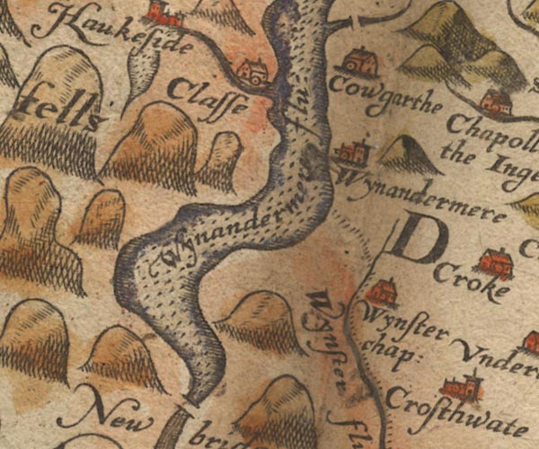 Sax9SD39.jpg item:- private collection : 2 Image © see bottom of page |
|||||||||||||||||||||||||
|
|
||||||||||||||||||||||||||
| evidence:- | old map:- Speed 1611 (Wmd) |
|||||||||||||||||||||||||
| source data:- | Map, hand coloured engraving, The Countie Westmorland and
Kendale the Cheif Towne, scale about 2.5 miles to 1 inch, by
John Speed, 1610, published by George Humble, Popes Head Alley,
London, 1611-12.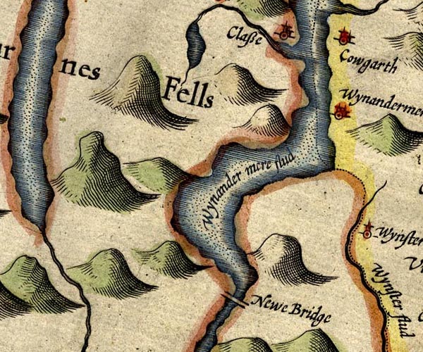 SP14SD39.jpg outline, shore shaded, interior pecked; drained by a stream northward item:- Armitt Library : 2008.14.5 Image © see bottom of page |
|||||||||||||||||||||||||
|
|
||||||||||||||||||||||||||
| evidence:- | old map:- Jansson 1646 |
|||||||||||||||||||||||||
| source data:- | Map, hand coloured engraving, Cumbria and Westmoria, ie
Cumberland and Westmorland, scale about 3.5 miles to 1 inch, by
John Jansson, Amsterdam, Netherlands, 1646.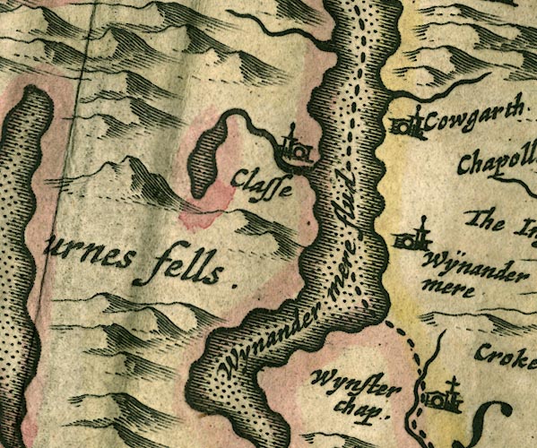 JAN3SD39.jpg Outline with shore shaded, dotted area. item:- JandMN : 88 Image © see bottom of page |
|||||||||||||||||||||||||
|
|
||||||||||||||||||||||||||
| evidence:- | old map:- Sanson 1679 |
|||||||||||||||||||||||||
| source data:- | Map, hand coloured engraving, Ancien Royaume de Northumberland
aujourdhuy Provinces de Nort, ie the Ancient Kingdom of
Northumberland or the Northern Provinces, scale about 9.5 miles
to 1 inch, by Nicholas Sanson, Paris, France, 1679. click to enlarge click to enlargeSAN2Cm.jpg outline, shore shaded; lake, with its outflow running into Windermere item:- Dove Cottage : 2007.38.15 Image © see bottom of page |
|||||||||||||||||||||||||
|
|
||||||||||||||||||||||||||
| evidence:- | old map:- Morden 1695 (Cmd) |
|||||||||||||||||||||||||
| source data:- | Map, uncoloured engraving, Cumberland, scale about 4 miles to 1
inch, by Robert Morden, 1695, published by Abel Swale, the
Unicorn, St Paul's Churchyard, Awnsham, and John Churchill, the
Black Swan, Paternoster Row, London, 1695-1715.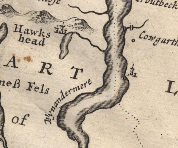 MD12SD39.jpg Outline with shore shading. item:- JandMN : 90 Image © see bottom of page |
|||||||||||||||||||||||||
|
|
||||||||||||||||||||||||||
| evidence:- | old map:- Morden 1695 (Wmd) |
|||||||||||||||||||||||||
| source data:- | Map, hand coloured engraving, Westmorland, scale about 2.5 miles to 1 inch, by Robert
Morden, published by Abel Swale, the Unicorn, St Paul's Churchyard, Awnsham, and John
Churchill, the Black Swan, Paternoster Row, London, 1695. MD10SD39.jpg Outline with shore shading, tinted blue; the stream shown from the north end running to Windermere lake is completely wrong, the Cunsey Beck runs from the south end to the lake. item:- JandMN : 24 Image © see bottom of page |
|||||||||||||||||||||||||
|
|
||||||||||||||||||||||||||
| evidence:- | old map:- Jefferys 1770 (Wmd) placename:- Estead Water |
|||||||||||||||||||||||||
| source data:- | Map, 4 sheets, The County of Westmoreland, scale 1 inch to 1
mile, surveyed 1768, and engraved and published by Thomas
Jefferys, London, 1770. J5SD39NE.jpg "ESTEAD WATER" outline with form lines; lake or tarn item:- National Library of Scotland : EME.s.47 Image © National Library of Scotland |
|||||||||||||||||||||||||
|
|
||||||||||||||||||||||||||
| evidence:- | descriptive text:- West 1778 (11th edn 1821) item:- fish, Esthwaite Water; perch; pike; eel; trout; char (none) |
|||||||||||||||||||||||||
| source data:- | Guide book, A Guide to the Lakes, by Thomas West, published by
William Pennington, Kendal, Cumbria once Westmorland, and in
London, 1778 to 1821. goto source Page 55:- "... the vale, which is floated with" "ESTHWAITE-WATER," "Two miles in length, and half a mile in breadth, intersected by a peninsula from each side, jutting far into the lake, finely elevated, crowned with cultivation, and bordered with fringed trees and coppice wood. The lake is encompassed with a good carriage road, and over its outlet is a narrow stone bridge. On the banks are villages and scattered houses, sweetly situated under woods and hanging grounds, enamelled with delightful verdure and soft vegetation; all which is heightened by the deep shade of the woods, and the strong back-ground of" goto sourcePage 56:- "rocky mountains. At the head of a gentle slope, with a just elevation, a handsome modern house, Belmount, is charmingly situated, and commands a delightful view of the lake with all its environs. The house of Thomas Alcock Beck, Esq. is most delightfully situated on the margin of the lake." "The fish here are perch, pike, eel, and trout. No char are found in this lake, though it is connected with Windermere-water." "..." goto sourcePage 190:- "A TABLE OF THE Height of Mountains and Lakes SEEN IN THIS TOUR, ... TAKEN FROM THE LEVEL OF THE SEA. ... by Mr. John Dalton." "Esthwaite-water ... 66 [yards]" |
|||||||||||||||||||||||||
|
|
||||||||||||||||||||||||||
| evidence:- | old map:- West 1784 map placename:- Esthwaite Water |
|||||||||||||||||||||||||
| source data:- | Map, hand coloured engraving, A Map of the Lakes in Cumberland,
Westmorland and Lancashire, scale about 3.5 miles to 1 inch,
engraved by Paas, 53 Holborn, London, about 1784.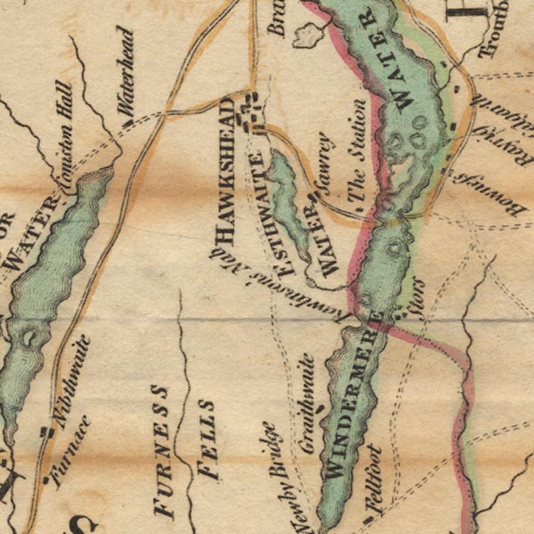 Ws02SD39.jpg "ESTHWAITE WATER" item:- Armitt Library : A1221.1 Image © see bottom of page |
|||||||||||||||||||||||||
|
|
||||||||||||||||||||||||||
| evidence:- | old text:- Clarke 1787 placename:- Estthwaitewater item:- fish, Esthwaite Water; pike; perch; eels |
|||||||||||||||||||||||||
| source data:- | Guide book, A Survey of the Lakes of Cumberland, Westmorland,
and Lancashire, written and published by James Clarke, Penrith,
Cumberland, and in London etc, 1787; published 1787-93. goto source Page 146:- "..." "... a Lake called Estthwaite-water, about a mile and a half in length, and somewhat less than half a mile in breadth: it is the sole property of Miles Sandy's, Esq; who has a boat and some few swans upon it, which add greatly to its beauty, and contains pike, perch, and eels, as the other Lakes, but not plentiful, and no charr. ..." |
|||||||||||||||||||||||||
|
|
||||||||||||||||||||||||||
| evidence:- | old map:- Cary 1789 (edn 1805) placename:- Estead Water |
|||||||||||||||||||||||||
| source data:- | Map, uncoloured engraving, Westmoreland, scale about 2.5 miles
to 1 inch, by John Cary, London, 1789; edition 1805.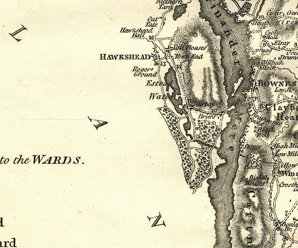 CY24SD39.jpg "Estead Water" outline with shore form lines; lake or tarn item:- JandMN : 129 Image © see bottom of page |
|||||||||||||||||||||||||
|
|
||||||||||||||||||||||||||
| evidence:- | old map:- Housman 1800 map 4 placename:- Easthwaite Water |
|||||||||||||||||||||||||
| source data:- | Maps, hand coloured engraving, Lakes in Lancashire and Westmorland, 7 lakes on one
sheet, engraved by McIntyre, Edinburgh, published by F Jollie, Carlisle, Cumberland,
and C Law, Ave Maria Lane, London, 1800.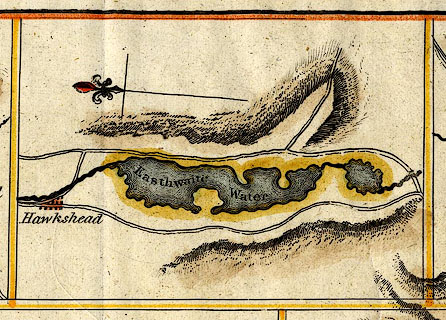 click to enlarge click to enlargeHM02Est.jpg "Easthwaite Water" item:- Dove Cottage : 2007.38.97 Image © see bottom of page |
|||||||||||||||||||||||||
|
|
||||||||||||||||||||||||||
| evidence:- | descriptive text:- Baker 1802 placename:- Easthwaite Water |
|||||||||||||||||||||||||
| source data:- | Perspective road map with sections in Lancashire, Westmorland,
and Cumberland, by J Baker, London 1802. pp.25-26:- "... that [water] of Easthwaite is found by passing the town of Hawrshead, ..." |
|||||||||||||||||||||||||
|
|
||||||||||||||||||||||||||
| evidence:- | old map:- Cooke 1802 placename:- Easthwaite Water |
|||||||||||||||||||||||||
| source data:- | Map, The Lakes, Westmorland and Cumberland, scale about 8.5
miles to 1 inch, engravedby Neele and Son, published by
Sherwood, Jones and Co, Paternoster Road, London, 1824. click to enlarge click to enlargeGRA1Lk.jpg "Easthwaite W." outline with form lines; lake or tarn item:- Hampshire Museums : FA2000.62.5 Image © see bottom of page |
|||||||||||||||||||||||||
|
|
||||||||||||||||||||||||||
| evidence:- | old map:- Cooke 1802 |
|||||||||||||||||||||||||
| source data:- | Map, Lancashire, scale about 18 miles to 1 inch, by George
Cooke, 1802, bound in Gray's New Book of Roads, 1824, published
by Sherwood, Jones and Co, Paternoster Road, London, 1824. click to enlarge click to enlargeGRA1La.jpg outline with form lines; lake or tarn item:- Hampshire Museums : FA2000.62.6 Image © see bottom of page |
|||||||||||||||||||||||||
|
|
||||||||||||||||||||||||||
| evidence:- | old map:- Laurie and Whittle 1806 placename:- Esthwaite Water |
|||||||||||||||||||||||||
| source data:- | Road map, Completion of the Roads to the Lakes, scale about 10
miles to 1 inch, by Nathaniel Coltman? 1806, published by Robert
H Laurie, 53 Fleet Street, London, 1834. click to enlarge click to enlargeLw18.jpg "Esthwaite Water" lake item:- private collection : 18.18 Image © see bottom of page |
|||||||||||||||||||||||||
|
|
||||||||||||||||||||||||||
| evidence:- | old text:- Capper 1808 placename:- Esthwaite |
|||||||||||||||||||||||||
| source data:- | Gazetteer, A Topographical Dictionary of the United Kingdom,
compiled by Benjamin Pitts Capper, published by Richard
Phillips, Bridge Street, Blackfriars, London, 1808; published
1808-29. goto source "... Esthwaite; this lake is 2 miles in length, but of different shapes and breadth, indented with bold promontories, woods, meadows, and corn fields; its vale is exactly between the celebrated lakes of Windermere and Coningstone, and runs in the same direction, but lies much higher. ..." |
|||||||||||||||||||||||||
|
|
||||||||||||||||||||||||||
| evidence:- | old print:- Wilkinson 1810 (plate 8) placename:- Estwaite Water |
|||||||||||||||||||||||||
| source data:- | Print, uncoloured soft ground etching, Estwaite Water, from below Bellemount, Lancashire,
by Joseph Wilkinson, engraved by William Frederick Wells, published by R Ackermann,
Repository of Arts, 101 Strand, London, 1810.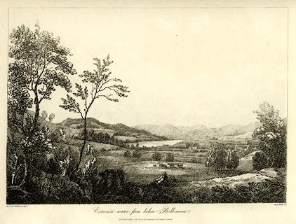 click to enlarge click to enlargeWKN108.jpg Plate 8 in Select Views in Cumberland, Westmoreland, and Lancashire. printed at bottom left, right, centre:- "Revd. Jos: Wilkinson delt. / W. F. Wells sc. / Estwaite-water, from below Bellemount. / Published July 1. 1810. by R: Ackermann. 101. Strand. London." item:- Fell and Rock Climbing Club : MN4.8 Image © see bottom of page |
|||||||||||||||||||||||||
|
|
||||||||||||||||||||||||||
| evidence:- | old print:- Green 1814 (plate 5) placename:- Esthwaite Water item:- cattle |
|||||||||||||||||||||||||
| source data:- | Print, tinted soft ground etching, Esthwaite Water, Hawkshead, Lancashire, by William
Green, Ambleside, Westmorland, 1814.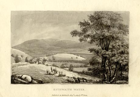 click to enlarge click to enlargeGN1005.jpg The 'island' is a headland, Strickland Ees. Plate 5 in Sixty Small Prints. printed at top right:- "5" printed at bottom:- "ESTHWAITE WATER. / Published at Ambleside Augst. 1, 1814, by Wm. Green." item:- Armitt Library : A6653.5 Image © see bottom of page |
|||||||||||||||||||||||||
|
|
||||||||||||||||||||||||||
| evidence:- | old print:- Green 1814 (plate 5) placename:- Esthwaite Water item:- cattle |
|||||||||||||||||||||||||
| source data:- | Print, uncoloured soft ground etching, Esthwaite Water, Hawkshead, Lancashire, by
William Green, Ambleside, Westmorland, 1814.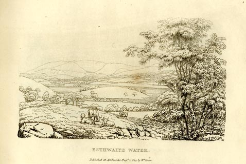 click to enlarge click to enlargeGN0905.jpg The 'island' is a headland, Strickland Ees. Plate 5 in Sixty Small Prints. printed at top right:- "5" printed at bottom:- "ESTHWAITE WATER. / Published at Ambleside Augst. 1, 1814, by Wm. Green." item:- Armitt Library : A6656.5 Image © see bottom of page |
|||||||||||||||||||||||||
|
|
||||||||||||||||||||||||||
| evidence:- | old text:- Green 1814 placename:- Esthwaite Water |
|||||||||||||||||||||||||
| source data:- | Set of prints, soft ground etchings, Sixty Small Prints, with
text, A Description of a Series of Sixty Small Prints, by
William Green, Ambleside, Westmorland, 1814. goto source page 5:- "..." "No.5." "ESTHWAITE WATER." "... Esthwaite Water is about two miles in length, and half a mile across. The most striking object on its borders is the promontory at Esthwaite Hall; it shoots boldly to the lake, which is encompassed by gentle hills. There is an excellent road round the lake; and the distant objects seen from and connected with it, if not sublime, are at least pleasing." "..." goto sourcepage 6:- "From Hawkshead proceed down the western side of the Water, and pass Esthwaite Hall: the road here divides; that on the right leads to Ulverstone, and the left either to the Ferry House or round Esthwaite Water." "Ascend the Ulverstone road about two hundred yards, to the common's boundary on the left, and from the trees near that boundary see the promontory before spoken of, and Esthwaite Hall between it and the eye. Each side the lake, as seen from this place, is environed with meadow and pasture ground pleasantly wooded; the lands at the head of the lake are of the same character, only diversified by villages peeping from amongst groves of trees: the scene is closed, though at a great distance, by the lofty mountains of Grasmere, Rydal, and Ambleside." |
|||||||||||||||||||||||||
|
|
||||||||||||||||||||||||||
| evidence:- | old print:- Green 1815 placename:- Esthwaite Water item:- cattle |
|||||||||||||||||||||||||
| source data:- | Print, coloured aquatint, Esthwaite Water, Hawkshead, Lancashire, by William Green,
Ambleside, Westmorland, 1815.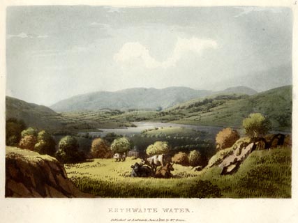 click to enlarge click to enlargeGN0504.jpg Plate 5 in Lake Scenery. printed at upper right:- "5" printed at bottom:- "MAN MOUNTAIN on CONISTON WATER. / Published at Ambleside, June 1, 1815, by Wm. Green." item:- Armitt Library : A6646.4 Image © see bottom of page |
|||||||||||||||||||||||||
|
|
||||||||||||||||||||||||||
| evidence:- | old map:- Otley 1818 placename:- Esthwaite Water |
|||||||||||||||||||||||||
| source data:- | Map, uncoloured engraving, The District of the Lakes,
Cumberland, Westmorland, and Lancashire, scale about 4 miles to
1 inch, by Jonathan Otley, 1818, engraved by J and G Menzies,
Edinburgh, Scotland, published by Jonathan Otley, Keswick,
Cumberland, et al, 1833.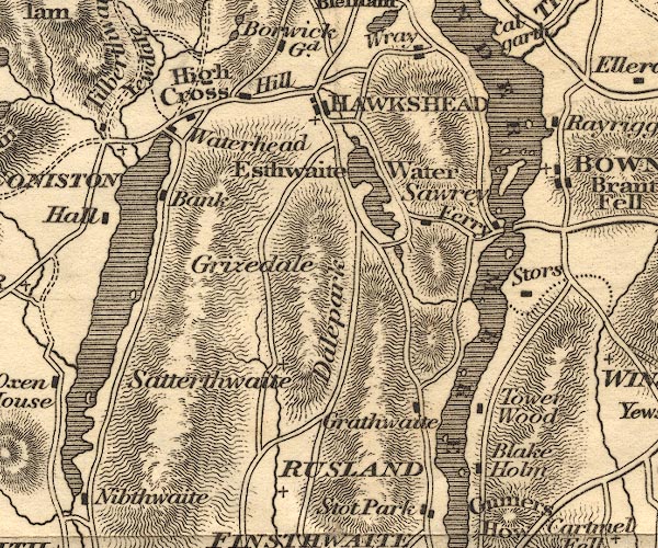 OT02SD39.jpg item:- JandMN : 48.1 Image © see bottom of page |
|||||||||||||||||||||||||
|
|
||||||||||||||||||||||||||
| evidence:- | old print:- Fielding and Walton 1821 (plate 8) placename:- Esthwaite Water |
|||||||||||||||||||||||||
| source data:- | Print, coloured aquatint, Esthwaite Water, Hawkshead, Lancashire, drawn by Theodore
H A Fielding, published by R Ackermann, 101 Strand, London, 1821.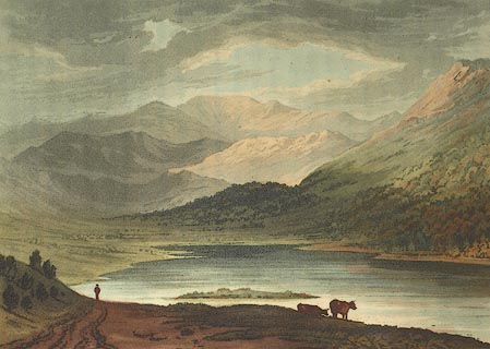 click to enlarge click to enlargeFW0108.jpg Tipped in opposite p.31 in A Picturesque Tour of the English Lakes. item:- Dove Cottage : 1993.R566.8 Image © see bottom of page |
|||||||||||||||||||||||||
|
|
||||||||||||||||||||||||||
| evidence:- | descriptive text:- Otley 1823 (5th edn 1834) |
|||||||||||||||||||||||||
| source data:- | Guide book, A Concise Description of the English Lakes, the
mountains in their vicinity, and the roads by which they may be
visited, with remarks on the mineralogy and geology of the
district, by Jonathan Otley, published by the author, Keswick,
Cumberland now Cumbria, by J Richardson, London, and by Arthur
Foster, Kirkby Lonsdale, Cumbria, 1823; published 1823-49,
latterly as the Descriptive Guide to the English Lakes. goto source Page 13:- "ESTHWAITE WATER" "Is a small placid lake, nearly two miles in length, and distinguished by a fine swelling peninsula, which reaches far into the water from the western side. It is situated near the ancient little town of Hawkshead, in a beautiful open valley, which is crowned with gentle eminences, and decorated with an agreeable composition of houses, fields, and trees." |
|||||||||||||||||||||||||
|
|
||||||||||||||||||||||||||
| evidence:- | descriptive text:- Ford 1839 (3rd edn 1843) placename:- Esthwaite Water item:- depth, Esthwaite Water |
|||||||||||||||||||||||||
| source data:- | Guide book, A Description of Scenery in the Lake District, by
Rev William Ford, published by Charles Thurnam, Carlisle, by W
Edwards, 12 Ave Maria Lane, Charles Tilt, Fleet Street, William
Smith, 113 Fleet Street, London, by Currie and Bowman,
Newcastle, by Bancks and Co, Manchester, by Oliver and Boyd,
Edinburgh, and by Sinclair, Dumfries, 1839. goto source Page 16:- "..." "ESTHWAITE WATER" "Is about two miles in length, and half a mile across. It is encompassed by an excellent carriage road, and from its unequal figure and enclosures - its two peninsulas fringed with trees, shooting into the lake - form exceeding good scenery. Perch, pike, eels, and trout, are the fish taken in its waters. A small floating island also occasionally appears to astonish the beholder." "In passing round the lake, there are three remote but distinct distances, which add grandeur to the placid lake, and its surrounding open valley and gently swelling eminences - the Langdale Pikes, the Fells of Grasmere, Rydal, Ambleside, and Gunner's How." "Some think the most advantageous point of view in which this water appears, is to the traveller" goto sourcePage 17:- "descending from the ferry over Windermere - in this, the lake, Hawkshead church, and Langdale Pikes, are prominent: others, again, that in which part of Esthwaite Hall is seen, lands with wood on each side of the lake, villages and groves of trees, and the lofty mountains of Grasmere, Rydal, &c. in the distance. The view which greets the eyes in descending the hill from Coniston, yields to neither in sweetness." goto sourcePage 177:- "A TABLE" "OF THE LENGTH, BREADTH, &c. OF THE LAKES," "COLLECTED FROM DIFFERENT AUTHORITIES."
|
|||||||||||||||||||||||||
|
|
||||||||||||||||||||||||||
| evidence:- | old map:- Ford 1839 map placename:- Eastwaite Water |
|||||||||||||||||||||||||
| source data:- | Map, uncoloured engraving, Map of the Lake District of
Cumberland, Westmoreland and Lancashire, scale about 3.5 miles
to 1 inch, published by Charles Thurnam, Carlisle, and by R
Groombridge, 5 Paternoster Row, London, 3rd edn 1843.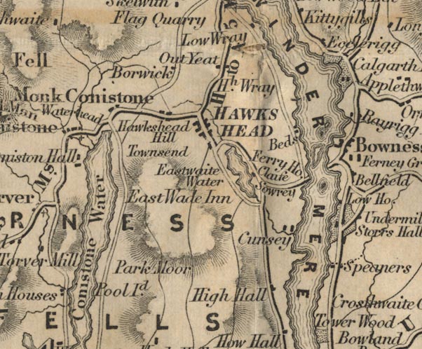 FD02SD39.jpg "Eastwaite Water" Outline with form lines. item:- JandMN : 100.1 Image © see bottom of page |
|||||||||||||||||||||||||
|
|
||||||||||||||||||||||||||
| evidence:- | old drawing:- Aspland 1840s-60s placename:- Esthwaite Water |
|||||||||||||||||||||||||
| source data:- | Drawing, pencil, Esthwaite Water, Lancashire, by Theophilus Lindsey Aspland, 1868-69.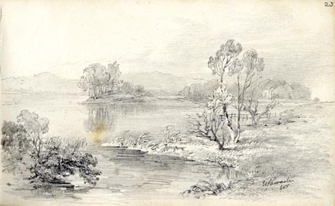 click to enlarge click to enlargeAS0625.jpg "Esthwaite / Wr" page number "23" item:- Armitt Library : 2008.61.25 Image © see bottom of page |
|||||||||||||||||||||||||
|
|
||||||||||||||||||||||||||
| evidence:- | old map:- Wyld 1847 placename:- Esthwaite Water |
|||||||||||||||||||||||||
| source data:- | Map, uncoloured engraving, Windermere, Rydal, Grasmere,
Esthwaite and Coniston Waters, scale about 3.5 miles to 1 inch,
by James Wyld, published by John Johnstone, Paternoster Row,
London, et al, 1847.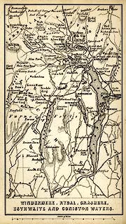 click to enlarge click to enlargeWLD3M1.jpg printed at bottom:- "WINDERMERE, RYDAL, GRASMERE, / ESTHWAITE AND CONISTON WATERS." item:- Armitt Library : A1201.64 Image © see bottom of page |
|||||||||||||||||||||||||
|
|
||||||||||||||||||||||||||
| evidence:- | old map:- Garnett 1850s-60s H placename:- Esthwaite Water |
|||||||||||||||||||||||||
| source data:- | Map of the English Lakes, in Cumberland, Westmorland and
Lancashire, scale about 3.5 miles to 1 inch, published by John
Garnett, Windermere, Westmorland, 1850s-60s. GAR2SD39.jpg "ESTHWAITE WATER" outline with shore form lines, lake or tarn item:- JandMN : 82.1 Image © see bottom of page |
|||||||||||||||||||||||||
|
|
||||||||||||||||||||||||||
| evidence:- | old text:- Martineau 1855 |
|||||||||||||||||||||||||
| source data:- | Guide book, A Complete Guide to the English Lakes, by Harriet
Martineau, published by John Garnett, Windermere, Westmorland,
and by Whittaker and Co, London, 1855; published 1855-76. goto source Page 29:- "... Esthwaite Water, which is two miles long, and half a mile broad;- a quiet sheet of water, with two promontories stretching into it, which appear like islands, nearly dividing it into a chain of ponds. A round pond at the northern end of the lake, connected with it by a narrow creek, exhibits a strange phenoemenon. It has a floating island, ..." |
|||||||||||||||||||||||||
|
|
||||||||||||||||||||||||||
| evidence:- | old text:- Martineau 1855 item:- depth, Esthwaite Water |
|||||||||||||||||||||||||
| source data:- | Guide book, A Complete Guide to the English Lakes, by Harriet
Martineau, published by John Garnett, Windermere, Westmorland,
and by Whittaker and Co, London, 1855; published 1855-76. goto source Page 180:- "A TABLE OF THE LENGTH, BREADTH, AND DEPTH OF THE LAKES." "No. : Names of Lakes. : Counties : Length in Miles. : Extreme breadth in Miles : Extreme depth in Feet : Height above the Sea" "8 : Esthwaite Water : Lancashire : 2 : ½: 80 : 198" |
|||||||||||||||||||||||||
|
|
||||||||||||||||||||||||||
| evidence:- | old print:- Payn 1867 |
|||||||||||||||||||||||||
| source data:- | Print, uncoloured engraving, The Valley of Esthwaite, from Iron Keld, Hawkshead, Lancashire,
by T L Aspland, published by J Garnett, Windermere, Westmorland, 1867.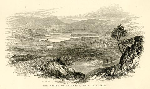 click to enlarge click to enlargePN0326.jpg On p.52 of The Lakes in Sunshine, text by James Payn. printed at bottom:- "THE VALLEY OF ESTHWAITE, FROM IRON KELD." item:- Fell and Rock Climbing Club : 184.26 Image © see bottom of page |
|||||||||||||||||||||||||
|
|
||||||||||||||||||||||||||
| evidence:- | old map:- Jenkinson 1875 map1 placename:- |
|||||||||||||||||||||||||
| source data:- | Map, Windermere Section, Westmorland and Lancashire, ?colour
lithograph, scale about 1 mile to 1 inch, by Stanford's
Geographical Establishment, published by Edward Stanford, 55
Charing Cross, London, 1875.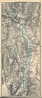 click to enlarge click to enlargeJK04.jpg item:- JandMN : 28.3 Image © see bottom of page |
|||||||||||||||||||||||||
|
|
||||||||||||||||||||||||||
| evidence:- | old print:- Bemrose 1881 item:- boat; rowing boat |
|||||||||||||||||||||||||
| source data:- | Print, uncoloured, Esthwaite and Hawkshead, Lancashire, published by Bemrose and Sons,
23 Old Bailey, London and Derby, by A B Moss, Carlisle, Cumberland, and by T Wilson,
Kendal, Westmorland, about 1881.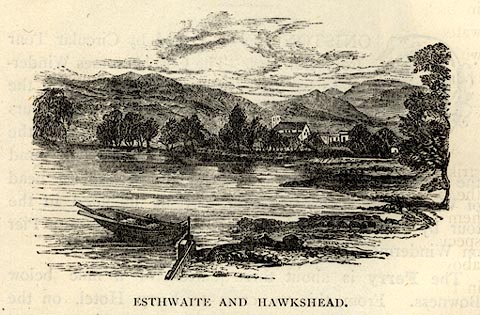 click to enlarge click to enlargeBEM110.jpg On p.42 of a Handy Guide to the English Lakes and Shap Spa. printed at bottom:- "ESTHWAITE AND HAWKSHEAD." item:- JandMN : 455.12 Image © see bottom of page |
|||||||||||||||||||||||||
|
|
||||||||||||||||||||||||||
| evidence:- | old print:- Philip/Wilson 1890s |
|||||||||||||||||||||||||
| source data:- | Print, engraving, Esthwaite and Hawkshead, published by George
Philip and Son, London, Philip, Son and Nephew, Liverpool,
Lancashire, and Titus Wilson, Kendal, Westmorland, about 1895.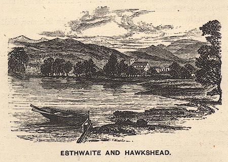 click to enlarge click to enlargePW1E15.jpg "ESTHWAITE AND HAWKSHEAD." item:- JandMN : 58.16 Image © see bottom of page |
|||||||||||||||||||||||||
|
|
||||||||||||||||||||||||||
| evidence:- | old map:- Pearson 1900s map (Win/Est) placename:- Esthwaite Water |
|||||||||||||||||||||||||
| source data:- | Map, lithograph, Round Windermere Lake and Esthwaite Water,
Westmorland and Cumberland, published by C Arthur Pearson,
Henrietta Street, London, 1900s.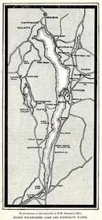 click to enlarge click to enlargePSN1M6.jpg On p.xxxix of Pearson's Gossipy Guide to the English Lakes and Neighbouring Districts. printed at bottom:- "By permission of the Controller of H.M. Stationery Office. / ROUND WINDERMERE LAKE AND ESTHWAITE WATER." item:- Armitt Library : A1188.8 Image © see bottom of page |
|||||||||||||||||||||||||
|
|
||||||||||||||||||||||||||
| evidence:- | old print:- Heaton Cooper 1905 (edn 1908) placename:- Esthwaite Water item:- apple blossom |
|||||||||||||||||||||||||
| source data:- | Print, colour halftone, Esthwaite Water, Apple Blossom, Hawkshead, Lancashire, from
a watercolour painting by Alfred Heaton Cooper, published by Adam and Charles Black,
London, 2nd edn 1908.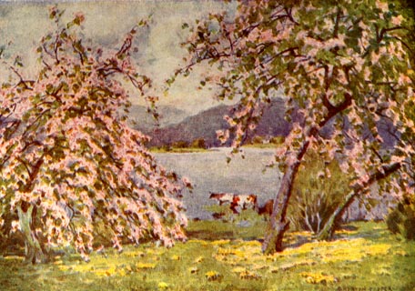 click to enlarge click to enlargeHC0116.jpg Opposite p.50 of The English Lakes, painted by Alfred Heaton Cooper, described by William T Palmer. printed at tissue opposite the print:- "ESTHWAITE WATER: APPLE BLOSSOM" item:- JandMN : 468.16 Image © see bottom of page |
|||||||||||||||||||||||||
|
|
||||||||||||||||||||||||||
| evidence:- | old print:- Robertson 1911 placename:- Esthwaite Lake |
|||||||||||||||||||||||||
| source data:- | Print, lithograph? Esthwaite Lake, from a watercolour by Arthur Tucker, published
by Chatto and Windus, London, 1911.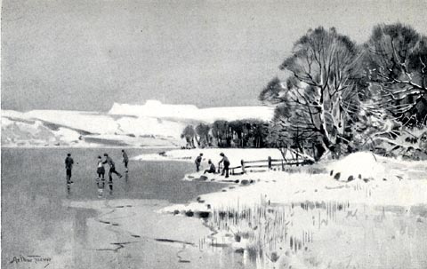 click to enlarge click to enlargeRSN124.jpg Tipped in opposite p.104 of Wordsworthshire by Eric Robertson. Winter, skaters. printed at bottom:- "ESTHWAITE LAKE (Hills of Langdale, in distance)" signed at painting lower left:- "Arthur Tucker" item:- JandMN : 197.25 Image © see bottom of page |
|||||||||||||||||||||||||
|
|
||||||||||||||||||||||||||
| evidence:- | old print:- Pearson 1900s placename:- Esthwaite Water |
|||||||||||||||||||||||||
| source data:- | Print, halftone photograph, Esthwaite Water and Hawkshead, Lancashire, published by
C Arthur Pearson, Henrietta Street, London, 1900s.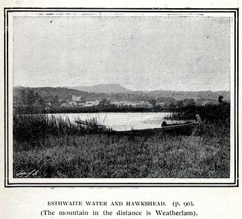 click to enlarge click to enlargePS1E34.jpg On p.89 of Pearson's Gossipy Guide to the English Lakes and Neighbouring Districts. printed at bottom:- "ESTHWAITE WATER AND HAWKSHEAD. (p.90). / (The mountain in the distance is Wetherlam)." item:- Armitt Library : A1188.41 Image © see bottom of page |
|||||||||||||||||||||||||
|
|
||||||||||||||||||||||||||
| evidence:- | outline view:- Jenkinson 1875 placename:- Esthwaite Water |
|||||||||||||||||||||||||
| source data:- | Print, lithograph, outline view, Panoramic Sketches from Helvellyn, Westmorland, by
Edwin A Pettitt, London, published by Edward Stanford, 55 Charing Cross, London, 1875. click to enlarge click to enlargeJk01E1.jpg "... Esthwaite Water ..." item:- JandMN : 28.5 Image © see bottom of page |
|||||||||||||||||||||||||
|
|
||||||||||||||||||||||||||
| evidence:- | old print:- Garnett 1850s-60s F |
|||||||||||||||||||||||||
| source data:- | Print, uncoloured engraving, Esthwaite Water from the Ulverston Road, Lancashire,
drawn and engraved by William Banks and Son, Edinburgh, published by John Garnett,
Windermere, Westmorland, 1850s-60s? click to enlarge click to enlargeGAR701.jpg Included in Views of the English Lakes. printed at bottom:- "Drawn & Engd. by W. Banks &Son, Edinr. / ESTHWAITE WATER. / From the Ulverston Road." item:- JandMN : 165.1 Image © see bottom of page |
|||||||||||||||||||||||||
|
|
||||||||||||||||||||||||||
| evidence:- | old print:- Sylvan 1847 placename:- Esthwaite Water item:- rowing boat; boat |
|||||||||||||||||||||||||
| source data:- | Print, engraving, Esthwaite Water and Hawkshead, Lancashire, published by John Johnstone,
Paternoster Row, London, et al, 1847.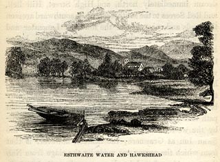 click to enlarge click to enlargeSYL127.jpg On p.90 of Sylvan's Pictorial Guide to the English Lakes. printed at bottom:- "ESTHWAITE WATER AND HAWKSHEAD." item:- Armitt Library : A1201.27 Image © see bottom of page |
|||||||||||||||||||||||||
|
|
||||||||||||||||||||||||||
| evidence:- | old print:- Rose 1832-35 |
|||||||||||||||||||||||||
| source data:- | Print, engraving, Windermere, Esthwaite Water and Coniston Lakes, by George Pickering,
engraved by le Petit, 1835.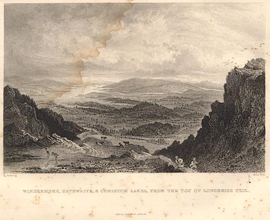 click to enlarge click to enlargeR353.jpg item:- JandMN : 66.62 Image © see bottom of page |
|||||||||||||||||||||||||
|
|
||||||||||||||||||||||||||
| evidence:- | old print:- Rose 1832-35 |
|||||||||||||||||||||||||
| source data:- | Print, engraving, Windermere, Esthwaite Water and Ambleside from Rydal Park, by George
Pickering, engraved by J Engleheart, 1835.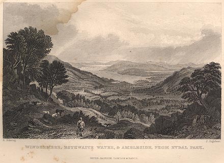 click to enlarge click to enlargeR349.jpg item:- JandMN : 66.47 Image © see bottom of page |
|||||||||||||||||||||||||
|
|
||||||||||||||||||||||||||
| evidence:- | old painting:- placename:- Esthwaite Water |
|||||||||||||||||||||||||
| source data:- | Painting, oil painting, Esthwaite Water, Hawkshead, Lancashire, by William Henry Hoodless,
1896.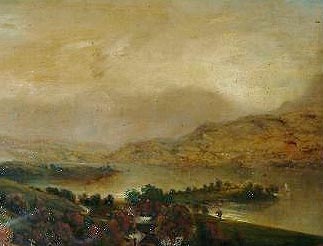 click to enlarge click to enlargePR1112.jpg Autumnal view of Esthwaite from an elevated perspective. A winding path leads towards the shore from left hand side of composition. A farmstead in a stand of trees lies at bottom centre, a tree covered promontory to its right. A lone yacht sails on the calm waters. Clouds descend over the fells rising beyond the far shore of the lake. inscribed at reverse on canvas:- "Esthwaite Water, Lancashire. Painted by WH Hoodless Wigton Aug 1896" item:- Tullie House Museum : 1971.54 Image © Tullie House Museum |
|||||||||||||||||||||||||
|
|
||||||||||||||||||||||||||
| evidence:- | old print:- Goodwin 1887 (edn 1890) placename:- Esthwaite Lake |
|||||||||||||||||||||||||
| source data:- | Print, etching? Esthwaite Lake, Hawkshead, Lancashire, by Harry Goodwin, published
by Swan Sonnenschein and Co, Paternoster Square, London, 1890.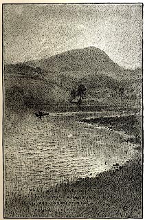 click to enlarge click to enlargePR1577.jpg Tipped in opposite p.24 of Through the Wordsworth Country, by William Knight. printed at lower right:- "When, from behind that craggy steep till then / The horizon's bound, a huge peak, black and huge, / As if with voluntary power instinct / Upreared its head." printed at lower right:- "HG 1886" item:- JandMN : 382.7 Image © see bottom of page |
|||||||||||||||||||||||||
|
|
||||||||||||||||||||||||||
 BLZ53.jpg (taken 28.4.3006) |
||||||||||||||||||||||||||
|
|
||||||||||||||||||||||||||
Lakes Guides menu.