 Old Cumbria Gazetteer
 |
 |
|
| Duke of Cumberland, Kendal | ||
| Duke of Cumberland | ||
| Street:- | Appleby Road | |
| Street:- | Shap Road | |
| locality:- | Kendal | |
| civil parish:- | Kendal (formerly Westmorland) | |
| county:- | Cumbria | |
| locality type:- | inn | |
| coordinates:- | SD52079330 | |
| 1Km square:- | SD5293 | |
| 10Km square:- | SD59 | |
|
|
||
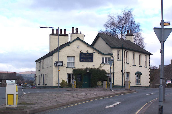 BLU62.jpg (taken 9.4.2006) |
||
|
|
||
| evidence:- | old map:- OS County Series (Wmd 38 4) placename:- Duke of Cumberland |
|
| source data:- | Maps, County Series maps of Great Britain, scales 6 and 25
inches to 1 mile, published by the Ordnance Survey, Southampton,
Hampshire, from about 1863 to 1948. |
|
|
|
||
| Currington, David: 2009: Pictorial Record of Public Houses in Kendal: Westmorland
CAMRA |
||
|
|
||
 Lakes Guides menu.