 Old Cumbria Gazetteer
 |
 |
|
| Dufton Pike, Dufton | ||
| Dufton Pike | ||
| civil parish:- | Dufton (formerly Westmorland) | |
| county:- | Cumbria | |
| locality type:- | hill | |
| coordinates:- | NY699266 | |
| 1Km square:- | NY6926 | |
| 10Km square:- | NY62 | |
| altitude:- | 1578 feet | |
| altitude:- | 481m | |
|
|
||
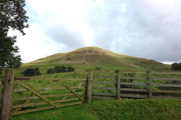
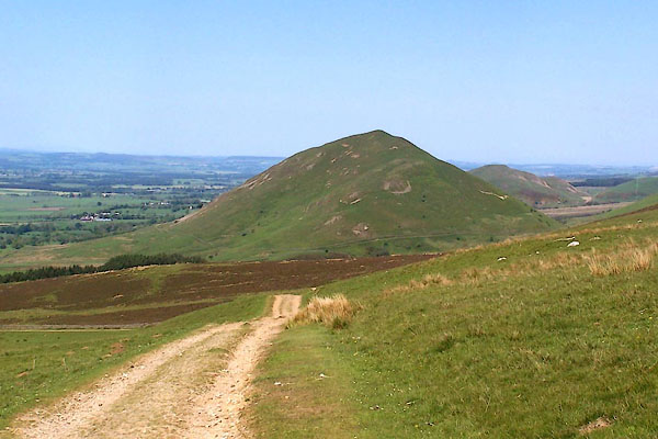 BQR82.jpg and the Pennine Way. (taken 1.6.2009) 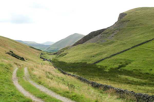 BRE55.jpg From:- Front to back, on the right, are Knock Pike, Dufton Pike, and Murton Pike. (taken 3.8.2009) |
||
|
|
||
| evidence:- | old map:- OS County Series (Wmd 9 3) placename:- Dufton Pike |
|
| source data:- | Maps, County Series maps of Great Britain, scales 6 and 25
inches to 1 mile, published by the Ordnance Survey, Southampton,
Hampshire, from about 1863 to 1948. |
|
|
|
||
| evidence:- | old map:- Morden 1695 (Wmd) placename:- Dufton Pike |
|
| source data:- | Map, hand coloured engraving, Westmorland, scale about 2.5 miles to 1 inch, by Robert
Morden, published by Abel Swale, the Unicorn, St Paul's Churchyard, Awnsham, and John
Churchill, the Black Swan, Paternoster Row, London, 1695.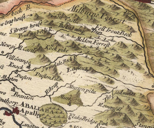 MD10NY72.jpg "Dufton Pike" Hillock. item:- JandMN : 24 Image © see bottom of page |
|
|
|
||
| evidence:- | old map:- Simpson 1746 map (Wmd) placename:- Dufton Pike |
|
| source data:- | Map, uncoloured engraving, Westmorland, scale about 8 miles to 1
inch, printed by R Walker, Fleet Lane, London, 1746.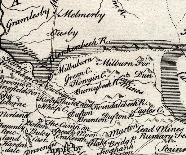 SMP2NYR.jpg "Dufton P." Hillock. item:- Dove Cottage : 2007.38.59 Image © see bottom of page |
|
|
|
||
| evidence:- | old map:- Bowen and Kitchin 1760 placename:- Dufton Pike |
|
| source data:- | Map, hand coloured engraving, A New Map of the Counties of
Cumberland and Westmoreland Divided into their Respective Wards,
scale about 4 miles to 1 inch, by Emanuel Bowen and Thomas
Kitchin et al, published by T Bowles, Robert Sayer, and John
Bowles, London, 1760.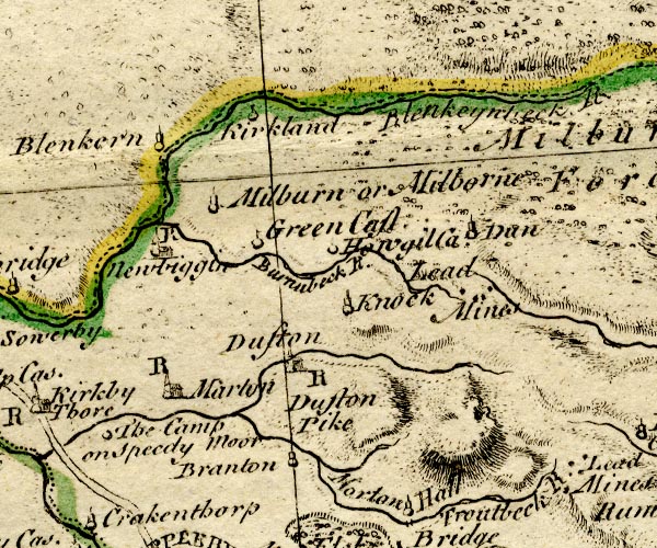 BO18NY62.jpg "Dufton Pike" hill hachuring item:- Armitt Library : 2008.14.10 Image © see bottom of page |
|
|
|
||
| evidence:- | old map:- Jefferys 1770 (Wmd) placename:- Dufton Pike |
|
| source data:- | Map, 4 sheets, The County of Westmoreland, scale 1 inch to 1
mile, surveyed 1768, and engraved and published by Thomas
Jefferys, London, 1770.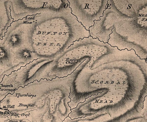 J5NY72NW.jpg "Dufton Pike" hill hachuring; hill or mountain item:- National Library of Scotland : EME.s.47 Image © National Library of Scotland |
|
|
|
||
| evidence:- | old map:- Cary 1789 (edn 1805) placename:- Dufton Pike |
|
| source data:- | Map, uncoloured engraving, Westmoreland, scale about 2.5 miles
to 1 inch, by John Cary, London, 1789; edition 1805.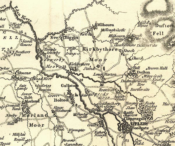 CY24NY62.jpg "Dufton Pike" hill hachuring item:- JandMN : 129 Image © see bottom of page |
|
|
|
||
| evidence:- | old painting:- placename:- Dufton Pike |
|
| source data:- | Painting, oil painting, Dufton Pike from Backstone Edge, Dufton, Westmorland, by Sir
Charles John Holmes, London, 1911-16.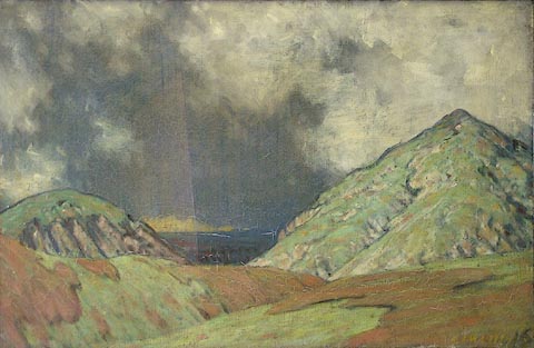 click to enlarge click to enlargePR0927.jpg View of Dufton Pike, to right of composition, from Backstone Edge which is covered in patches of bracken. Between the two fells, in centre of composition, lies a distant landscape thrown into shadow by black storm clouds. The horizon gleams weakly as the sun sets. initialled &dated at bottom right:- "CJH 1911-16" labelled at reverse:- "CJ Holmes 1911-1916 Dufton Pike from Backstone Edge 1911-16 CJ Holmes 13 Ladbroke Grove W" item:- Tullie House Museum : 1937.19.1 Image © Tullie House Museum |
|
|
|
||
 CGO41.jpg From S. (taken 14.9.2017) 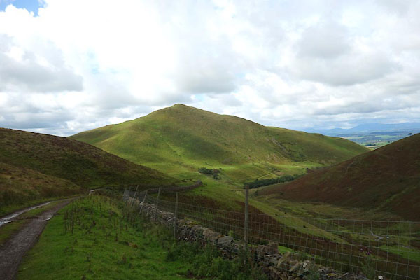 CGO42.jpg From N, from Great Rundale. (taken 14.9.2017) 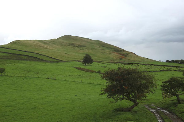 CGO43.jpg From NW, from Cosca Hill (taken 14.9.2017) 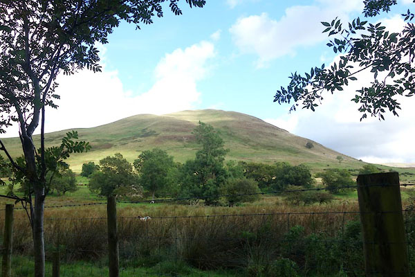 CGO71.jpg From W. (taken 14.9.2017) 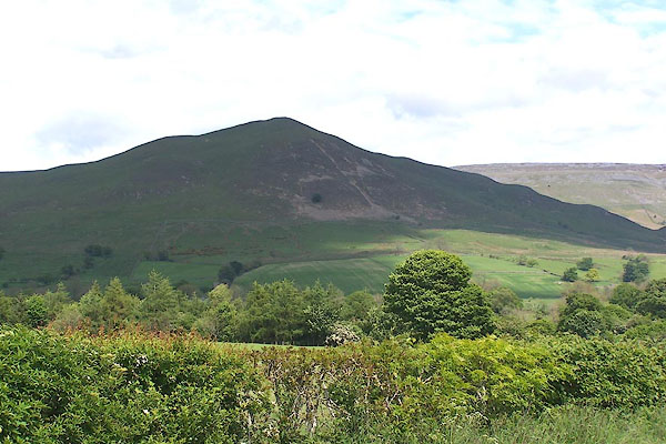 BNS85.jpg (taken 29.5.2007) 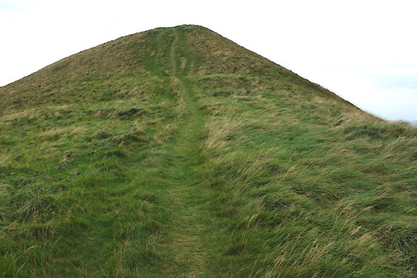 CGQ01.jpg The top. (taken 24.9.2017) 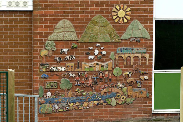 BXF58.jpg Mosaic at Long Marton School. (taken 31.8.2012) |
||
|
|
||
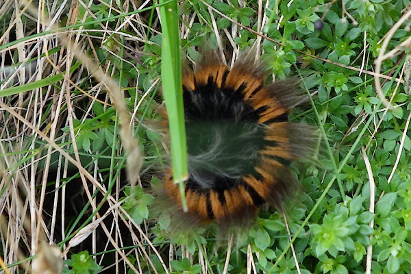 CGP98.jpg Caterpillar. (taken 24.9.2017)  CGP99.jpg Caterpillar. (taken 24.9.2017) |
||
|
|
||
 Lakes Guides menu.