 Old Cumbria Gazetteer
 |
 |
|
| Driggith Mine, Caldbeck | ||
| Driggith Mine | ||
| Driggeth Mine | ||
| Drigga Mine | ||
| locality:- | Driggith Beck | |
| locality:- | High Pike | |
| locality:- | Caldbeck Fells | |
| civil parish:- | Caldbeck (formerly Cumberland) | |
| county:- | Cumbria | |
| locality type:- | lead mine | |
| locality type:- | copper mine | |
| locality type:- | barium mine | |
| locality type:- | mine | |
| coordinates:- | NY32763527 (etc) | |
| 1Km square:- | NY3235 | |
| 10Km square:- | NY33 | |
| references:- | Adams, John: 1988: Mines of the Lake District Fells: Dalesman Books (Lancaster, Lancashire)::
ISBN 0 85206 931 6 |
|
|
|
||
 BRC92.jpg (taken 20.7.2009) |
||
|
|
||
| evidence:- | old map:- OS County Series (Cmd 48 5) placename:- Driggith Mine |
|
| source data:- | Maps, County Series maps of Great Britain, scales 6 and 25
inches to 1 mile, published by the Ordnance Survey, Southampton,
Hampshire, from about 1863 to 1948. "Driggith Mine (Old Lead Mine)" |
|
|
|
||
| evidence:- | old text:- Postlethwaite 1877 (3rd edn 1913) placename:- Driggeth Mine item:- lead ore; copper ore; galena; copper pyrites; blende; barytes; silver |
|
| source data:- | Book, Mines and Mining in the English Lake District, by John Postlethwaite, Keswick,
published by W H Moss and Sons, Whitehaven, Cumberland now Cumbria, 1877; published
1877-1913. goto source goto sourcepage 130:- "DRIGGETH MINE." "This mine is situated about a mile and a half east of Roughtengill, and on a direct course of its veins. It produces many varieties of lead and copper ores, and also small quantities of blende and barytes. The lead contains about 25 ounces of silver per ton." "Three adits, namely, the thirty, sixty, and ninety fathom levels, have been driven, and a large extent of ground excavated, especially above the sixty fathom level. The ground below has been less productive." "Driggeth was opened at a much more recent date than Roughtengill, but it yielded large quantities of lead and copper ores, and returned considerable profits. Afterwards, it became less prosperous, and was abandoned about thirty-five years ago." |
|
|
|
||
| evidence:- | old map:- Postlethwaite 1877 (3rd edn 1913) placename:- Driggeth Mine |
|
| source data:- | Map, uncoloured engraving, Map of the Lake District Mining Field, Westmorland, Cumberland,
Lancashire, scale about 5 miles to 1 inch, by John Postlethwaite, published by W H
Moss and Sons, 13 Lowther Street, Whitehaven, Cumberland, 1877 edn 1913.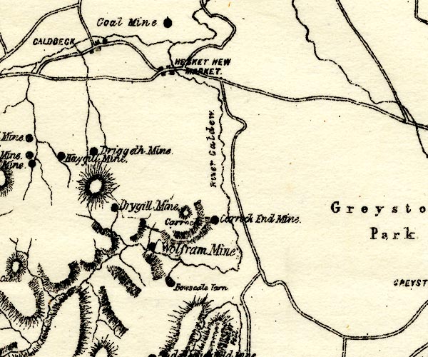 PST2NY33.jpg "Driggeth Mine" mine symbol item:- JandMN : 162.2 Image © see bottom of page |
|
|
|
||
| evidence:- | visit log:- KDMRS 1979-82 placename:- Driggeth Mines item:- campylite; malachite; azurite |
|
| source data:- | Notes, log book of Geological Outings, mine plans, etc, Kendal
and District Mine Research Society, Kendal area, Cumbria, etc,
visits made 1979-82. Geological Outing of the Kendal and District Mine Research Society Log book page 10:- "DATE - 13/5/79 SUNDAY / MAP REF - 3280 3525 / LOCATION - DRIGGETH / NAME - DRIGGETH MINES / TYPE OF SITE - MINE WORKINGS / WORKING OR DISUSED - DISUSED / PEOPLE IN PARTY [ ] / NOS. OF PHOTOS - No.57. / SPECIMENS FOUND - SMALL CRYSTALS OF CAMPYLITE AND SMALL AMOUNTS OF MALACHITE / COMMENTS - VERY HOT DAY. NO LEVELS OPEN, WITH THE EXCEPTION OF ONE WHICH IS IN DRYGILL, BUT IS FULL OF WATER." Log book page 72:- "DATE - 15/9/80 / MAP REF - 3280/3525 / LOCATION - DRIGGETH / NAME - DRIGGETH MINES / TYPE OF SITE - MINES / WORKING OR DISUSED - DISUSED. / PEOPLE IN PARTY [ ] / NOS. OF PHOTOS - 7 / SPECIMENS FOUND - CAMPYLITE, AZURITE &MALACHITE. / COMMENTS - WARM DULL DAY. ONLY ONE LEVEL LEFT OPEN, IN WATER 2FT-3FT DEEP. AND ENDING IN A ROOF FALL. THIS FALL IS PASSABLE BUT WAS NOT ATTEMPTED DUE TO THE UNSAFE NATURE OF THE ROOF." item:- private collection : 82 Image © see bottom of page |
|
|
|
||
| MN photo:- |
There is not a lot to see here. |
|
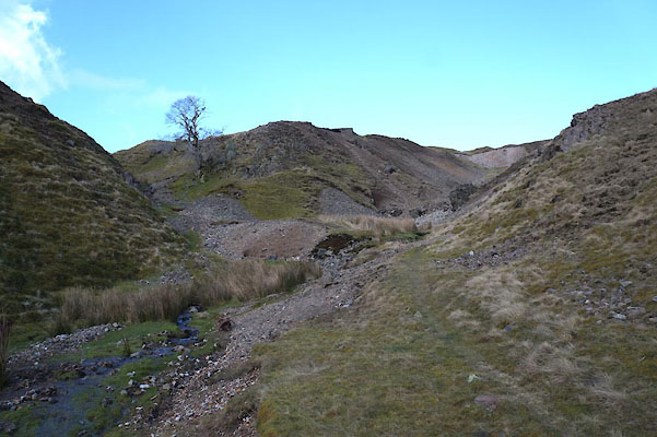 BZZ59.jpg (taken 3.3.2014) 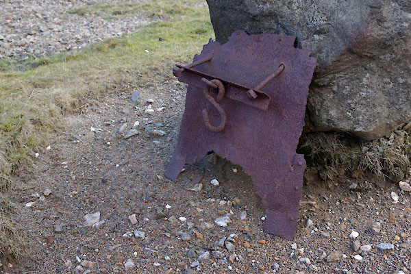 BZZ60.jpg Scrap metal. (taken 3.3.2014) 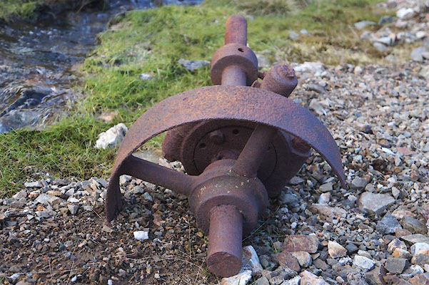 BZZ61.jpg Scrap, shaft, pulley, plummer block. (taken 3.3.2014) 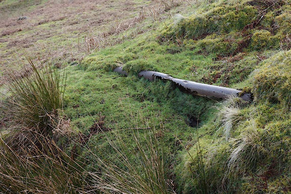 CAA56.jpg Pipe. (taken 3.3.2014) 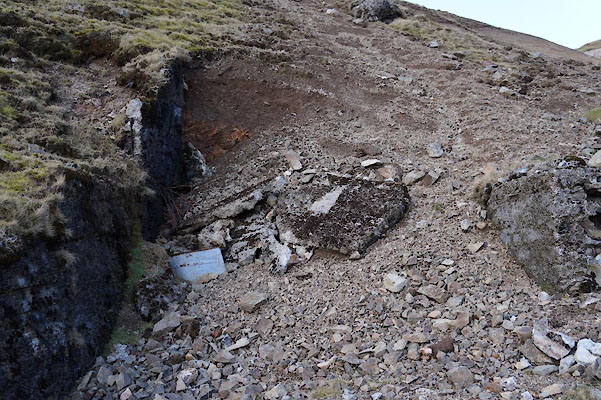 BZZ62.jpg Site of level, (taken 3.3.2014) 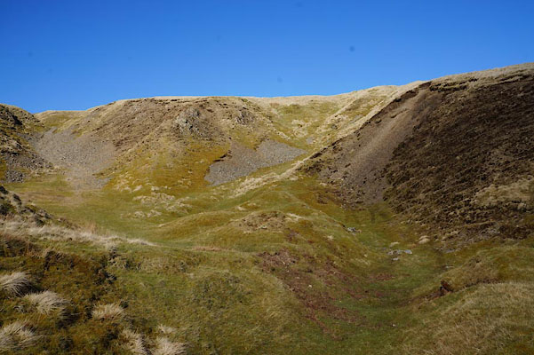 BZZ63.jpg Site of level, (taken 3.3.2014) 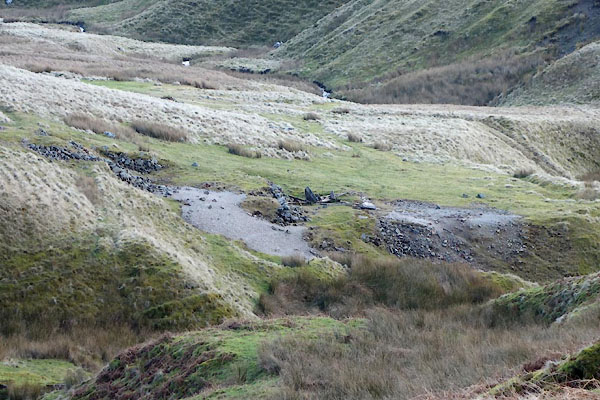 CAA55.jpg Site of level? (taken 3.3.2014) 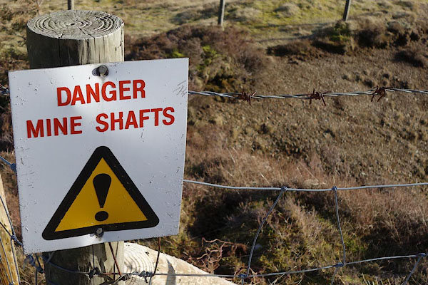 CAA84.jpg Shaft, (taken 3.3.2014) 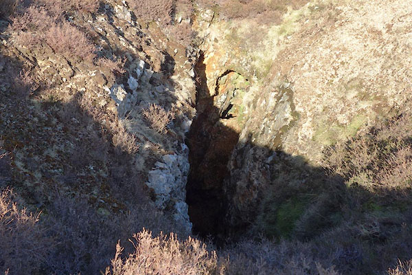 CAA85.jpg Shaft, (taken 3.3.2014) 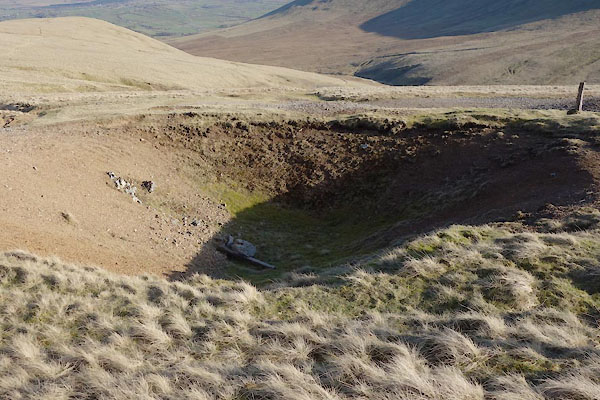 CAA87.jpg Hole, (taken 3.3.2014) 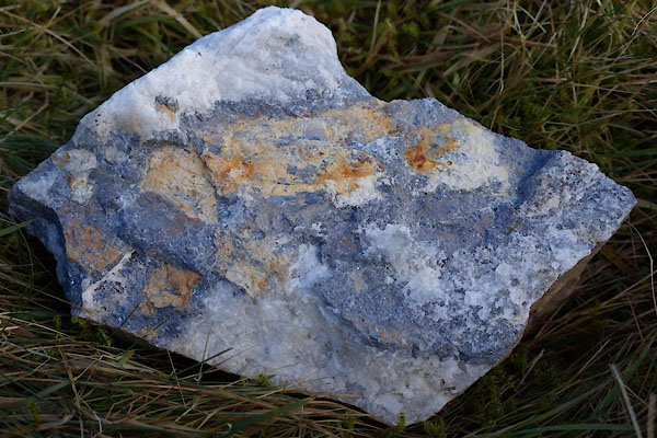 BZZ64.jpg Rock. (taken 3.3.2014) 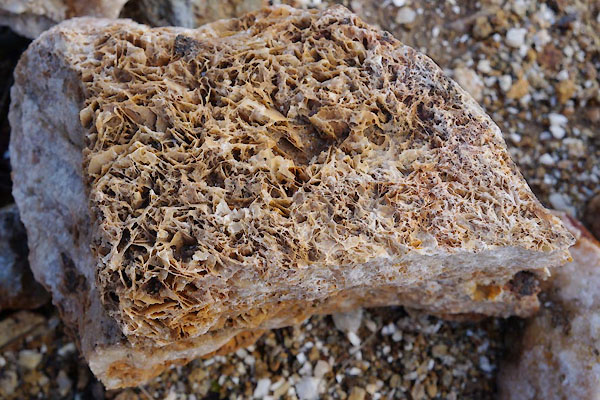 BZZ65.jpg Rock (taken 3.3.2014) 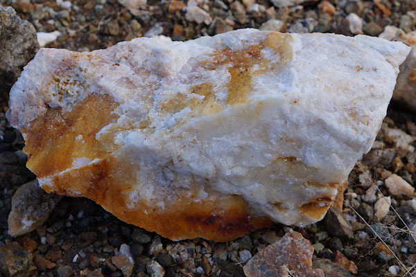 BZZ66.jpg Rock (taken 3.3.2014) |
||
|
|
||
| :- |
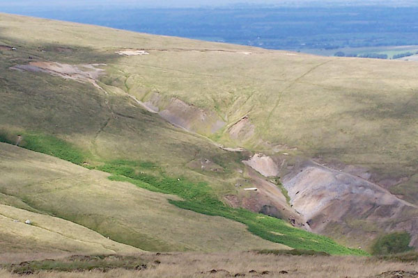
Located at the head of Driggith Beck, perhaps started 17th or 18th century; worked
to 1940s. |
|
| Various levels in the area, exploiting Driggith Main Vein and South Vein, many minerals:
galena, lead sulphide, PbS; baryte, barium sulphate, BaSO4; sphalerite, zinc blende,
zinc sulphide, ZnS; and chalcopyrite, copper iron sulphide, CuFeS2; and some silver. |
||
| : 2015 (?): Mines in Cumbria: Cumbria RIGS Adams, John: 1988: Mines of the Lake District Fells: Dalesman Books (Lancaster, Lancashire):: ISBN 0 85206 931 6 |
||
|
|
||
Lakes Guides menu.