 Old Cumbria Gazetteer
 |
 |
|
| Dalton Tunnel, Dalton Town with Newton | ||
| Dalton Tunnel | ||
| site name:- | Furness Railway | |
| locality:- | Dalton-in-Furness | |
| civil parish:- | Dalton Town with Newton (formerly Lancashire) | |
| county:- | Cumbria | |
| locality type:- | railway tunnel | |
| coordinates:- | SD22657366 | |
| coordinates:- | SD22837376 | |
| 1Km square:- | SD2273 | |
| 10Km square:- | SD27 | |
|
|
||
 CCV99.jpg From the station. (taken 17.4.2015) 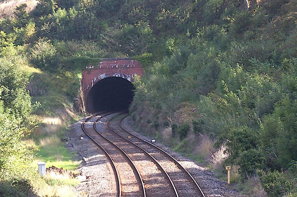 BMO46.jpg West portal. (taken 30.8.2006) |
||
|
|
||
| evidence:- | old map:- OS County Series (Lan 16 13) |
|
| source data:- | Maps, County Series maps of Great Britain, scales 6 and 25
inches to 1 mile, published by the Ordnance Survey, Southampton,
Hampshire, from about 1863 to 1948.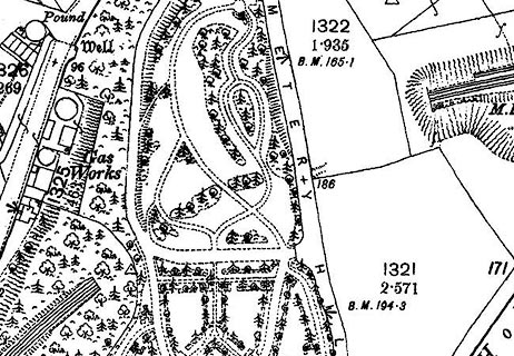 click to enlarge click to enlargeCSRY0142.jpg |
|
|
|
||
 Lakes Guides menu.