 |
 |
   |
|
|
|
Dalston Hall |
| civil parish:- |
Dalston (formerly Cumberland) |
| county:- |
Cumbria |
| locality type:- |
buildings |
| coordinates:- |
NY37675157 (etc) |
| 1Km square:- |
NY3751 |
| 10Km square:- |
NY35 |
|
|
| evidence:- |
old map:- OS County Series (Cmd 23 14)
placename:- Dalston Hall
|
| source data:- |
Maps, County Series maps of Great Britain, scales 6 and 25
inches to 1 mile, published by the Ordnance Survey, Southampton,
Hampshire, from about 1863 to 1948.
|
|
|
| evidence:- |
old map:- Saxton 1579
placename:- Dauston Hall
|
| source data:- |
Map, hand coloured engraving, Westmorlandiae et Cumberlandiae Comitatus ie Westmorland
and Cumberland, scale about 5 miles to 1 inch, by Christopher Saxton, London, engraved
by Augustinus Ryther, 1576, published 1579-1645.
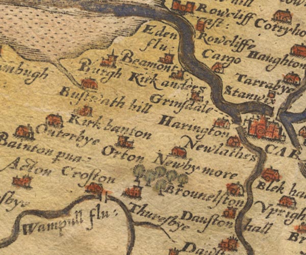
Sax9NY35.jpg
Tower, symbol for a house, hall, tower, etc. "Dauston hall"
item:- private collection : 2
Image © see bottom of page
|
|
|
| evidence:- |
old map:- Speed 1611 (Cmd)
placename:- Dauston Hal
|
| source data:- |
Map, hand coloured engraving, Cumberland and the Ancient Citie
Carlile Described, scale about 4 miles to 1 inch, by John Speed,
1610, published by J Sudbury and George Humble, Popes Head
Alley, London, 1611-12.
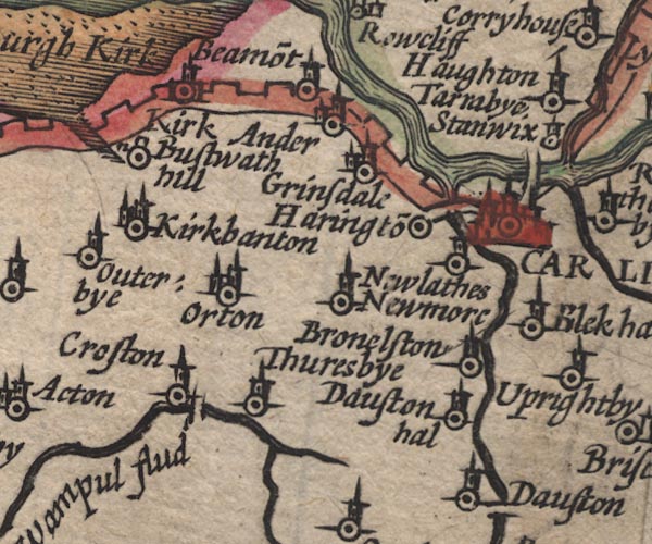
SP11NY35.jpg
"Dauston hal"
circle, tower
item:- private collection : 16
Image © see bottom of page
|
|
|
| evidence:- |
old map:- Jansson 1646
placename:- Dauston Hall
|
| source data:- |
Map, hand coloured engraving, Cumbria and Westmoria, ie
Cumberland and Westmorland, scale about 3.5 miles to 1 inch, by
John Jansson, Amsterdam, Netherlands, 1646.
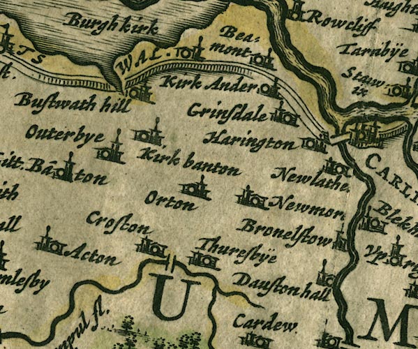
JAN3NY35.jpg
"Dauston hall"
Buildings and tower.
item:- JandMN : 88
Image © see bottom of page
|
|
|
| evidence:- |
old map:- Morden 1695 (Cmd)
placename:- Dalston Hall
|
| source data:- |
Map, uncoloured engraving, Cumberland, scale about 4 miles to 1
inch, by Robert Morden, 1695, published by Abel Swale, the
Unicorn, St Paul's Churchyard, Awnsham, and John Churchill, the
Black Swan, Paternoster Row, London, 1695-1715.
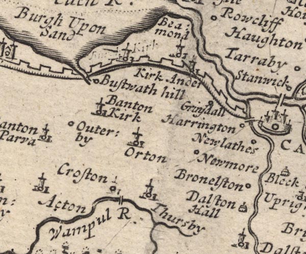
MD12NY35.jpg
"Dalston Hall"
Drawing of a house.
item:- JandMN : 90
Image © see bottom of page
|
|
|
| evidence:- |
descriptive text:- Simpson 1746
placename:- Dalston Hall
|
| source data:- |
Atlas, three volumes of maps and descriptive text published as
'The Agreeable Historian, or the Compleat English Traveller
...', by Samuel Simpson, 1746.
 goto source goto source
"... Dalston Hall, Sir George Dalston's. ..."
|
|
|
| evidence:- |
old map:- Bowen and Kitchin 1760
placename:- Dalton hall
|
| source data:- |
Map, hand coloured engraving, A New Map of the Counties of
Cumberland and Westmoreland Divided into their Respective Wards,
scale about 4 miles to 1 inch, by Emanuel Bowen and Thomas
Kitchin et al, published by T Bowles, Robert Sayer, and John
Bowles, London, 1760.
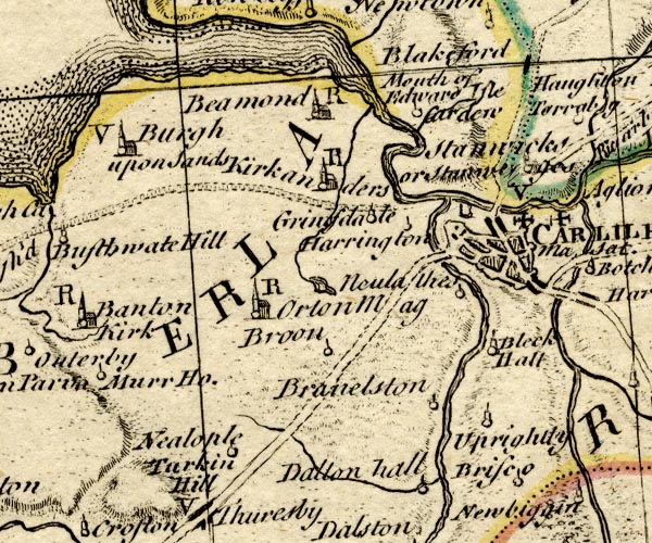
BO18NY35.jpg
"Dalton hall"
circle and line
item:- Armitt Library : 2008.14.10
Image © see bottom of page
|
|
|
| evidence:- |
old map:- Donald 1774 (Cmd)
placename:- Dalston Hall
|
| source data:- |
Map, hand coloured engraving, 3x2 sheets, The County of Cumberland, scale about 1
inch to 1 mile, by Thomas Donald, engraved and published by Joseph Hodskinson, 29
Arundel Street, Strand, London, 1774.
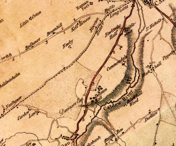
D4NY35SE.jpg
"Dalston Hall / Davinson Esqr."
house
item:- Carlisle Library : Map 2
Image © Carlisle Library |
|
|
| evidence:- |
road book:- Cary 1798 (2nd edn 1802)
placename:- Dalston Hall
|
| source data:- |
Road book, itineraries, Cary's New Itinerary, by John Cary, 181
Strand, London, 2nd edn 1802.
 goto source goto source
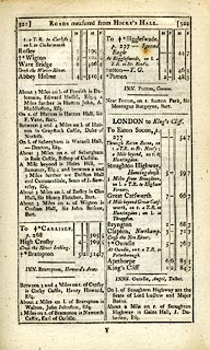 click to enlarge click to enlarge
C38321.jpg
page 321-322 "A mile beyond [Rose Castle] ... and between 2 and 3 Miles further are Dalston Hall
and Cummersdale, Seats of J. Sowerby, Esq."
item:- JandMN : 228.1
Image © see bottom of page
|
|
|
| evidence:- |
road book:- Cary 1798 (2nd edn 1802)
placename:- Dalston Hall
|
| source data:- |
Road book, itineraries, Cary's New Itinerary, by John Cary, 181
Strand, London, 2nd edn 1802.
 goto source goto source
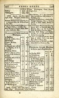 click to enlarge click to enlarge
C38557.jpg
page 557-558 "Near Dalston, on l. are Cummersdale, and Dalston Hall, Seats of J. Sowerby, Esq."
item:- JandMN : 228.2
Image © see bottom of page
|
|
|
| evidence:- |
descriptive text:- Ford 1839 (3rd edn 1843)
placename:- Dalston Hall
|
| source data:- |
Guide book, A Description of Scenery in the Lake District, by
Rev William Ford, published by Charles Thurnam, Carlisle, by W
Edwards, 12 Ave Maria Lane, Charles Tilt, Fleet Street, William
Smith, 113 Fleet Street, London, by Currie and Bowman,
Newcastle, by Bancks and Co, Manchester, by Oliver and Boyd,
Edinburgh, and by Sinclair, Dumfries, 1839.
 goto source goto source
Page 99:- "..."
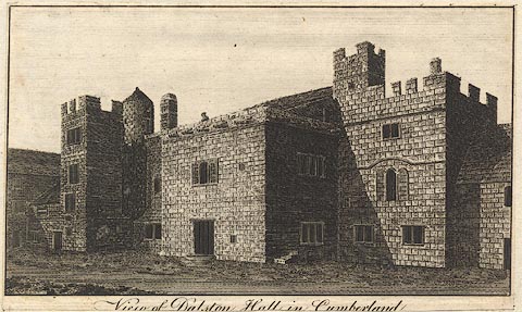
"Following, however, the high road, the only object to be noticed is Dalston Hall,
now used as a farm-house. It has a venerable look of olden times: the outline is varied
with turrets and battlements."
 goto source goto source
Page 100:- "Just below the parapet is a cornice ornamented with stone cannon, in imitation of
the early invented ones, formed of bars of iron welded together, or rings twisted.
It has long passed from the family of that name. A fine avenue of trees leads up to
it, and commands, from the rising ground, an extensive and beautiful prospect of Dalston,
the vale, the woods of Rose, and the distant fells. The traces of a Roman encampment
are observable in front. .."
|
|
|
| evidence:- |
old map:- Ford 1839 map
placename:- Dalston Hall
|
| source data:- |
Map, uncoloured engraving, Map of the Lake District of
Cumberland, Westmoreland and Lancashire, scale about 3.5 miles
to 1 inch, published by Charles Thurnam, Carlisle, and by R
Groombridge, 5 Paternoster Row, London, 3rd edn 1843.
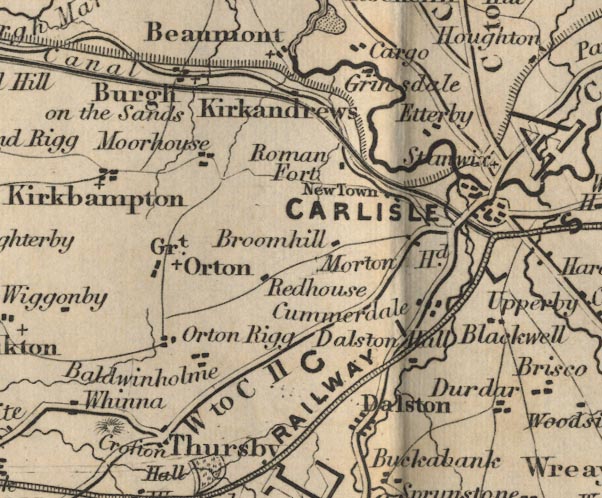
FD02NY35.jpg
"Dalston Hall"
item:- JandMN : 100.1
Image © see bottom of page
|
|
|
| evidence:- |
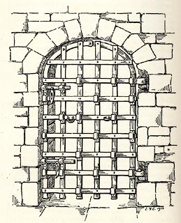
old print:- Curwen 1913
placename:- Dalston Hall
item:- door; iron yett
|
| source data:- |
Print, uncoloured lithograph, Entrance Door to Dalston Hall, an iron yett, Dalston,
Cumberland, published for the Cumberland and Westmorland Antiquarian and Archaeological
Society by Titus Wilson, Kendal, Westmorland, 1913.
 click to enlarge click to enlarge
CW0132.jpg
On p.176 of The Castles and Fortified Towers of Cumberland, Westmorland, and Lancashire
North of the Sands, by John F Curwen.
printed at bottom:- "ENTRANCE DOOR TO DALSTON HALL."
printed at lower right:- "J. F. C. 1913"
item:- Armitt Library : A782.32
Image © see bottom of page
|
|
|
| evidence:- |
database:- Listed Buildings 2010
placename:- Dalston Hall
|
| source data:- |
courtesy of English Heritage
"DALSTON HALL NY 376515 / / / DALSTON / CARLISLE / CUMBRIA / II[star] / 78312 / NY3765851566"
|
|
|
| evidence:- |
old painting:-
item:- oak; tree
|
| source data:- |
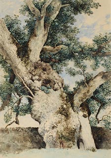
Painting, watercolour, Study for Tree in 'The Rookery', Dalston, Cumberland, by William
James Blacklock, about 1854.
 click to enlarge click to enlarge
PR0957.jpg
An ancient oak tree with hollow trunk stands beside a drystone wall. This is a study
for the tree on the far left of composition in The Rookery by William James Blacklock.
item:- Tullie House Museum : 1949.37.1
Image © Tullie House Museum |
|
|
| evidence:- |
old print:- Lowther 1780s-90s
|
| source data:- |
Print, engraving, Dalston Hall, Dalston, Cumbria, late 18th century.
 click to enlarge click to enlarge
BNF03.jpg
item:- Dove Cottage : Lowther.68
Image © see bottom of page
|
|
|
| evidence:- |
old painting:-
item:- rookery
|
| source data:- |
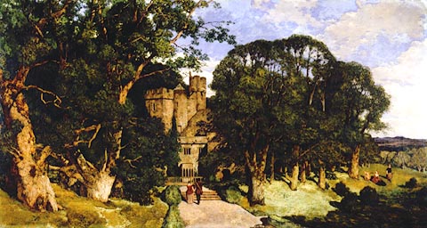
Painting, oil painting, The Rookery, Dalston Hall, Dalston, Cumberland, by William
James Blacklock, 1854.
 click to enlarge click to enlarge
PR0937.jpg
The Rookery 1854 oil on canvas by William James Blacklock . This oil painting shows
Dalston Hall near Carlisle surrounded by ancient trees on a summer's day. A young
couple wearing seventeenth century dress walk along the path leading to the hall,
their backs to the viewer. To right, a second couple sit and a another woman stands
in parkland beside the trees which surround the hall. Distant fells rise beyond sloping
woodland. The figures cast strong shadows and almost have a photographic quality.
The painting was exhibited at the Royal Academy in 1854. In this painting we can see
Blacklock's characteristic and very unusual painting style. The trees are almost three
dimensional.
signed &dated at bottom left:- "W J Blacklock 1854"
labelled at reverse:- "'The Rookery' by Wm Jas Blacklock 1836-1855 Exhibited at Royal Academy"
labelled at reverse:- "No 1 The Rookery W J Blacklock Cumwhitton Carlisle"
item:- Tullie House Museum : 1946.67.1
Image © Tullie House Museum |
|
|
hearsay:-
|
Pele built about 1500, has its original yett; additions in 17th-19th centuries. Closed
to vists.
|
|
|
notes:-
|
late 15th century tower, hall, etc
|
|
Perriam, D R &Robinson, J: 1998: Medieval Fortified Buildings of Cumbria: CWAAS::
ISBN 1 873124 23 6; plan and illustartions
|
|
|


 goto source

 goto source
 click to enlarge
 goto source
 click to enlarge
 goto source
 goto source
 click to enlarge
 click to enlarge
 click to enlarge
 click to enlarge