 Old Cumbria Gazetteer
 |
 |
|
| Curthwaite Station, Westward | ||
| Curthwaite Station | ||
| site name:- | Maryport and Carlisle Railway | |
| locality:- | West Curthwaite | |
| civil parish:- | Westward (formerly Cumberland) | |
| county:- | Cumbria | |
| locality type:- | railway station | |
| coordinates:- | NY32574925 | |
| 1Km square:- | NY3249 | |
| 10Km square:- | NY34 | |
| SummaryText:- | Opened 1850; closed 1950. | |
|
|
||
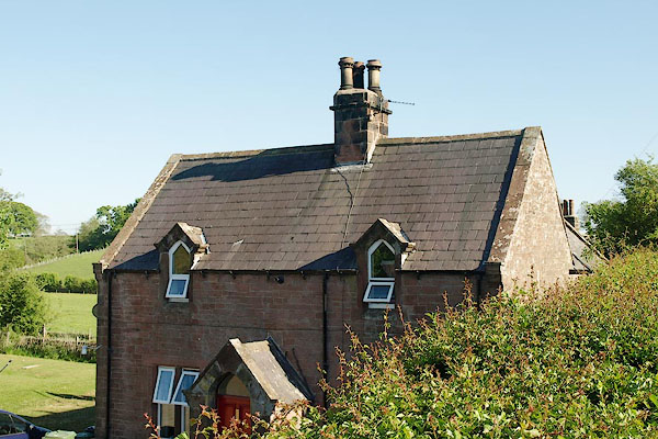 BSU53.jpg (taken 23.5.2010)  BZO94.jpg Chimneys. (taken 1.11.2013) |
||
|
|
||
| evidence:- | old map:- OS County Series (Cmd 29 8) placename:- Curthwaite Station item:- railway bridge |
|
| source data:- | Maps, County Series maps of Great Britain, scales 6 and 25
inches to 1 mile, published by the Ordnance Survey, Southampton,
Hampshire, from about 1863 to 1948.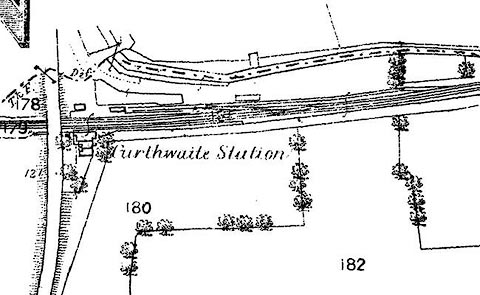 click to enlarge click to enlargeCSRY0043.jpg "Curthwaite Station" |
|
|
|
||
| evidence:- | old map:- Garnett 1850s-60s H placename:- Curthwaite Station |
|
| source data:- | Map of the English Lakes, in Cumberland, Westmorland and
Lancashire, scale about 3.5 miles to 1 inch, published by John
Garnett, Windermere, Westmorland, 1850s-60s.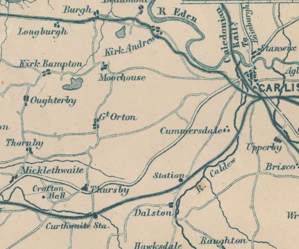 GAR2NY35.jpg "Curthwaite Sta." dot by railway item:- JandMN : 82.1 Image © see bottom of page |
|
|
|
||
| evidence:- | database:- Listed Buildings 2010 |
|
| source data:- | courtesy of English Heritage "WATER TOWER / / / WESTWARD / ALLERDALE / CUMBRIA / II / 72525 / NY3251749246" |
|
| source data:- | courtesy of English Heritage "Water tower. Dated 1843; built to serve the Maryport and Carlisle Railway (Curthwaite railway station was opened in May 1843). The ironwork carries the inscription 'Hareshaw Ironworks, Hexham, 1843" and the structure was probably designed by John Blackmore (Engineer to the Railway Company). Stone base (Containing a single service room) supports tank. Base, 3xl bays, each bay with round-headed arch, received, with plain capitals divided by unadorned pilasters. Double doors to single end bay; side bays with door, window with glazing bars, and plain masonry respectively. Moulded cornice. Tank, 4x2 panels with cruciform sunken centres. Internall; tank supported by cambered cross girder (I-section), and 2 axiel girders, also of I section with marked alteration. This water tower is understood to be the last surviving original operational structure on the Maryport and Carlisle Railway." |
|
|
|
||
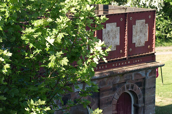 BSU54.jpg Water tower:- "[HARESHAW] WORKS HEXHAM 1843" (taken 23.5.2010) 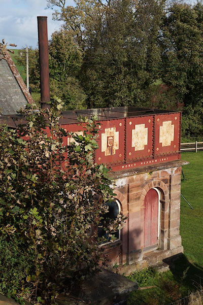 BZO93.jpg Water tower:- "[HARESHAW] WORKS HEXHAM 1843" (taken 1.11.2013) |
||
|
|
||
 Lakes Guides menu.