 Old Cumbria Gazetteer
 |
 |
|
| Crow Holme, Windermere lake | ||
| Crow Holme | ||
| Puppy Holme | ||
| site name:- | Windermere lake | |
| civil parish:- | Windermere (formerly Westmorland) | |
| county:- | Cumbria | |
| locality type:- | island | |
| coordinates:- | SD39109580 | |
| 1Km square:- | SD3995 | |
| 10Km square:- | SD39 | |
|
|
||
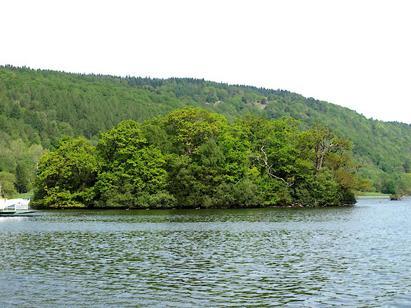 BPD52.jpg (taken 12.5.2008) |
||
|
|
||
| evidence:- | old map:- OS County Series (Wmd 32 15) placename:- Crow Holm |
|
| source data:- | Maps, County Series maps of Great Britain, scales 6 and 25
inches to 1 mile, published by the Ordnance Survey, Southampton,
Hampshire, from about 1863 to 1948. "Crow Holm / Boat Houses" |
|
| source data:- | Maps, County Series maps of Great Britain, scales 6 and 25
inches to 1 mile, published by the Ordnance Survey, Southampton,
Hampshire, from about 1863 to 1948. "Crow Holme" |
|
|
|
||
| evidence:- | old map:- Crosthwaite 1783-94 (Win/Ble) placename:- Crow Holm |
|
| source data:- | Map, uncoloured engraving, An Accurate Map of the Grand Lake of
Windermere, scale about 2 inches to 1 mile, by Peter
Crosthwaite, Keswick, Cumberland, 1783, version published 1819.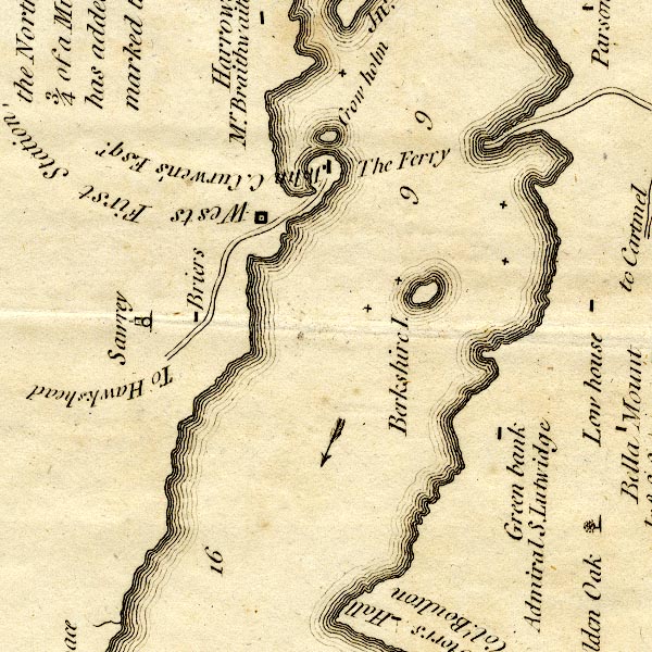 CT9SD39X.jpg "Crow holm" island item:- Armitt Library : 2008.14.102 Image © see bottom of page |
|
|
|
||
| evidence:- | old map:- Clarke 1787 map (Windermere S) placename:- Crowholm |
|
| source data:- | Map, A Map of the Southern Part of the Lake Winandermere and its
Environs, scale about 6.5 ins to 1 mile, by James Clarke,
engraved by Samuel John Neele, 352 Strand, published by James
Clarke, Penrith, Cumberland and in London etc, 1787.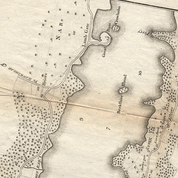 CLBSD39X.jpg "Crowholm" item:- private collection : 10.11 Image © see bottom of page |
|
|
|
||
| evidence:- | old map:- Clarke 1787 map (Windermere N) placename:- Crow Holme |
|
| source data:- | Map, A Map of the Northern Part of the Lake Winandermere and its
Environs, scale about 6.5 ins to 1 mile, by James Clarke,
engraved by Samuel John Neele, 352 Strand, published by James
Clarke, Penrith, Cumberland and in London etc, 1787.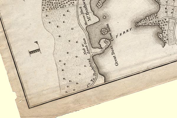 CLASD39X.jpg "Crow holme" item:- private collection : 10.10 Image © see bottom of page |
|
|
|
||
 Lakes Guides menu.