 Old Cumbria Gazetteer
 |
 |
|
| Cropple How, Muncaster | ||
| Cropple How | ||
| civil parish:- | Muncaster (formerly Cumberland) | |
| county:- | Cumbria | |
| locality type:- | buildings | |
| coordinates:- | SD12879774 | |
| 1Km square:- | SD1297 | |
| 10Km square:- | SD19 | |
|
|
||
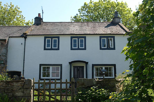 BYM26.jpg (taken 4.6.2013) |
||
|
|
||
| evidence:- | old map:- OS County Series (Cmd 83 5) placename:- Croppel How |
|
| source data:- | Maps, County Series maps of Great Britain, scales 6 and 25
inches to 1 mile, published by the Ordnance Survey, Southampton,
Hampshire, from about 1863 to 1948. |
|
|
|
||
| evidence:- | old map:- Donald 1774 (Cmd) placename:- Coople How |
|
| source data:- | Map, hand coloured engraving, 3x2 sheets, The County of Cumberland, scale about 1
inch to 1 mile, by Thomas Donald, engraved and published by Joseph Hodskinson, 29
Arundel Street, Strand, London, 1774.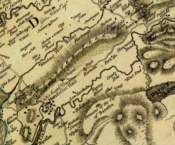 D4SD19NW.jpg "Coople How" block or blocks, labelled in lowercase; a hamlet or just a house item:- Carlisle Library : Map 2 Image © Carlisle Library |
|
|
|
||
| evidence:- | database:- Listed Buildings 2010 placename:- Cropple How Farm |
|
| source data:- | courtesy of English Heritage "CROPPLE HOW FARMHOUSE / / / MUNCASTER / COPELAND / CUMBRIA / II / 76264 / SD1287697741" |
|
|
|
||
| hearsay:- |
The farm house has a wattle and daub chimney hood. |
|
|
|
||
 Lakes Guides menu.