 |
 |
   |
|
|
|
Copperheap Bay |
| site name:- |
Derwent Water |
| civil parish:- |
Above Derwent (formerly Cumberland) |
| county:- |
Cumbria |
| locality type:- |
bay |
| coordinates:- |
NY25382171 (etc) |
| 1Km square:- |
NY2521 |
| 10Km square:- |
NY22 |
|
|
| evidence:- |
old map:- OS County Series (Cmd 64 10)
placename:- Copperheap Bay
|
| source data:- |
Maps, County Series maps of Great Britain, scales 6 and 25
inches to 1 mile, published by the Ordnance Survey, Southampton,
Hampshire, from about 1863 to 1948.
|
|
|
| evidence:- |
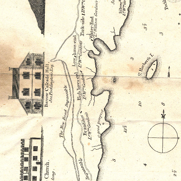
old map:- Crosthwaite 1783-94 (Der)
|
| source data:- |
Map, uncoloured engraving, An Accurate Map of the Matchless Lake
of Derwent, ie Derwent Water, scale about 3 inches to 1 mile, by
Peter Crosthwaite, Keswick, Cumberland, 1783, version published
1800.

CT2NY21P.jpg
item:- Armitt Library : 1959.191.3
Image © see bottom of page
|
|
|
| evidence:- |
old text:- Postlethwaite 1877 (3rd edn 1913)
placename:- CopperheapBay
item:- copper ore
|
| source data:- |
Book, Mines and Mining in the English Lake District, by John Postlethwaite, Keswick,
published by W H Moss and Sons, Whitehaven, Cumberland now Cumbria, 1877; published
1877-1913.
 goto source goto source
page 75:- "... Six furnaces [Keswick Smelting House] were in operation in 1567, supplied chiefly
with ore from the mines in Newlands; but small quantities were also brought from Caldbeck
and Coniston. It is generally supposed that the ore was conveyed from the mines in
Newlands to the western shore of Derwentwater, and thence by boats to Keswick. The
place where it was embarked is called Copperheap Bay, from a mound of very impure
copper ore which still remains to mark the place."
|
|
|


 goto source