 Old Cumbria Gazetteer
 |
 |
|
| Church Bridge, Cartmel | ||
| Church Bridge | ||
| site name:- | Eea, River | |
| locality:- | Cartmel | |
| civil parish:- | Lower Allithwaite (formerly Lancashire) | |
| county:- | Cumbria | |
| locality type:- | bridge | |
| coordinates:- | SD37897877 | |
| 1Km square:- | SD3778 | |
| 10Km square:- | SD37 | |
|
|
||
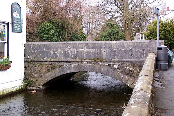 BLU33.jpg (taken 7.4.2006) 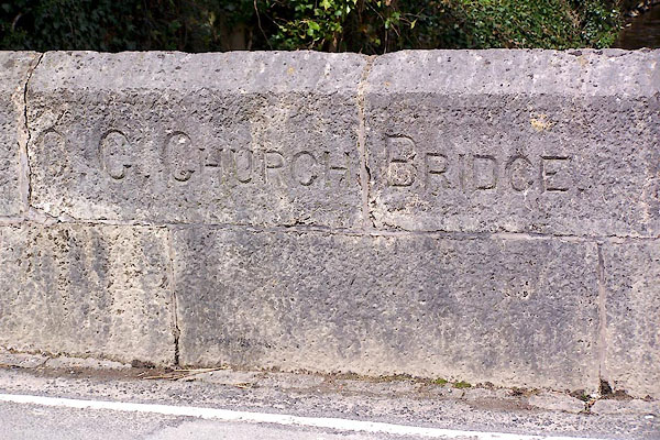 BLU34.jpg Plaque on parapet:- "C.C. CHURCH BRIDGE" (taken 7.4.2006) |
||
|
|
||
| evidence:- | old map:- OS County Series (Lan 17 3) placename:- Church Bridge |
|
| source data:- | Maps, County Series maps of Great Britain, scales 6 and 25
inches to 1 mile, published by the Ordnance Survey, Southampton,
Hampshire, from about 1863 to 1948. |
|
|
|
||
| evidence:- | old map:- Bowen and Kitchin 1760 |
|
| source data:- | Map, hand coloured engraving, A New Map of the Counties of
Cumberland and Westmoreland Divided into their Respective Wards,
scale about 4 miles to 1 inch, by Emanuel Bowen and Thomas
Kitchin et al, published by T Bowles, Robert Sayer, and John
Bowles, London, 1760.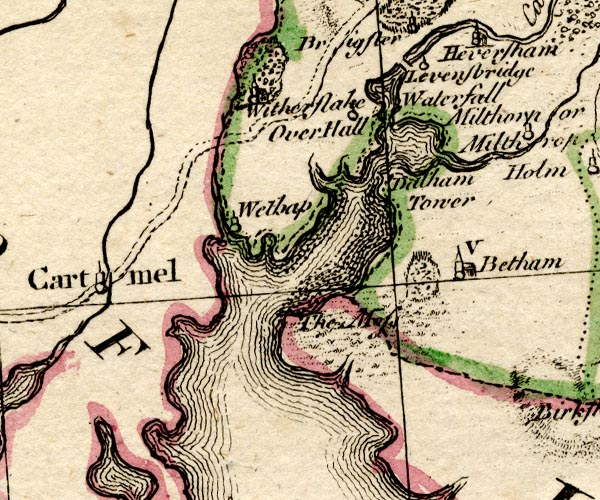 BO18SD37.jpg road across stream at Cartmel item:- Armitt Library : 2008.14.10 Image © see bottom of page |
|
|
|
||
| evidence:- | database:- Listed Buildings 2010 placename:- Church Bridge |
|
| source data:- | courtesy of English Heritage "CHURCH BRIDGE / / THE SQUARE / LOWER ALLITHWAITE / SOUTH LAKELAND / CUMBRIA / II / 77003 / SD3788478769" |
|
| source data:- | courtesy of English Heritage "Bridge. Dated 1829. Dressed stone and ashlar. Segmental arch with ashlar voussoirs and key; band above. Ashlar parapet with date to south side of south parapet. South side of north parapet inscribed; "C.C. CHURCH BRIDGE"." |
|
|
|
||
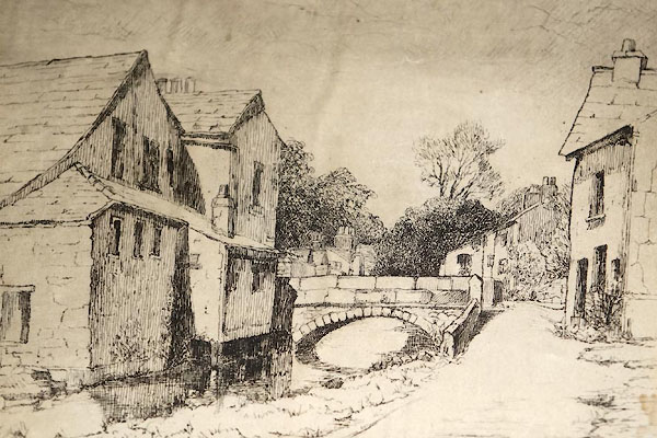 CEB91.jpg |
||
|
|
||
 Lakes Guides menu.