Old Cumbria Gazetteer
 |
 |
|
||
| Castlerigg, St John's Castlerigg etc | ||||
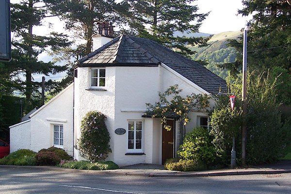
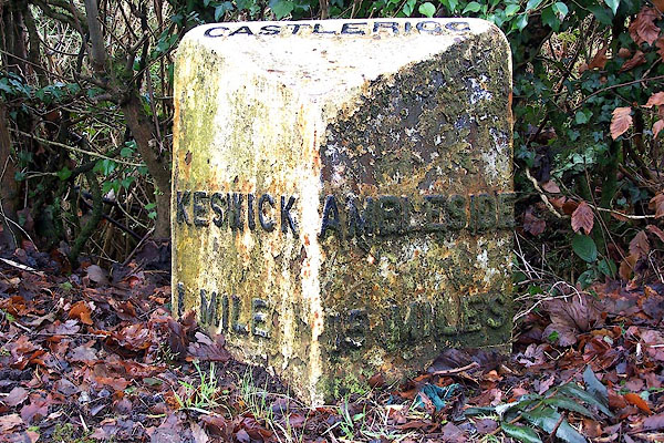
| Castlerigg | ||||
| civil parish:- | St John's Castlerigg and Wythburn (formerly Cumberland) | |||
| county:- | Cumbria | |||
| locality type:- | locality | |||
| locality type:- | buildings | |||
| coordinates:- | NY28242263 (etc) | |||
| 1Km square:- | NY2822 | |||
| 10Km square:- | NY22 | |||
|
|
||||
| evidence:- | old map:- OS County Series (Cmd 64 7) placename:- Castlerigg |
|||
| source data:- | Maps, County Series maps of Great Britain, scales 6 and 25
inches to 1 mile, published by the Ordnance Survey, Southampton,
Hampshire, from about 1863 to 1948. |
|||
|
|
||||
| evidence:- | possibly old map:- Berry 1679 placename:- Cust |
|||
| source data:- | Road map, diagram, The Grand Roads of England, engraved by John
Rich, made and published by William Berry, at the Sign of the
Globe, London, 1679. "Cust" |
|||
|
|
||||
| evidence:- | old map:- Donald 1774 (Cmd) placename:- Castle Rigg |
|||
| source data:- | Map, hand coloured engraving, 3x2 sheets, The County of Cumberland, scale about 1
inch to 1 mile, by Thomas Donald, engraved and published by Joseph Hodskinson, 29
Arundel Street, Strand, London, 1774.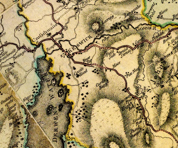 D4NY22SE.jpg "Castle Rigg" block or blocks, labelled in lowercase; a hamlet or just a house item:- Carlisle Library : Map 2 Image © Carlisle Library |
|||
|
|
||||
| evidence:- | old map:- West 1784 map placename:- Castlerigg |
|||
| source data:- | Map, hand coloured engraving, A Map of the Lakes in Cumberland,
Westmorland and Lancashire, scale about 3.5 miles to 1 inch,
engraved by Paas, 53 Holborn, London, about 1784.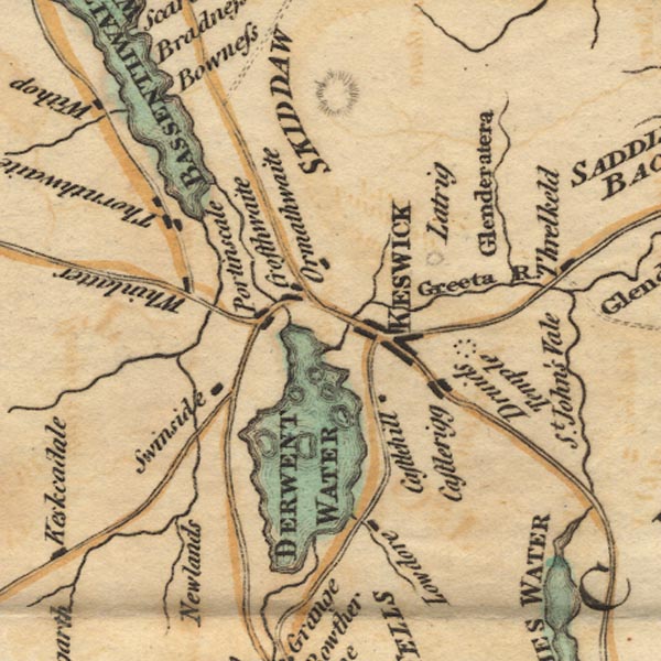 Ws02NY22.jpg item:- Armitt Library : A1221.1 Image © see bottom of page |
|||
|
|
||||
| evidence:- | old text:- Clarke 1787 placename:- Castrigg item:- placename, Castlerigg; castle |
|||
| source data:- | Guide book, A Survey of the Lakes of Cumberland, Westmorland,
and Lancashire, written and published by James Clarke, Penrith,
Cumberland, and in London etc, 1787; published 1787-93. goto source goto sourcePage 105:- "..." "We will now ascend to the top of Castrigg ; some of our modern writers say that it took its name from a castle of the Radcliffs, or Derwentwaters, which stood upon it; and have gone so far as to tell you, that they built a house upon the Island called Lord's with the stones of it; none of them, however, tell whereabouts this castle stood, or find any the least vestiges of one: Besides, they might get stones at one twentieth part of the distance, and as there are no stones that can be wrought with chissels got in this part of the country, it would be no advantage at all that they had been made use of before." "..." goto sourcePage 107:- "Mr West, in his guide to the Lakes, says, that there has been a Roman station here. That they might have one near this Druidical temple I will not deny, but that they ever had one upon Castrigg, is, I think, very improbable. This idea has taken its rise from the name, which Mr West supposes to be a corruption of Castle-Rigg: on the contrary, I take Castrigg to be the original and proper name; it is so spelled in the manor-books, and seems, like many other names in this country, to be a compound of various languages, viz. Latin and English. It seems not improbable that this hill was, for a long time after the Romans left Britain, called simply Castra, or the camp, and that the addition of Rigg, which signifies a ridge or hill, was added to it at a very late period. That any encampment which was here was Roman, is pretty evident: The Romans, out of hatred to the persons and religious tenets of the Druids, always built their forts near some of their places of resort: They thus prevented the Britons from their usual visits to these fanes, and the Druids from encouraging their countrymen by their divination." "..." |
|||
|
|
||||
| evidence:- | old map:- Clarke 1787 map (Ambleside to Keswick) placename:- Castlerigg |
|||
| source data:- | Map, A Map of the Roads Lakes etc between Keswick and Ambleside,
scale about 2.5 ins to 1 mile, by James Clarke, engraved by S J
Neele, 352 Strand, published by James Clarke, Penrith,
Cumberland and in London etc, 1787.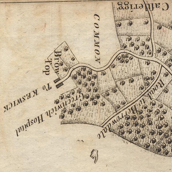 CL9NY22Q.jpg "Castlerigg" item:- private collection : 10.9 Image © see bottom of page |
|||
|
|
||||
| evidence:- | old print:- Green 1815 placename:- Castlerigg item:- cattle |
|||
| source data:- | Print, coloured aquatint, Derwent Water from Castlerigg, St John's Castlerigg and
Wythburn, Cumberland, by William Green, Ambleside, Westmorland, 1815.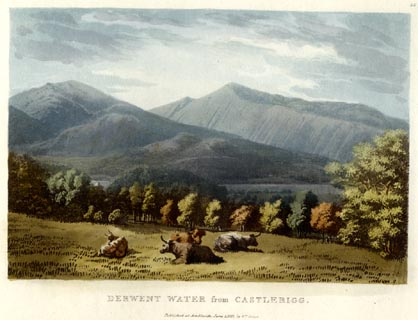 click to enlarge click to enlargeGN0533.jpg Plate 36 in Lake Scenery. printed at upper right:- "36" printed at bottom:- "DERWENT WATER from CASTLERIGG. / Published at Ambleside, June 1, 1815, by Wm. Green." item:- Armitt Library : A6646.33 Image © see bottom of page |
|||
|
|
||||
| evidence:- | old map:- Otley 1818 placename:- Castlerigg |
|||
| source data:- | Map, uncoloured engraving, The District of the Lakes,
Cumberland, Westmorland, and Lancashire, scale about 4 miles to
1 inch, by Jonathan Otley, 1818, engraved by J and G Menzies,
Edinburgh, Scotland, published by Jonathan Otley, Keswick,
Cumberland, et al, 1833.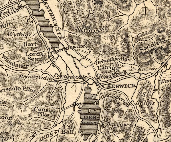 OT02NY22.jpg item:- JandMN : 48.1 Image © see bottom of page |
|||
|
|
||||
| evidence:- | descriptive text:- Otley 1823 (5th edn 1834) item:- viewpoint |
|||
| source data:- | Guide book, A Concise Description of the English Lakes, the
mountains in their vicinity, and the roads by which they may be
visited, with remarks on the mineralogy and geology of the
district, by Jonathan Otley, published by the author, Keswick,
Cumberland now Cumbria, by J Richardson, London, and by Arthur
Foster, Kirkby Lonsdale, Cumbria, 1823; published 1823-49,
latterly as the Descriptive Guide to the English Lakes. goto source Page 111:- "...The Keswick road inclines to the left, and surmounting the cultivated ridge called Castlerigg, there is a full view of Derwent Lake, with part of that of Bassenthwaite, the town and vale of Keswick, with its surrounding mountains. ..." |
|||
|
|
||||
| evidence:- | perhaps old map:- Ford 1839 map placename:- Castle Hill placename:- Castle Rigg |
|||
| source data:- | Map, uncoloured engraving, Map of the Lake District of
Cumberland, Westmoreland and Lancashire, scale about 3.5 miles
to 1 inch, published by Charles Thurnam, Carlisle, and by R
Groombridge, 5 Paternoster Row, London, 3rd edn 1843.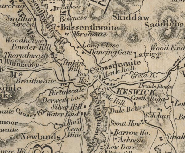 FD02NY22.jpg "Castle Hill" "Castle Rigg" item:- JandMN : 100.1 Image © see bottom of page |
|||
|
|
||||
| notes:- |
There is a supposed site of a 'castle', or at least a manor house, somewhere here. |
|||
| Perriam, D R &Robinson, J: 1998: Medieval Fortified Buildings of Cumbria: CWAAS::
ISBN 1 873124 23 6 |
||||
|
|
||||
| personal | ||||
| person:- | : Bankes, John, Sir |
|||
| place:- | birthplace | |||
|
|
||||
| places:- |
|
|||
|
||||
|
||||
|
||||
|
||||
|
||||
|
||||
|
||||
Lakes Guides menu.