 Old Cumbria Gazetteer
 |
 |
|
| Castle Folds, Asby | ||
| Castle Folds | ||
| locality:- | Great Asby Scar | |
| civil parish:- | Asby (formerly Westmorland) | |
| county:- | Cumbria | |
| locality type:- | british settlement | |
| coordinates:- | NY65000934 | |
| 1Km square:- | NY6509 | |
| 10Km square:- | NY60 | |
|
|
||
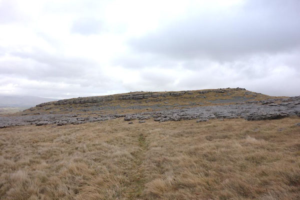 CCM61.jpg (taken 17.2.2015) 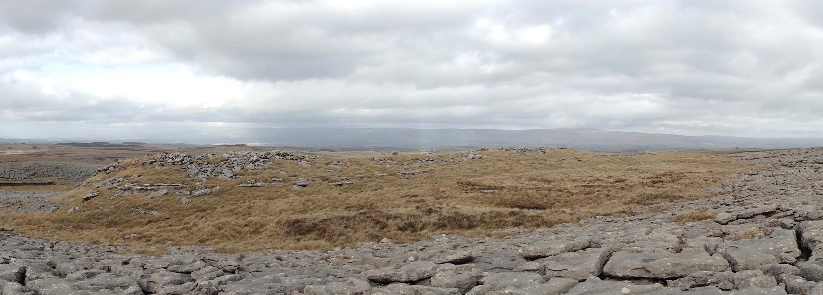 Click to enlarge CCM62.jpg (taken 17.2.2015) |
||
|
|
||
| evidence:- | old map:- OS County Series (Wmd 22 9) placename:- Castle Folds |
|
| source data:- | Maps, County Series maps of Great Britain, scales 6 and 25
inches to 1 mile, published by the Ordnance Survey, Southampton,
Hampshire, from about 1863 to 1948. |
|
|
|
||
| evidence:- | old text:- Camden 1789 (Gough Additions) placename:- Castle Folds |
|
| source data:- | Book, Britannia, or A Chorographical Description of the Flourishing Kingdoms of England,
Scotland, and Ireland, by William Camden, 1586, translated from the 1607 Latin edition
by Richard Gough, published London, 1789. goto source goto sourcePage 156:- "... Behind Orton Scarr, ... on a large tract of naked rocks in a solitary place, is a place called Castle folds, strongly walled about, and containing about one acre and a half, to shelter cattle in case of inroads, and at the highest corner has been a fort for the keepers. ..." |
|
|
|
||
| evidence:- | site plan:- Historical Monuments 1936 placename:- Castle Folds |
|
| source data:- | Site plan, uncoloured lithograph, Castle Folds in Asby parish, Asby, Westmorland,
scale about 1 to 1300, published by Royal Commission on Historical Monuments England,
London, 1936.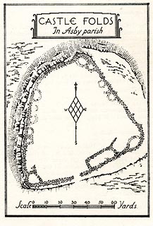 click to enlarge click to enlargeHMW017.jpg On p.19 of the Inventory of the Historical Monuments in Westmorland. printed, top "CASTLE FOLDS / In Asby parish" RCHME no. Wmd, Asby 22 item:- Armitt Library : A745.17 Image © see bottom of page |
|
|
|
||
Lakes Guides menu.