 Old Cumbria Gazetteer
 |
 |
|
| Caldbeck Fells, Caldbeck | ||
| Caldbeck Fells | ||
| civil parish:- | Caldbeck (formerly Cumberland) | |
| county:- | Cumbria | |
| locality type:- | hill | |
| locality type:- | fell | |
| coordinates:- | NY29874120 (etc etc) | |
| 1Km square:- | NY2941 | |
| 10Km square:- | NY24 | |
|
|
||
| evidence:- | old map:- OS County Series (Cmd 37 11) placename:- Caldbeck Fells |
|
| source data:- | Maps, County Series maps of Great Britain, scales 6 and 25
inches to 1 mile, published by the Ordnance Survey, Southampton,
Hampshire, from about 1863 to 1948. OS County Series (Cmd 47 8) |
|
|
|
||
| evidence:- | probably old map:- Mercator 1595 (edn?) |
|
| source data:- | Map, hand coloured engraving, Northumbria, Cumberlandia, et
Dunelmensis Episcopatus, ie Northumberland, Cumberland and
Durham etc, scale about 6.5 miles to 1 inch, by Gerard Mercator,
Duisberg, Germany, about 1595.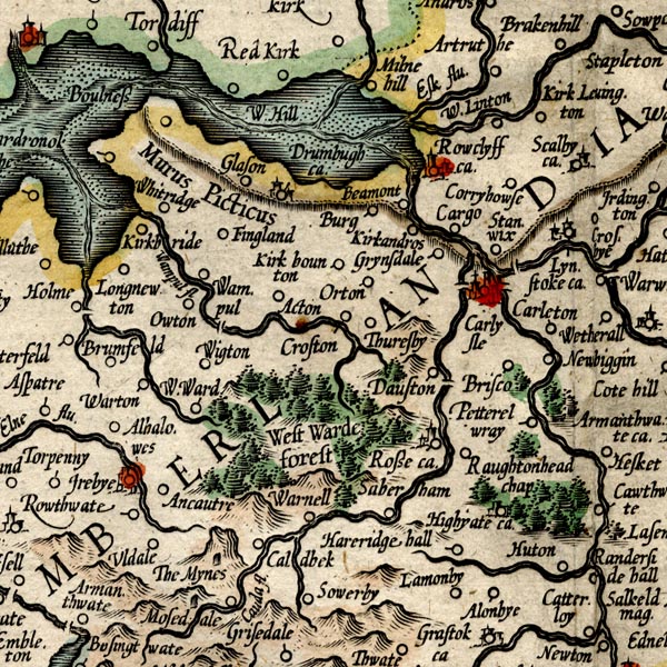 MER8CumC.jpg "" hillock, shaded on east; hill or mountain item:- JandMN : 169 Image © see bottom of page |
|
|
|
||
| evidence:- | old text:- Gents Mag placename:- Caudebeck Fells |
|
| source data:- | Magazine, The Gentleman's Magazine or Monthly Intelligencer or
Historical Chronicle, published by Edward Cave under the
pseudonym Sylvanus Urban, and by other publishers, London,
monthly from 1731 to 1922. goto source goto sourceGentleman's Magazine 1747 p.522 "... ..." "A Journey to CAUDEBEC FELLS, with a Map and Description of the same." "ONE curiosity is apt to excite another; after visiting Cross-fells, †my inclinations led me to examine those of Caudebeck, that lateral detachment of the British Alps, which overspreads great part of Cumberland; distinguished by insuperable precipices, and tow'ring peaks, and exhibiting landskapes of a quite different and more romantic air than any part of the general ridge, and of nearer affinity to the Switzerland Alps. My intention in this journey was to visit the Wadd-mines, the peculiar product of these mountains, and no where else discovered on the globe; but as they are kept close shut up, and the weather was extremely unfavourable, I deferred that examination to a more proper time, and contented myself with the varieties in the neighbourhood of Mose-dale; here I found villages in the narrow bottoms, that feel no more benefit from the solar rays for two months about the winter solstice, than the old Cimmerians, or the Laplanders who inhabit about the North Cape of Norway." "Swinsted on Cauda is a strong instance that the property of the Artic circle is not confined to those unhappy regions which lie within 23 degrees of the pole, especially with regard to the solar light." "These mountains differ not only in figure, but are very dissimilar in property to the main body, being dry, smooth, and more agreeably verdant, where precipices occur not. The rocks upon which they are built, being of a fissile absorbent nature, serving to imbibe the descending rains, which are thrown off from the more compact strata of the general ridge, and take broken and uneven courses, through the loose and spongy texture of their outward covering, forming sometimes morasses, but more frequently rotten bogs, and sinuous mires of difficult passage" " †Of which see the description, p.384-5." |
|
|
|
||
| evidence:- | old text:- Gents Mag 1747 placename:- Caudbeck Fells |
|
| source data:- | Map, uncoloured engraving, perspective view, Caudbeck Fells ie
Caldbeck Fells, scale about 1+ miles to 1 inch, published in the
Gentleman's Magazine, 1747. goto source Gentleman's Magazine 1747 opp p.524 Map, uncoloured engraving, perspective view, Caudbeck Fells ie Caldbeck Fells, scale about 1+ miles to 1 inch, published by the Gentleman's Magazine, London, 1747. 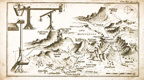 click to enlarge click to enlargeGM14.jpg Size: wxh, sheet = 21x12.5cm; scale = 1 to 78000? item:- Carlisle Library : Map 43 Image © Carlisle Library |
|
|
|
||
| evidence:- | old text:- Gents Mag 1747 item:- flower; birds; geology |
|
| source data:- | Map, perspective view, Caudbeck Fells ie Caldbeck Fells, scale about 1+ miles to 1
inch, and descriptive text, published in the Gentleman's Magazine, November 1747. goto source Gentleman's Magazine 1747 p.523 "No such disagreeable objects interrupt the traveller here; if he guards against the precipices, he has no other danger to encounter." "The most common plants which I observed are," "Adianthum nigrum officinarum (of Ray) black maiden hair." "Lujula, acetosa sylvestris, wood or mountain sorrel." "Muscus squammosus montanus repens, sabinae folio." "Muscus clavatus juniperinis foliis reflexis, clavis singularibus sine pediculis. Several mosses of the capsulated kind." "Brush moss." "Rorella longifolia perennis, and other sun-dews." "The shrubs rising from the latices of the rocks, are dwarf birch, dwarf mountain oak, of so untractable a genius that no soil will meliorate it." "Fraxinus sylvestris, ornus montana, wild mountain ash, with red fruit. I do not remember to have seen this tree in the South, nearer than Derbyshire; it differs both in size and leaf from the service tree, of which species it is, according to the botanists, and is a very beautiful one when the fruit is ripe; the superstitious use it against witchcraft." "The only bird peculiar to these rocks is the raven." "It is a received Cumberland proverb, that the mountains of Caudebeck are worth all England besides, but it has not yet been verify'd by experience; and if we may be allow'd to conjecture from the nature of their stones, found in the rivulets and quarries, it may be difficult to say when they will. Most of their lapilli are a fluor of the stalactite kind, or a sparry talc resembling white flint, variegated with hexagonal crystalline spars, whose points will cut glass like the adamant, but immediately lose that property from their fragil quality. Others are impregnated with the marcasite of lead, but so blended with an arsenical sulphur that they evaporate in the process of separation, and others are of the copperas kind; all of them containing such heterogeneal qualities in their composition, as never to yield a proper gratification for the tryal. Their quarries, also, only abound with a fissile blue-ish slate, useful for the covering of their houses, but very remote from the metalline nature: Indeed in Brandlegill-beck, and the Northern descents, copper has been formerly dug, but the mines are long since worn out; hereabouts the lapis calaminaris is also found." "Under mount Skiddow is the head of the river Cauda; it issues thro' a narrow trough, and takes its winding course with great rapidity to Mosedale, where it turns northward for Carlisle. Near two miles above that village (Mosedale) it receives a small rivulet from Bouscale-tarn, a lake near a mile in circumference, on the side of a high mountain, so strangely surrounded with a more eminent amphitheatrical ridge of quarry rocks, that it is excluded the benefit of the sun for at least four months, in the middle of winter; but this is not its only singularity. Several of the most credible inhabitants thereabouts, affirming that they frequently see the stars in it at mid-day; but in order to discover that phaenomenon, the firmament must be perfectly clear, the air stable, and the water unagitated. These circumstances not concurring at the time I was there, depriv'd me of the pleasure of that sight, and of recommending it to the naturalists upon my own ocular evidence, which I regret the want of, as I question if the like has been any where else observed. The spectator must be situated at least 200 yards above the lake, and as much below the summit of the semi-ambient ridge; and as there are other high mountains, which in that position may break and deaden the solar rays, I can only give an implicit credit to the power of their agency, 'till I am convinc'd of their effects, and am qualified to send it better recommended to the publick." "At Grisedale the water turns bothways, so that in a sudden shower you may with your foot only, send the rain-water, either to Carlisle or Cockermouth, by the channels of Cauda or Lender-maken. This last springs under Saddle back, a Parnassian eminence, with two prominent peaks; the most northerly is called Blencarter, a suprizingly high precipice of the quarry kind." "..." |
|
|
|
||
| evidence:- | old map:- Donald 1774 (Cmd) placename:- Caldbeck Fells |
|
| source data:- | Map, hand coloured engraving, 3x2 sheets, The County of Cumberland, scale about 1
inch to 1 mile, by Thomas Donald, engraved and published by Joseph Hodskinson, 29
Arundel Street, Strand, London, 1774. D4NY33NW.jpg "Caldbeck Fells"  D4NY23SE.jpg  D4NY33SW.jpg "CALDBECK FELLS" hill hachuring; a hill or mountain item:- Carlisle Library : Map 2 Images © Carlisle Library |
|
|
|
||
| evidence:- | descriptive text:- Otley 1823 (5th edn 1834) item:- geology |
|
| source data:- | Guide book, A Concise Description of the English Lakes, the
mountains in their vicinity, and the roads by which they may be
visited, with remarks on the mineralogy and geology of the
district, by Jonathan Otley, published by the author, Keswick,
Cumberland now Cumbria, by J Richardson, London, and by Arthur
Foster, Kirkby Lonsdale, Cumbria, 1823; published 1823-49,
latterly as the Descriptive Guide to the English Lakes. goto source Page 156:- "... A curious mixed rock of basaltic appearance is found near Berrier; it skirts the north side of Caldbeck Fells, forms the hill called Binsey, and may be seen on the north side of the Derwent near to Cockermouth." "..." goto sourcePage 161:- "A superincumbent bed of limestone, by some called the mountain, by others the upper transition limestone, mantles round these mountains, in a position unconformable to the strata of the slaty and other rocks upon which it reposes. It bassets out near ... Ireby, Caldbeck, Hesket, ..." |
|
|
|
||
| evidence:- | old map:- Ford 1839 map placename:- Caldbeck Fells |
|
| source data:- | Map, uncoloured engraving, Map of the Lake District of
Cumberland, Westmoreland and Lancashire, scale about 3.5 miles
to 1 inch, published by Charles Thurnam, Carlisle, and by R
Groombridge, 5 Paternoster Row, London, 3rd edn 1843.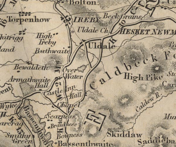 FD02NY23.jpg 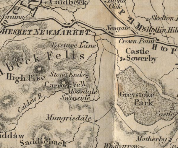 FD02NY33.jpg "Caldbeck Fells" Hill hachuring. item:- JandMN : 100.1 Image © see bottom of page |
|
|
|
||
| evidence:- | old map:- Ford 1839 map placename:- Caldbeck Fells |
|
| source data:- | Map, uncoloured engraving, Map of the Lake District of
Cumberland, Westmoreland and Lancashire, scale about 3.5 miles
to 1 inch, published by Charles Thurnam, Carlisle, and by R
Groombridge, 5 Paternoster Row, London, 3rd edn 1843. FD02NY23.jpg FD02NY33.jpg "Caldbeck Fells" Hill hachuring. item:- JandMN : 100.1 Image © see bottom of page |
|
|
|
||
| evidence:- | old map:- Garnett 1850s-60s H placename:- Caldbeck Fells |
|
| source data:- | Map of the English Lakes, in Cumberland, Westmorland and
Lancashire, scale about 3.5 miles to 1 inch, published by John
Garnett, Windermere, Westmorland, 1850s-60s.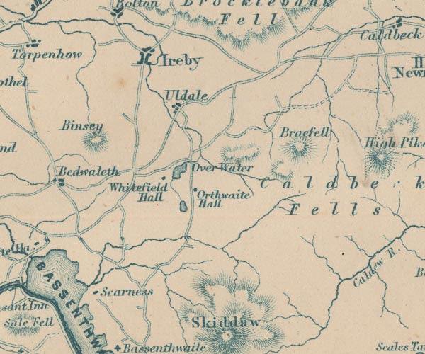 GAR2NY23.jpg "Caldbeck Fells" hill hachuring item:- JandMN : 82.1 Image © see bottom of page |
|
|
|
||
| evidence:- | old text:- Postlethwaite 1877 (3rd edn 1913) placename:- Caldbeck Fells item:- mine; copper ore; lead ore |
|
| source data:- | Book, Mines and Mining in the English Lake District, by John Postlethwaite, Keswick,
published by W H Moss and Sons, Whitehaven, Cumberland now Cumbria, 1877; published
1877-1913. goto source page 129:- "MINES IN THE CALDBECK FELLS" "The Caldbeck Fells District is a rich mining field, and attracted the attention of miners at a very early date. In the reign of Queen Elizabeth copper was raised here, and carried to the great smelting works at Keswick, and the proverb which affirms that -" ""Caldbeck and Caldbeck Fells Are worth all England else."" "is said to belong to a much earlier period. The district is intersected by numerous ore-bearing veins, some of which produce copper, others lead, and in some cases both of these minerals in a great variety of forms and colours. Considerable quantities of zinc, iron pyrites, manganese and barytes are also found in them. Some of the galena is very rich in silver, producing from twenty-five to thirty ounces per ton, and other species of lead ore, from eight to ten ounces. When smelted the former yields about seventy-five per cent. and the latter from fifty-five to sixty per cent. of lead. The copper ores vary from fifteen to thirty per cent." |
|
|
|
||
| notes:- |
The fells are rich in minerals:- |
|
| "Caldbeck and Caldbeck Fells Are worth all England else, -" |
||
| Baron 1925 |
||
|
|
||
Lakes Guides menu.