 Old Cumbria Gazetteer
 |
 |
|
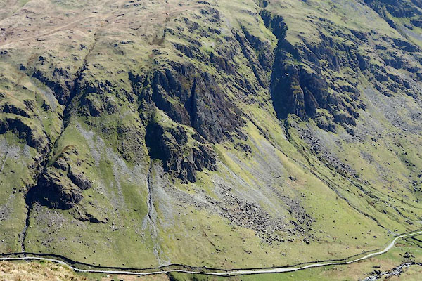
| Buckbarrow Crag, Longsleddale | ||
| Buckbarrow Crag | ||
| civil parish:- | Longsleddale (formerly Westmorland) | |
| county:- | Cumbria | |
| locality type:- | rocks | |
| coordinates:- | NY48260753 (etc) | |
| 1Km square:- | NY4807 | |
| 10Km square:- | NY40 | |
|
|
||
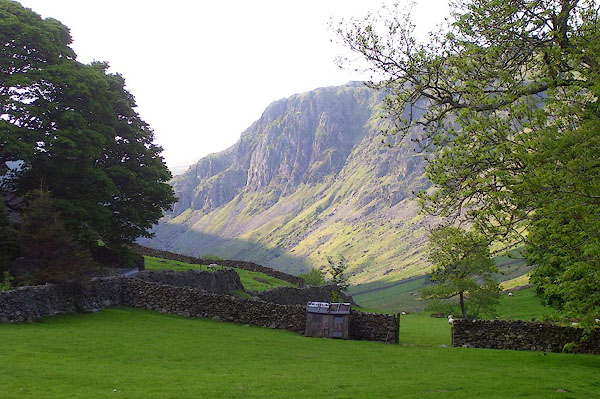 BPF83.jpg (taken 24.5.2008) 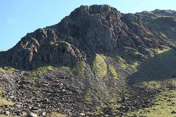 CAK23.jpg (taken 19.4.2014) |
||
|
|
||
| evidence:- | old map:- OS County Series (Wmd 27 2) placename:- Buckbarrow Crag |
|
| source data:- | Maps, County Series maps of Great Britain, scales 6 and 25
inches to 1 mile, published by the Ordnance Survey, Southampton,
Hampshire, from about 1863 to 1948. |
|
|
|
||
| evidence:- | old postcard:- |
|
| source data:- | Postcard, sepia coloured photograph, Longsleddale, Westmorland, about 1900s.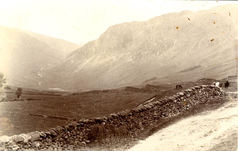 click to enlarge click to enlargePH0158.jpg item:- private collection : 346 Image © see bottom of page |
|
|
|
||
| evidence:- | probably descriptive text:- West 1778 (11th edn 1821) placename:- Crowbarrow |
|
| source data:- | Guide book, A Guide to the Lakes, by Thomas West, published by
William Pennington, Kendal, Cumbria once Westmorland, and in
London, 1778 to 1821. goto source goto sourcePage 166:- "... [from Gatescarth] ... You enter Long-Sleddale between two shattered rocky mountains. That on the left, Crowbarrow, is not less terrible to look up at, when under it, than any rock in Barrowside or Borrowdale, and it has covered a much larger space with ruins. ..." |
|
|
|
||
| evidence:- | old text:- Housman 1800 placename:- Crowbarrow placename:- Backbarrow |
|
| source data:- | Guide book, Descriptive Tour, and Guide to the Lakes, Caves, Mountains ..., by John
Housman, published by F Jollie, Carlisle, Cumberland and C Law, Ave Maria Lane, London,
1800; published
1800-21. Page 71:- "... The dale then contracts a little, and towards its head the rocks become eminently conspicuous; one of which, on the right, called Crowbarrow, or Backbarrow, is truly awful. ..." |
|
|
|
||
| evidence:- | old map:- Hodgson 1828 placename:- Buckbarrow Crag |
|
| source data:- | Map, hand coloured engraving, 4 sheets mounted together on linen and rolled, Plan
of the County of Westmorland, scale about 1.25 inches to 1 mile, by Thomas Hodgson,
engraved by W R Gardner, Harpur Street, London, published by Thomas Hodgson, Lancaster,
and perhaps by C Smith, 172 Strand, London,1828.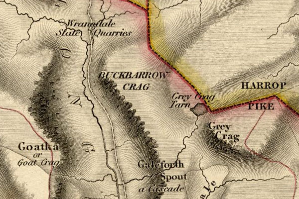 HDG6lsl4.jpg map courtesy of Mark Cropper "BUCKBARROW CRAG" item:- private collection : 371 Image © see bottom of page |
|
|
|
||
| evidence:- | old print:- Watson 1894 |
|
| source data:- | View of upper Longsleddale including Sadgill, Goat Scar and Buckbarrow, in The Annals
of a Quiet Valley, by A Country Parson edited by John Watson, published by J M Dent
and Co, London, 1894.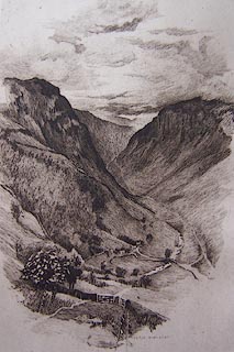 click to enlarge click to enlargeWT1E01.jpg "BERTHA NEWCOMBE" item:- Kendal Library : 5 Image © see bottom of page |
|
|
|
||
| evidence:- | old text:- Gents Mag item:- fox; hunting; fox hound |
|
| source data:- | Magazine, The Gentleman's Magazine or Monthly Intelligencer or
Historical Chronicle, published by Edward Cave under the
pseudonym Sylvanus Urban, and by other publishers, London,
monthly from 1731 to 1922. goto source Gentleman's Magazine 1899 part 2 p.551 "[The Shepherd's Year] ..." "... No fewer than seven foxes have been known to be afoot in the hinterland surrounding Buckbarrow earth at one time, within a radius of half a mile. The "earth-stoppers," it may be remarked, are often disappointed of a view of the hunting after all. I knew one man of over seventy climb from Sacgill (sic) to the top of Buckbarrow before daylight. Arrived there, he stopped all the holes he could find, lit a small fire of peat, and stayed till nightfall, with his two dogs for company. This was on a day when February rain-clouds closed thick about the fells, and his position could only have been one of great discomfort. Meantime the huntsman, in a farmyard half a dozen miles away, was disconsolately wandering about alone, for on the previous day, when the hounds were walking across the mist-piled division between two valleys, the majority of them had bolted on a hot scent, and could not be traced. ..." |
|
|
|
||
| evidence:- | textbook:- EPNS Westmorland 1967 placename:- Buckbarrowe |
|
| source data:- | Book, The Place Names of Westmorland, two volumes, by A H Smith,
published for the English Place Name Society by Cambridge
University Press, Cambridgeshire, 1967 |
|
|
|
||
| evidence:- | parish register:- KendalRO : WPR85 Register of Burials placename:- Buckbarrow |
|
| source data:- | Buried at St Mary's Church, 7 December 1881:- "A poor man unknown - a tramp found dead from exposure on Buckbarrow" |
|
|
|
||
 Buckbarrow Crag: climb routes Buckbarrow Crag: climb routes |
||
|
|
||
| Buckbarrow Crag: climb 20130709 |
||
|
|
||
| :- |
Several climbs are shown in the Journal of the FRCC. |
|
|
|
||
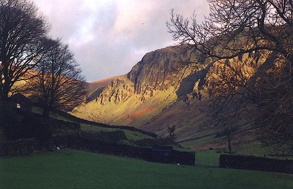
 CAK24.jpg (taken 19.4.2014) 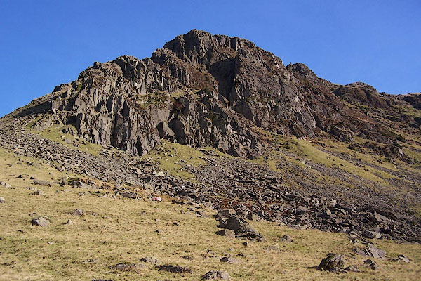 BPU98.jpg (taken 17.11.2008) 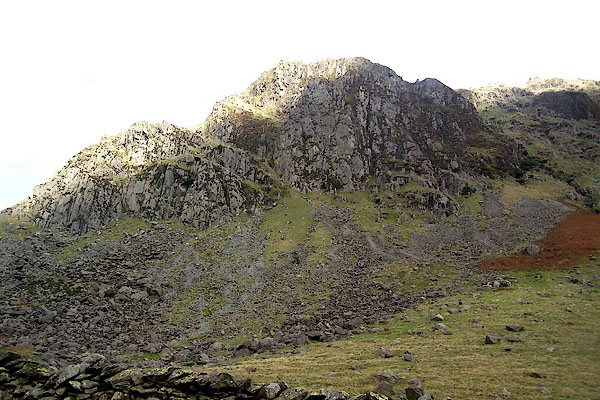 BMV06.jpg (taken 8.10.2006) 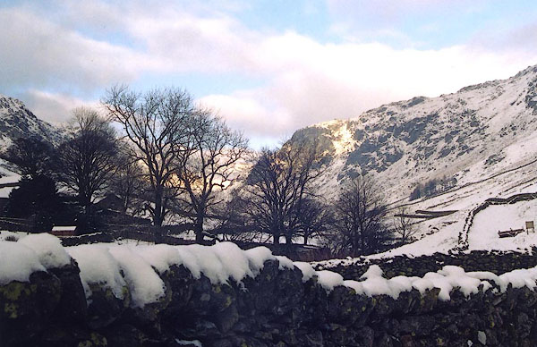 BJH34.jpg (taken 21.12.2004) |
||
|
|
||
 BJJ02.jpg (taken 31.12.2004) 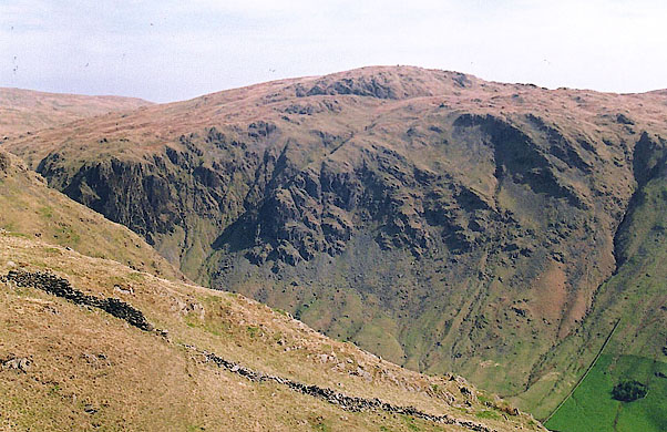 BIQ32.jpg below Tarn Crag (taken 24.4.2004) |
||
|
|
||
Lakes Guides menu.