 Old Cumbria Gazetteer
 |
 |
|
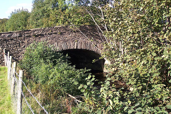
| Brigg House Bridge, Torver | ||
| Brigg House Bridge | ||
| site name:- | Torver Beck | |
| locality:- | Torver (outskirts) | |
| civil parish:- | Torver (formerly Lancashire) | |
| county:- | Cumbria | |
| locality type:- | bridge | |
| coordinates:- | SD28559452 | |
| 1Km square:- | SD2894 | |
| 10Km square:- | SD29 | |
|
|
||
 BJV51.jpg A stone on the north parapet has:- "C.C. BRIGG HOUSE BRIDGE" (taken 16.9.2005) |
||
|
|
||
| evidence:- | old map:- OS County Series (Lan 4 11) placename:- Brigg House Bridge |
|
| source data:- | Maps, County Series maps of Great Britain, scales 6 and 25
inches to 1 mile, published by the Ordnance Survey, Southampton,
Hampshire, from about 1863 to 1948. |
|
|
|
||
 Lakes Guides menu.