 Old Cumbria Gazetteer
 |
 |
|
| Townend Bridge, Watermillock | ||
| Townend Bridge | ||
| site name:- | Castlehow Beck | |
| site name:- | Pencilmill Beck (?) | |
| locality:- | Watermillock | |
| civil parish:- | Matterdale (formerly Cumberland) | |
| county:- | Cumbria | |
| locality type:- | bridge | |
| locality type:- | ford (ex) | |
| coordinates:- | NY44532272 | |
| 1Km square:- | NY4422 | |
| 10Km square:- | NY42 | |
|
|
||
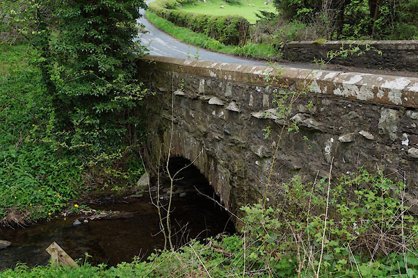 CAM52.jpg (taken 29.4.2014) |
||
|
|
||
| evidence:- | old map:- OS County Series (Cmd 66 5) |
|
| source data:- | Maps, County Series maps of Great Britain, scales 6 and 25
inches to 1 mile, published by the Ordnance Survey, Southampton,
Hampshire, from about 1863 to 1948. Shows a ford, on the west side, and a bridge. |
|
|
|
||
| evidence:- | old map:- Clarke 1787 map (Ullswater) |
|
| source data:- | Map, A Map of the Lake Ullswater and its Environs, scale about
6.5 ins to 1 mile, by James Clarke, engraved by S J Neele, 352
Strand, published by James Clarke, Penrith, Cumberland and in
London etc, 1787.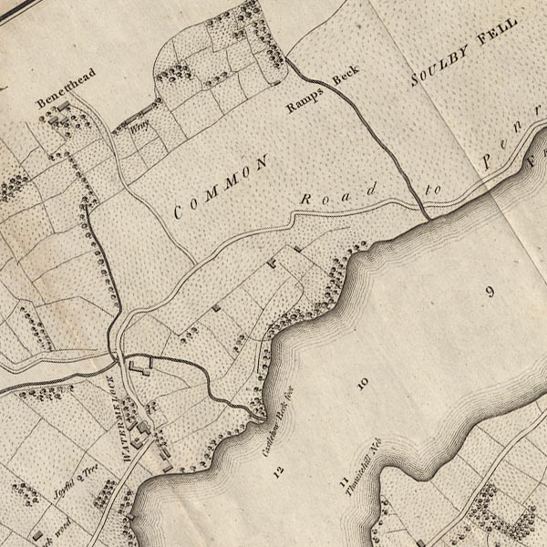 CL4NY42L.jpg Drawn by a bridge symbol. item:- private collection : 10.4 Image © see bottom of page |
|
|
|
||
 Lakes Guides menu.