 Old Cumbria Gazetteer
 |
 |
|
| Brathay Bay, Windermere lake | ||
| Brathay Bay | ||
| site name:- | Windermere lake | |
| locality:- | Brathay | |
| civil parish:- | Skelwith (formerly Lancashire) | |
| county:- | Cumbria | |
| locality type:- | bay | |
| coordinates:- | NY37000288 | |
| 1Km square:- | NY3702 | |
| 10Km square:- | NY30 | |
|
|
||
| evidence:- | old map:- OS County Series (Wmd 26 14) placename:- Brathay Bay |
|
| source data:- | Maps, County Series maps of Great Britain, scales 6 and 25
inches to 1 mile, published by the Ordnance Survey, Southampton,
Hampshire, from about 1863 to 1948. OS County Series (Lan 2 6) |
|
|
|
||
| evidence:- | old map:- Clarke 1787 map (Windermere N) |
|
| source data:- | Map, A Map of the Northern Part of the Lake Winandermere and its
Environs, scale about 6.5 ins to 1 mile, by James Clarke,
engraved by Samuel John Neele, 352 Strand, published by James
Clarke, Penrith, Cumberland and in London etc, 1787.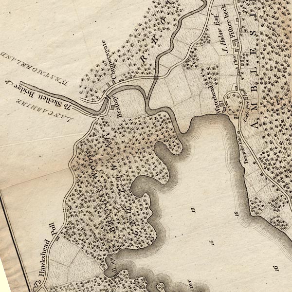 CLANY30R.jpg item:- private collection : 10.10 Image © see bottom of page |
|
|
|
||
| evidence:- | old photograph:- Bell 1880s-1940s item:- rowing boat; boat |
|
| source data:- | Photograph, sepia, Brathay Bay, Windermere lake, by Skelwith, Lancashire, by Herbert
Bell, photographer, Ambleside, Westmorland, 1890s.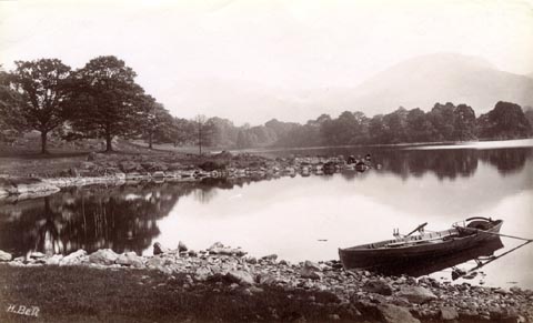 click to enlarge click to enlargeHB0810.jpg internegative at lower left:- "H. Bell" item:- Armitt Library : ALPS473 Image © see bottom of page |
|
|
|
||
| hearsay:- |
Perhaps referred to as Horseshoe Cove by Arthur Ransome. |
|
|
|
||
 Lakes Guides menu.