 Old Cumbria Gazetteer
 |
 |
|
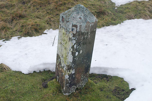
| boundary stone, Kaber/Stainmore | ||
| civil parish:- | Kaber (formerly Westmorland) | |
| civil parish:- | Stainmore (formerly Westmorland) | |
| county:- | Cumbria | |
| locality type:- | boundary stone | |
| locality type:- | township boundary mark | |
| locality type:- | parish boundary mark | |
| coordinates:- | NY87550872 | |
| 1Km square:- | NY8708 | |
| 10Km square:- | NY80 | |
| old boundary | ||
| locality:- | Cumberland boundary | |
| locality:- | Westmorland boundary | |
|
|
||
 BSA01.jpg "TOWNSHIP OF SOUTH STAINMORE / TOWNSHIP OF KABER" (taken 22.1.2010) 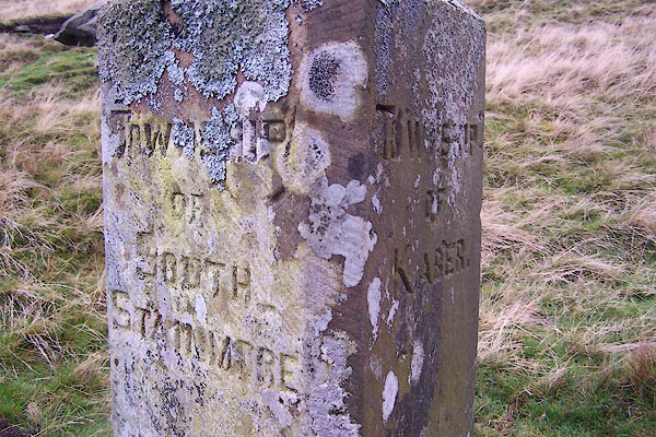 BJZ15.jpg "TOWNSHIP OF SOUTH STAINMORE / TOWNSHIP OF KABER" (taken 4.11.2005) |
||
|
|
||
| evidence:- | database:- Listed Buildings 2010 |
|
| source data:- | courtesy of English Heritage "BOUNDARY STONE ON NORTH SIDE OF ROAD TO NORTH WEST OF GATE HOUSE / / / KABER / EDEN / CUMBRIA / II / 73344 / NY8755808725" |
|
| source data:- | courtesy of English Heritage "Boundary stone; C19. Single stone c3 ft high with angled sides and segmental top. Inscribed in sans serif lettering: TOWNSHIP OF SOUTH STAINMORE on north face, TOWNSHIP OF KABER on south." |
|
|
|
||
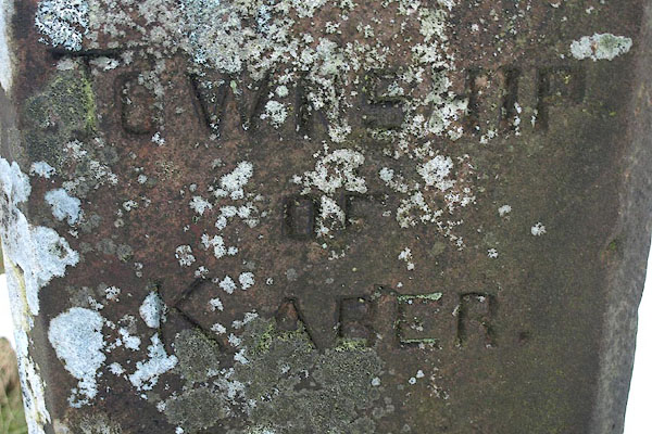 BSA02.jpg "TOWNSHIP / OF / KABER" (taken 22.1.2010) 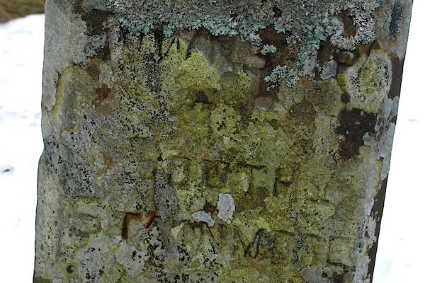 BSA03.jpg "TOWNSHIP / OF / SOUTH / STAINMORE" (taken 22.1.2010) |
||
|
|
||
 Lakes Guides menu.