 Old Cumbria Gazetteer
 |
 |
|
| boundary stone, Stainmore | ||
| civil parish:- | Stainmore (formerly Westmorland) | |
| county:- | Cumbria | |
| locality type:- | boundary stone | |
| locality type:- | county boundary mark (?) | |
| coordinates:- | NY83151991 | |
| 1Km square:- | NY8319 | |
| 10Km square:- | NY81 | |
| county:- | Durham | |
| current boundary | ||
| locality:- | Cumbria boundary (?) | |
| old boundary | ||
| locality:- | Cumberland boundary (?) | |
| SummaryText:- | Boundary of what? E 45 means what? | |
|
|
||
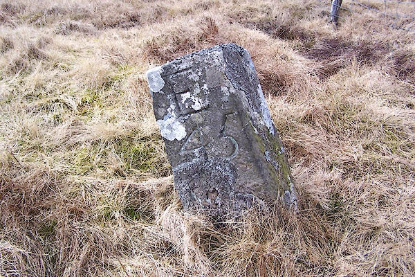 BLX45.jpg Inscribed stone:- "E 45" (taken 21.4.2006) |
||
|
|
||
| evidence:- | database:- Listed Buildings 2010 |
|
| source data:- | courtesy of English Heritage "BOUNDARY STONE NEXT TO FENCE CIRCA 30 FEET FROM ROAD / / B6276 (NORTH OF BROUGH) / STAINMORE / EDEN / CUMBRIA / II / 435943 / NY8315419918" |
|
| source data:- | courtesy of English Heritage "Boundary stone; mid C19. Single tapered stone c2 1/2 ft high, square in plan. E46 carved on east face." |
|
|
|
||
 Lakes Guides menu.