 Old Cumbria Gazetteer
 |
 |
|
| boundary stone, Brough/Stainmore | ||
| civil parish:- | Brough (formerly Westmorland) | |
| civil parish:- | Stainmore (formerly Westmorland) | |
| county:- | Cumbria | |
| locality type:- | boundary stone | |
| locality type:- | township boundary mark | |
| locality type:- | parish boundary mark (also) | |
| coordinates:- | NY81011584 | |
| 1Km square:- | NY8115 | |
| 10Km square:- | NY81 | |
|
|
||
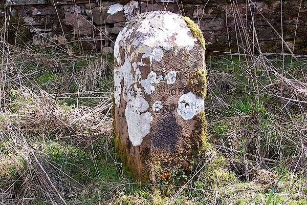 BLX32.jpg Inscribed stone:- "TOWNSHIP OF NORTH STAINMORE. / TOWNSHIP OF BROUGH." (taken 21.4.2006) |
||
|
|
||
| evidence:- | database:- Listed Buildings 2010 |
|
| source data:- | courtesy of English Heritage "BOUNDARY STONE TO SOUTH OF HAZEL BANK / / B6276 (NORTH EAST OF BROUGH; SOUTH SIDE) / BROUGH / EDEN / CUMBRIA / II / 73294 / NY8101015842" |
|
| source data:- | courtesy of English Heritage "Boundary stone; C19. Single stone. c3 ft high with angled sides and segmental top. Inscribed in sans serif lettering: TOWNSHIP OF NORTH STAINMORE on east face, TOWNSHIP OF BROUGH on west." |
|
|
|
||
 Lakes Guides menu.