 Old Cumbria Gazetteer
 |
 |
|
| Blake Holme, Windermere lake | ||
| Blake Holme | ||
| site name:- | Windermere lake | |
| civil parish:- | Cartmel Fell (formerly Lancashire) | |
| county:- | Cumbria | |
| locality type:- | island | |
| coordinates:- | SD38248982 | |
| 1Km square:- | SD3889 | |
| 10Km square:- | SD38 | |
|
|
||
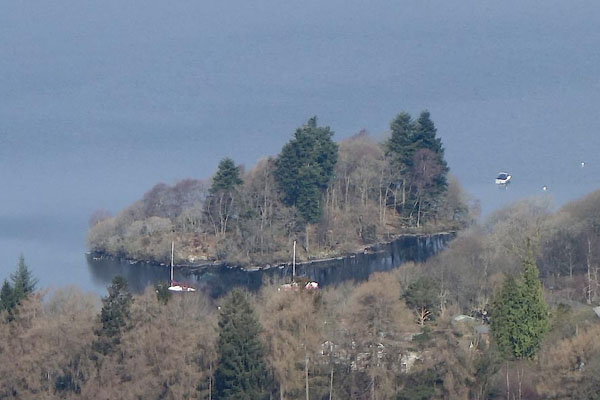 BYE46.jpg (taken 12.4.2013) |
||
|
|
||
| evidence:- | old map:- OS County Series (Wmd 37 14) placename:- Blake Holme |
|
| source data:- | Maps, County Series maps of Great Britain, scales 6 and 25
inches to 1 mile, published by the Ordnance Survey, Southampton,
Hampshire, from about 1863 to 1948. |
|
|
|
||
| evidence:- | old map:- Crosthwaite 1783-94 (Win/Ble) placename:- Blake Holm |
|
| source data:- | Map, uncoloured engraving, An Accurate Map of the Grand Lake of
Windermere, scale about 2 inches to 1 mile, by Peter
Crosthwaite, Keswick, Cumberland, 1783, version published 1819.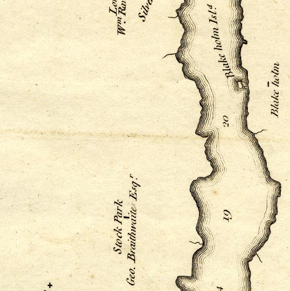 CT9SD38U.jpg "Blake holm Isld." island item:- Armitt Library : 2008.14.102 Image © see bottom of page |
|
|
|
||
| evidence:- | old map:- Clarke 1787 map (Windermere S) placename:- Blake Holm |
|
| source data:- | Map, A Map of the Southern Part of the Lake Winandermere and its
Environs, scale about 6.5 ins to 1 mile, by James Clarke,
engraved by Samuel John Neele, 352 Strand, published by James
Clarke, Penrith, Cumberland and in London etc, 1787.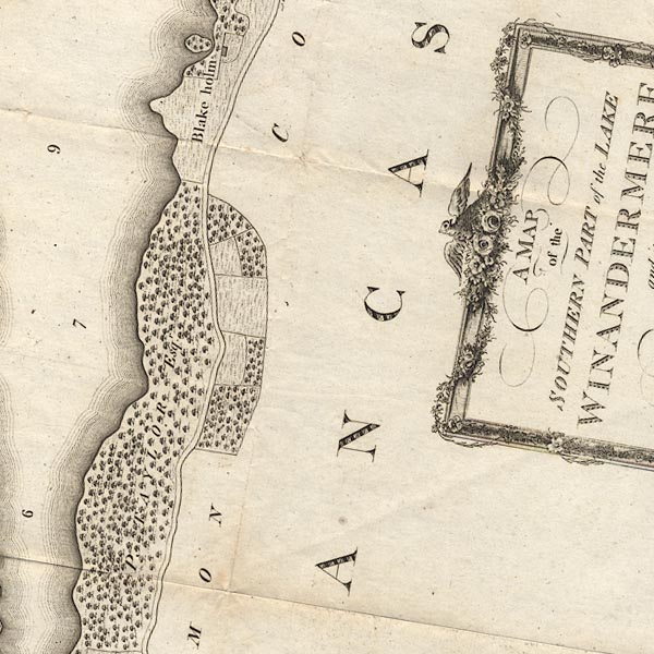 CLBSD38Z.jpg "Blake holm" item:- private collection : 10.11 Image © see bottom of page |
|
|
|
||
| evidence:- | old map:- Prior 1874 map 1 placename:- Blake Holme |
|
| source data:- | Map, uncoloured engraving or lithograph? Winander Mere, scale
about 2.5 miles to 1 inch, published by John Garnett,
Windermere, Westmorland, 1874. click to enlarge click to enlargePI03M1.jpg "Blake H." island item:- private collection : 133.1 Image © see bottom of page |
|
|
|
||
| hearsay:- |
Referred to as Wild Cat Island by Arthur Ransome. |
|
|
|
||
 Lakes Guides menu.