 Old Cumbria Gazetteer
 |
 |
|
| Birks Crag, Bampton | ||
| Birks Crag | ||
| civil parish:- | Bampton (formerly Westmorland) | |
| county:- | Cumbria | |
| locality type:- | rocks | |
| coordinates:- | NY466127 | |
| 1Km square:- | NY4612 | |
| 10Km square:- | NY41 | |
| altitude:- | 1495 feet | |
| altitude:- | 456m | |
|
|
||
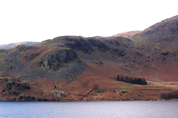 BLO66.jpg (taken 25.1.2006) |
||
|
|
||
| evidence:- | outline view:- Otley 1823 (8th edn 1849) placename:- Birk Crag |
|
| source data:- | Engraving, outline view of mountains, Hawes Water from Measand Beck, drawn by T Binns,
engraved by O Jewitt, opposite p.16 of A Descriptive Guide of the English Lakes, by
Jonathan Otley, 8th edition, 1849.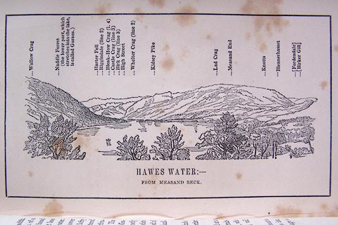 click to enlarge click to enlargeO80E09.jpg item:- Armitt Library : A1180.10 Image © see bottom of page |
|
|
|
||
 Lakes Guides menu.