 Old Cumbria Gazetteer
 |
 |
|
| Bellbridge, Sebergham | ||
| Bellbridge | ||
| civil parish:- | Sebergham (formerly Cumberland) | |
| county:- | Cumbria | |
| locality type:- | buildings | |
| coordinates:- | NY36424310 | |
| 1Km square:- | NY3643 | |
| 10Km square:- | NY34 | |
|
|
||
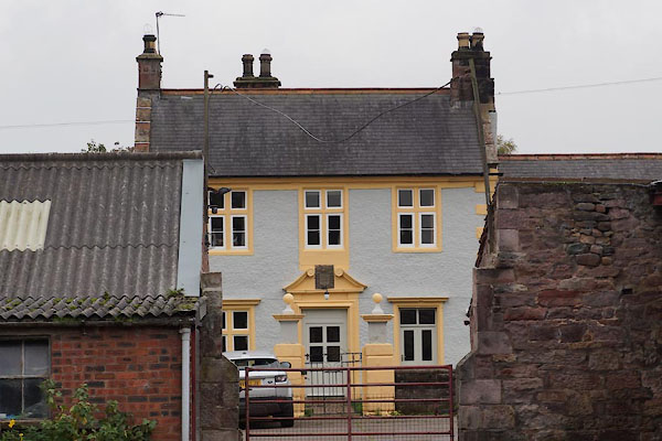 BZN11.jpg (taken 18.10.2013) 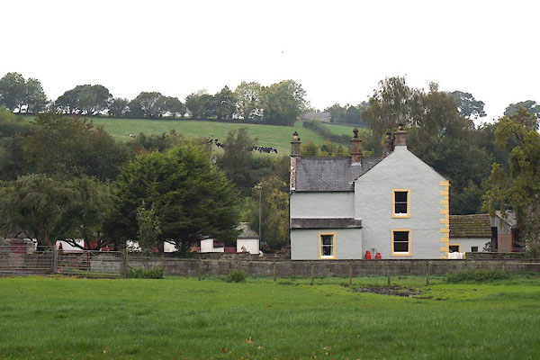 BZN12.jpg (taken 18.10.2013) |
||
|
|
||
| evidence:- | old map:- OS County Series (Cmd 38 2) placename:- Bellbridge |
|
| source data:- | Maps, County Series maps of Great Britain, scales 6 and 25
inches to 1 mile, published by the Ordnance Survey, Southampton,
Hampshire, from about 1863 to 1948. |
|
|
|
||
| evidence:- | old map:- Donald 1774 (Cmd) placename:- Bell Bridge |
|
| source data:- | Map, hand coloured engraving, 3x2 sheets, The County of Cumberland, scale about 1
inch to 1 mile, by Thomas Donald, engraved and published by Joseph Hodskinson, 29
Arundel Street, Strand, London, 1774.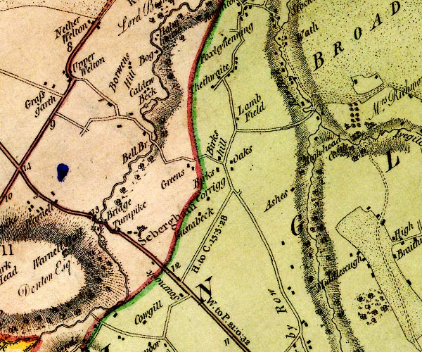 D4NY34SE.jpg "Bell Br." block or blocks, labelled in lowercase; a hamlet or just a house item:- Carlisle Library : Map 2 Image © Carlisle Library |
|
|
|
||
| evidence:- | database:- Listed Buildings 2010 placename:- Bellbridge Farm |
|
| source data:- | courtesy of English Heritage "BELLBRIDGE FARMHOUSE / / / SEBERGHAM / ALLERDALE / CUMBRIA / II / 72460 / NY3642643106" |
|
|
|
||
| evidence:- | database:- Listed Buildings 2010 |
|
| source data:- | courtesy of English Heritage "GATEPOSTS IN FRONT OF BELLRIDGE FARMHOUSE / / / SEBERGHAM / ALLERDALE / CUMBRIA / II / 72461 / NY3641843117" |
|
|
|
||
| evidence:- | database:- Listed Buildings 2010 item:- date stone (1774) |
|
| source data:- | courtesy of English Heritage "BARN TO NORTH EAST OF BELLBRIDGE FARMHOUSE / / / SEBERGHAM / ALLERDALE / CUMBRIA / II / 72463 / NY3645743124" |
|
|
|
||
| evidence:- | database:- Listed Buildings 2010 item:- date stone |
|
| source data:- | courtesy of English Heritage "BYRES TO NORTH OF BELLBRIDGE FARMHOUSE / / / SEBERGHAM / ALLERDALE / CUMBRIA / II / 72462 / NY3642043139" |
|
|
|
||
 Lakes Guides menu.