 Old Cumbria Gazetteer
 |
 |
|
| Barrow Island, Barrow-in-Furness | ||
| Barrow Island | ||
| locality:- | Barrow-in-Furness | |
| civil parish:- | Barrow-in-Furness (formerly Lancashire) | |
| county:- | Cumbria | |
| locality type:- | island | |
| 1Km square:- | SD2068 | |
| 10Km square:- | SD26 | |
|
|
||
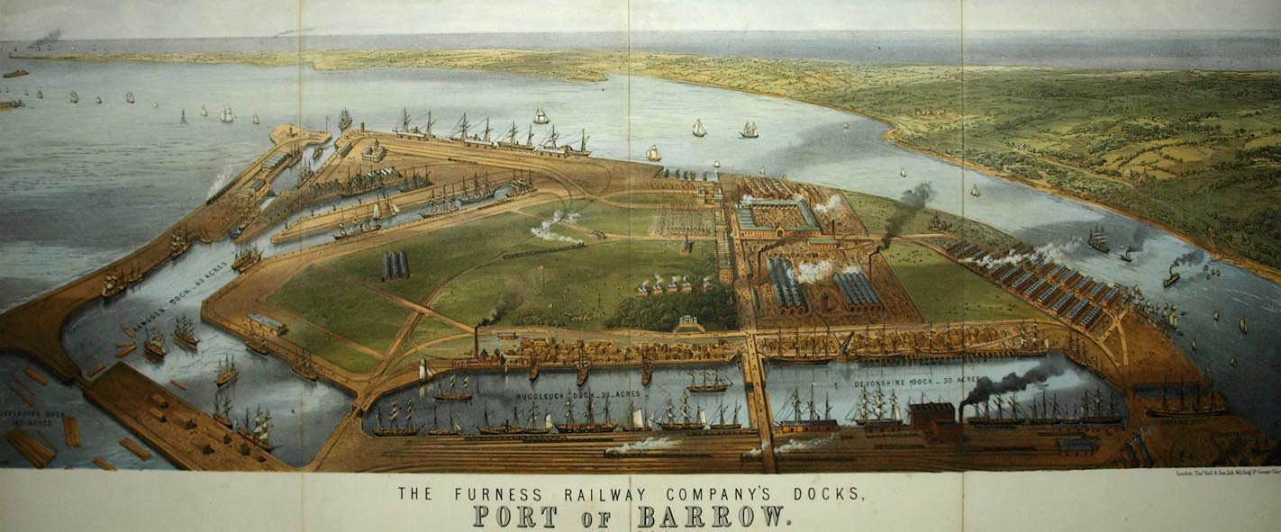 click to enlarge click to enlargeBPS81.jpg Aerial view. "THE FURNESS RAILWAY COMPANY'S DOCKS. / PORT OF BARROW." courtesy the Dock Museum |
||
|
|
||
| evidence:- | old map:- West 1784 map placename:- Old Barrow |
|
| source data:- | Map, hand coloured engraving, A Map of the Lakes in Cumberland,
Westmorland and Lancashire, scale about 3.5 miles to 1 inch,
engraved by Paas, 53 Holborn, London, about 1784.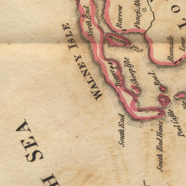 Ws02SD16.jpg item:- Armitt Library : A1221.1 Image © see bottom of page |
|
|
|
||
| evidence:- | old map:- Garnett 1850s-60s H |
|
| source data:- | Map of the English Lakes, in Cumberland, Westmorland and
Lancashire, scale about 3.5 miles to 1 inch, published by John
Garnett, Windermere, Westmorland, 1850s-60s.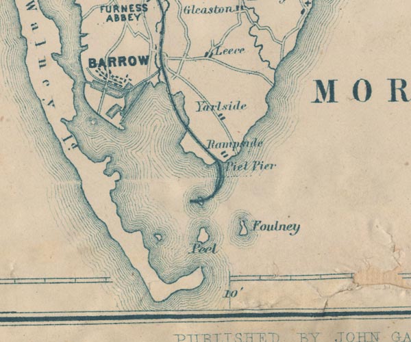 GAR2SD26.jpg area item:- JandMN : 82.1 Image © see bottom of page |
|
|
|
||
| hearsay:- |
The island was owned by John Wood, 1685:- |
|
| "who practised physic, was considered by the illiterate as a necromancer or cunning
man, and various stories have been related of his skill in the black art ..." |
||
| The island was sold to the Michaelson Family, 1700. And bought by the Furness Railway,
1863. |
||
|
|
||
 Lakes Guides menu.