 Old Cumbria Gazetteer
 |
 |
|
| Band, Lakes | ||
| locality:- | Langdale Fell | |
| locality:- | Great Langdale | |
| civil parish:- | Lakes (formerly Westmorland) | |
| county:- | Cumbria | |
| coordinates:- | NY26590596 | |
| 1Km square:- | NY2605 | |
| 10Km square:- | NY20 | |
|
|
||
| evidence:- | old map:- OS County Series (Wmd 25 5) placename:- Band, The |
|
| source data:- | Maps, County Series maps of Great Britain, scales 6 and 25
inches to 1 mile, published by the Ordnance Survey, Southampton,
Hampshire, from about 1863 to 1948. OS County Series (Wmd 25 6) |
|
|
|
||
| evidence:- | outline view:- Tattersall 1836 (version 1869) placename:- Band, The |
|
| source data:- | Print, hand coloured, Valley of the Stake, Mickleden etc, Westmorland, drawn by George
Tattersall, 1836, engraved by W F Topham, published by T J Allman, 463 Oxford Street,
London, 1869.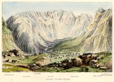 click to enlarge click to enlargeTAT204.jpg Included in The Lakes of England, by W F Topham. printed at bottom:- "VALLEY OF THE STAKE." printed at bottom:- "Pike o'Bliscoe. / The Band. / Style End. / Bowfell. / The Stake. Pike o'Stickle. / Pt. of Harrison Stickle." item:- Armitt Library : A1067.4 Image © see bottom of page |
|
|
|
||
| evidence:- | outline view:- Tattersall 1836 placename:- Band, The |
|
| source data:- | Print, engraving, Valley of The Stake, Mickleden, Westmorland, drawn by George Tattersall,
engraved by W F Topham, published by Sherwood and Co, Paternoster Row, London, about
1836.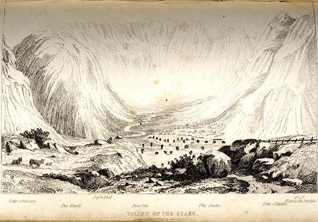 click to enlarge click to enlargeTAT109.jpg The print is captioned with mountain names and acts as an outline view. Tipped in opposite p.42 of The Lakes of England, by George Tattersall. printed at bottom:- "VALLEY OF THE STAKE. / London Pubd. April 15th. 1836, by Sherwood &Co." printed at bottom left to right:- "Pike o'Bliscoe. / The Band. / Style End. / Bowfell. / The Stake. / Pike o'Stickle. / Pt. of Harrison Stickle." item:- Armitt Library : A1204.10 Image © see bottom of page |
|
|
|
||
 Lakes Guides menu.