 Old Cumbria Gazetteer
 |
 |
|
| Abbot's Bay, Derwent Water | ||
| Abbot's Bay | ||
| site name:- | Derwent Water | |
| civil parish:- | Above Derwent (formerly Cumberland) | |
| county:- | Cumbria | |
| locality type:- | bay | |
| coordinates:- | NY25311938 | |
| 1Km square:- | NY2519 | |
| 10Km square:- | NY21 | |
|
|
||
| evidence:- | old map:- Crosthwaite 1783-94 (Der) |
|
| source data:- | Map, uncoloured engraving, An Accurate Map of the Matchless Lake
of Derwent, ie Derwent Water, scale about 3 inches to 1 mile, by
Peter Crosthwaite, Keswick, Cumberland, 1783, version published
1800.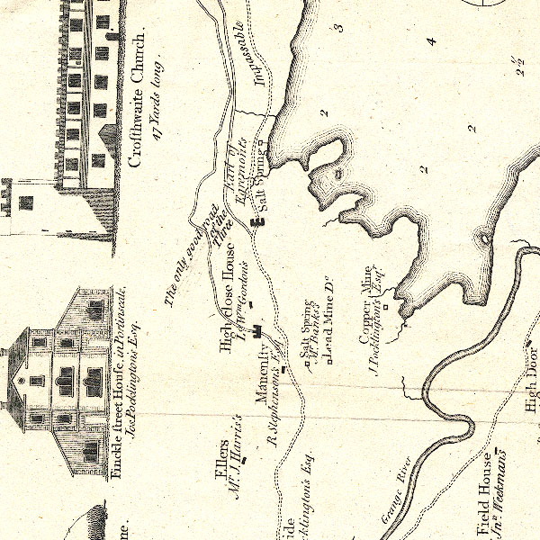 CT2NY21N.jpg item:- Armitt Library : 1959.191.3 Image © see bottom of page |
|
|
|
||
| evidence:- | old map:- Clarke 1787 map (Der) placename:- |
|
| source data:- | Map, uncoloured engraving, Map of Derwentwater and its Environs,
scale about 13 ins to 1 mile, by James Clarke, engraved by S J
Neele, published by James Clarke, Penrith, Cumberland and in
London etc, 1787.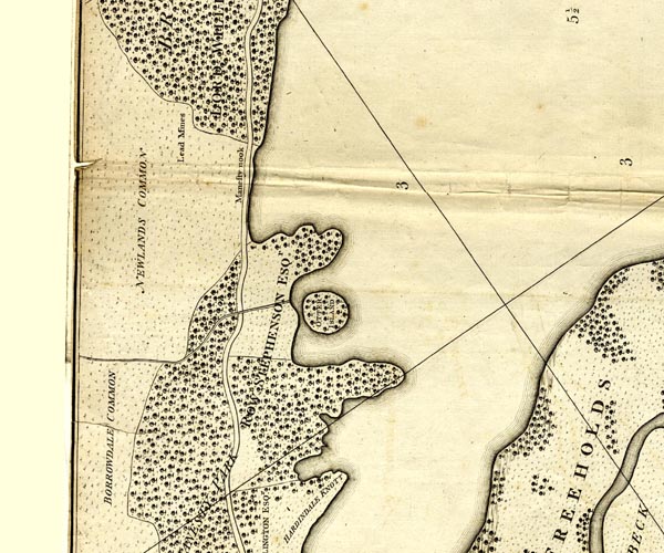 CL152519.jpg bay item:- private collection : 169 Image © see bottom of page |
|
|
|
||
 Lakes Guides menu.