 Jefferys 1770 SD68SE

|

|
|
|
gazetteer links places may or may not be labelled on the map |
||

|
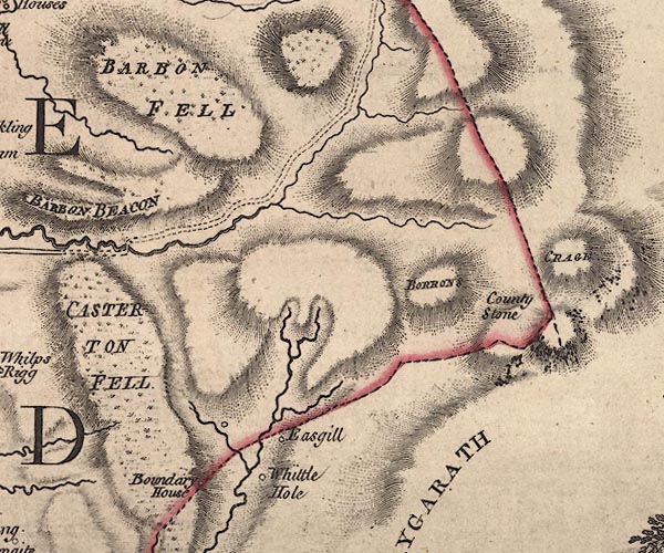
-- Barbon High Fell |
|
|
|
-- Barbon Low Fell -- "CASTERTON FELL" |
|
|
|
-- Barkin Beck |
|
|
|
-- Blindbeck Bridge |
|
|
|
-- Casterton Fell |
|
|
|
-- County Stone -- "County Stone" |
|
|
|
-- Crag Hill -- "BORRONS" |
|
|
|
-- Ease Gill |
|
|
|
-- Great Coum -- "CRAGE" |
|
|
|
-- Hellot Scales Barn -- "Easgill" |
|
|
|
-- Middleton Fell -- "MIDDLETON FELL" -- "BARBON
FELL" |
|
|
|
-- Short Gill |
|
|
|
-- Smithy House -- "Boundary House" |
|
|
|
-- Whittle Hole -- "Whittle Hole" |
|
|
civil parishes The area roughly includes parts of parishes:- Middleton Barbon Casterton Dent |
||
|
counties The area includes parts of counties:- Lancashire |
||
|
|
||
|
|
Lakes Guides menu. | |