 Old Cumbria Gazetteer
 |
 |
|
| County Stone, Dent | ||
| County Stone | ||
| county:- | Cumbria (Westmorland) | |
| county:- | Cumbria (North Yorkshire) | |
| county:- | Lancashire | |
| locality type:- | boundary stone | |
| locality type:- | stone | |
| locality type:- | county boundary mark | |
| coordinates:- | SD70148274 | |
| 1Km square:- | SD7082 | |
| 10Km square:- | SD78 | |
| county:- | Lancashire | |
| current boundary | ||
| locality:- | Cumbria boundary | |
| old boundary | ||
| locality:- | Westmorland boundary | |
| SummaryText:- | This was the meeting point of three county boundaries; Westmorland, North Yorkshire, and Lancashire; but no more. | |
|
|
||
| evidence:- | old map:- OS County Series (Wmd 44 16) placename:- County Stone |
|
| source data:- | Maps, County Series maps of Great Britain, scales 6 and 25
inches to 1 mile, published by the Ordnance Survey, Southampton,
Hampshire, from about 1863 to 1948. "County Stone" |
|
|
|
||
| evidence:- | old map:- Saxton 1579 placename:- Countye Stone |
|
| source data:- | Map, hand coloured engraving, Westmorlandiae et Cumberlandiae Comitatus ie Westmorland
and Cumberland, scale about 5 miles to 1 inch, by Christopher Saxton, London, engraved
by Augustinus Ryther, 1576, published 1579-1645.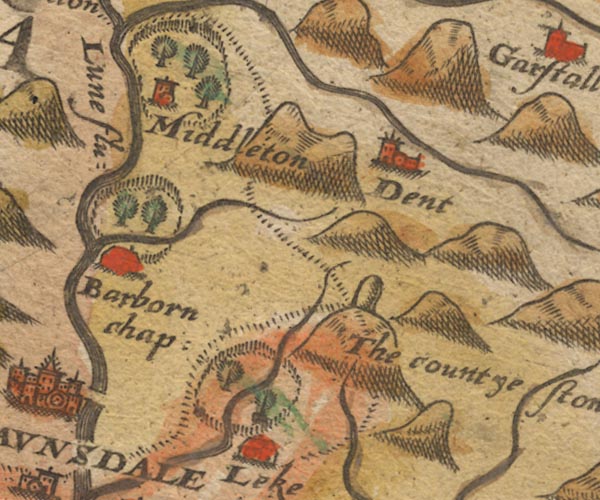 Sax9SD68.jpg "The countye stone" Stone on a hillock; boundary of Westmorelandia, Lancastria and Eboracensis. item:- private collection : 2 Image © see bottom of page |
|
|
|
||
| evidence:- | old map:- Burghley 1590 B |
|
| source data:- | Map, ms on paper, a View of the County of Lancashire, copied for
William Cecil, Lord Burghley, late 1570s, from an original on
vellum drawn about 1576-77, a block inscribed:- "Countie stone / TP" and labelled:- "this ston ys called the countie stone that devideth Lancashire yorkshire and westmerl[and]" |
|
|
|
||
| evidence:- | old map:- Speed 1611 (Wmd) placename:- Countye Stone, The |
|
| source data:- | Map, hand coloured engraving, The Countie Westmorland and
Kendale the Cheif Towne, scale about 2.5 miles to 1 inch, by
John Speed, 1610, published by George Humble, Popes Head Alley,
London, 1611-12.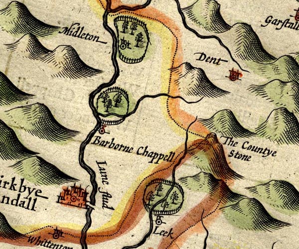 SP14SD68.jpg "The Countye Stone" on a hillock, at the meet of three counties item:- Armitt Library : 2008.14.5 Image © see bottom of page |
|
|
|
||
| evidence:- | old map:- Jansson 1646 placename:- Countye Stone |
|
| source data:- | Map, hand coloured engraving, Cumbria and Westmoria, ie
Cumberland and Westmorland, scale about 3.5 miles to 1 inch, by
John Jansson, Amsterdam, Netherlands, 1646.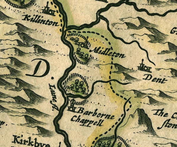 JAN3SD68.jpg "The Countye Stone" Lumpy hillock, no stone drawn, by county boundary. item:- JandMN : 88 Image © see bottom of page |
|
|
|
||
| evidence:- | old map:- Morden 1695 (Wmd) placename:- County Stone |
|
| source data:- | Map, hand coloured engraving, Westmorland, scale about 2.5 miles to 1 inch, by Robert
Morden, published by Abel Swale, the Unicorn, St Paul's Churchyard, Awnsham, and John
Churchill, the Black Swan, Paternoster Row, London, 1695.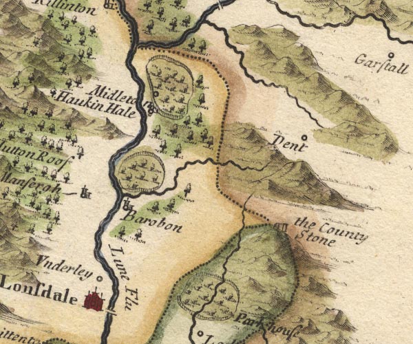 MD10SD68.jpg "the County Stone" A pair of stones on a hillock, at the meet of three counties. item:- JandMN : 24 Image © see bottom of page |
|
|
|
||
| evidence:- | old map:- Simpson 1746 map (Wmd) placename:- County Stone |
|
| source data:- | Map, uncoloured engraving, Westmorland, scale about 8 miles to 1
inch, printed by R Walker, Fleet Lane, London, 1746.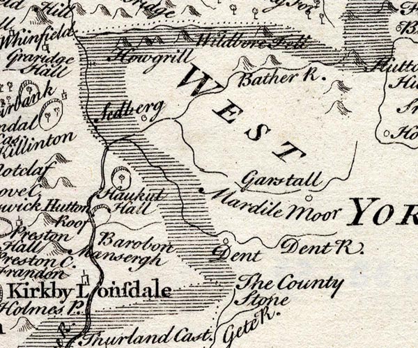 SMP2SDU.jpg "The County Stone" At the meet of Westmorland, Lancashire and Yorkshire. item:- Dove Cottage : 2007.38.59 Image © see bottom of page |
|
|
|
||
| evidence:- | old map:- Bowen and Kitchin 1760 placename:- County Stone, The |
|
| source data:- | Map, hand coloured engraving, A New Map of the Counties of
Cumberland and Westmoreland Divided into their Respective Wards,
scale about 4 miles to 1 inch, by Emanuel Bowen and Thomas
Kitchin et al, published by T Bowles, Robert Sayer, and John
Bowles, London, 1760.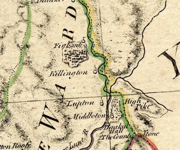 BO18SD69.jpg "The County Stone" no symbol, at the meet of counties Westmorland Yorkshire Lancashire item:- Armitt Library : 2008.14.10 Image © see bottom of page |
|
|
|
||
| evidence:- | old map:- Jefferys 1770 (Wmd) placename:- County Stone |
|
| source data:- | Map, 4 sheets, The County of Westmoreland, scale 1 inch to 1
mile, surveyed 1768, and engraved and published by Thomas
Jefferys, London, 1770.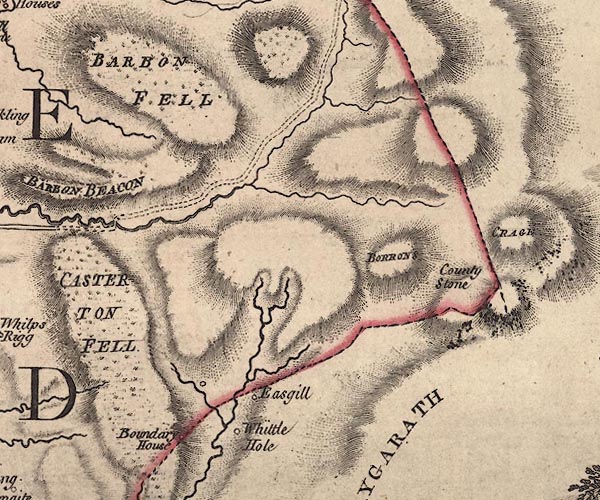 J5SD68SE.jpg "County Stone" boundary stone; on county boundary item:- National Library of Scotland : EME.s.47 Image © National Library of Scotland |
|
|
|
||
 Lakes Guides menu.