 Jefferys 1770 NY81SW

|

|
|
|
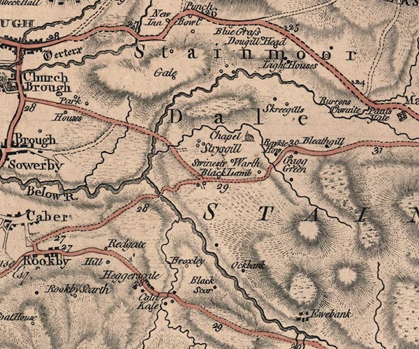
gazetteer links places may or may not be labelled on the map |
||

|
-- Argill Beck |
|
|
|
-- Argill Bridge |
|
|
|
-- Augill Bridge |
|
|
|
-- Barrenthwaite Hall -- "Burrons Thwaite" |
|
|
|
-- Belah, River -- "Below R." |
|
|
|
-- Bleathgill -- "Bleathgill" |
|
|
|
-- Broxty House -- "Broxley" |
|
|
|
-- Coldkeld -- "Cold Kale" |
|
|
|
-- Crag Green -- "Cragg Green" |
|
|
|
-- Dowgill Head -- "Dougill Head" |
|
|
|
-- Heggerscales -- "Heggerscale" |
|
|
|
-- High Park House -- "Park Houses" |
|
|
|
-- Hill -- "Hill" |
|
|
|
-- Howgill Sike |
|
|
|
-- Light Trees -- "Light Houses" |
|
|
|
-- Low Park House -- "Park Houses" |
|
|
|
-- Mousegill Beck |
|
|
|
-- New Hall -- "Black Scar" |
|
|
|
-- Oakbank -- "Ockbank" |
|
|
|
-- Oxenthwaite Bridge |
|
|
|
-- Park House -- "Park Houses" |
|
|
|
-- Powbrand Bridge |
|
|
|
-- Powbrand Sike |
|
|
|
-- Raykle How -- "Raykle How" |
|
|
|
-- Redgate -- "Redgate" |
|
|
|
-- Bowes to Brough |
|
|
|
-- Kirkby Stephen to Tan Hill |
|
|
|
-- Kirkby Stephen to Rey Cross |
|
|
|
-- Rookby Scarth -- "Rookby Scarth" |
|
|
|
-- Skirrygill -- "Skreegills" |
|
|
|
-- Slip Inn -- "Black Lamb" |
|
|
|
-- St Stephen's Church -- "Chapel" |
|
|
|
-- Stainmore Common -- "STAINMOOR FOREST" |
|
|
|
-- Stainmore -- "Stainmoor Dale" |
|
|
|
-- Stricegill -- "Strysgill" |
|
|
|
-- Swinstone House -- "Swinesty Warth" |
|
|
|
-- Thorney Gale -- "Gale" |
|
|
civil parishes The area roughly includes parts of parishes:- Stainmore Brough Brough Sowerby Kaber Winton |
||
|
|
||
|
|
Lakes Guides menu. | |