 Jefferys 1770 NY61SW

|

|
|
|
gazetteer links places may or may not be labelled on the map |
||

|
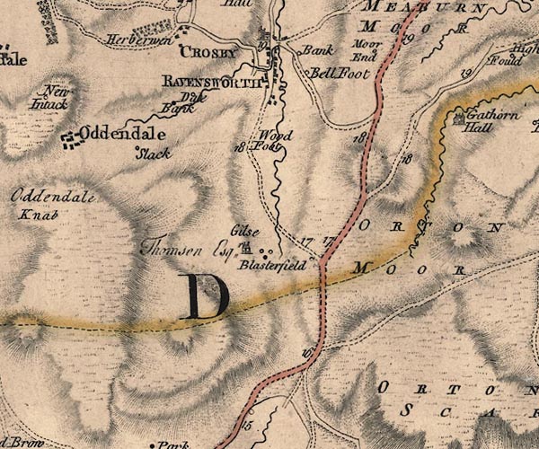
-- Bank, The -- "Bank" |
|
|
|
-- Bell Foot -- "Bell Foot" |
|
|
|
-- Blasterfield Farm -- "Blasterfield" |
|
|
|
-- Crosby Ravensworth -- "CROSBY RAVENSWORTH" |
|
|
|
-- Dalebanks Beck |
|
|
|
-- Gaythorne Plain -- "ORTON MOOR" |
|
|
|
-- Gilts -- "Gilse / Thomson Esqr." |
|
|
|
-- High Dalebanks -- "Dale Bank" |
|
|
|
-- Hulls -- "Moor End" |
|
|
|
-- Low Dalebanks -- "Dale Bank" |
|
|
|
-- Tebay to Appleby |
|
|
|
-- Crosby Ravensworth road |
|
|
|
-- Great Ormside road |
|
|
|
-- Slacks -- "Slack" |
|
|
|
-- Woodfoot -- "Wood Foot" |
|
|
civil parishes The area roughly includes parts of parishes:- Crosby Ravensworth Asby |
||
|
|
||
|
|
Lakes Guides menu. | |