 Jefferys 1770 SD5192I

|

|
|
|
gazetteer links places may or may not be labelled on the map |
||

|
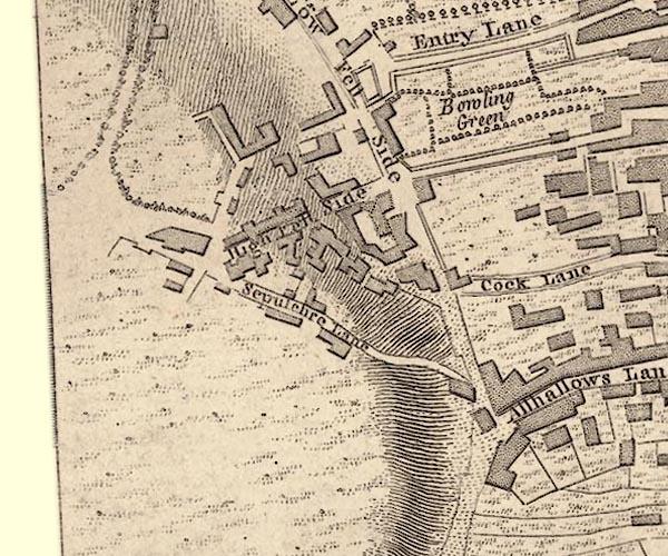
-- bowling green, Kendal -- "Bowling Green" |
|
|
|
-- Kendal Fell |
|
|
|
-- Low Fellside -- "Low Fell Side" |
|
|
|
-- Old Shambles -- "Cock Lane" |
|
|
|
-- Sepulchre Lane -- "Sepulchre Lane" |
|
|
|
-- Syke, The -- "High Fell Side" |
|
|
civil parishes The area roughly includes parts of parishes:- Kendal |
||
|
|
||
|
|
Lakes Guides menu. | |