 Jansson 1646 NY54


|

|
|
|
gazetteer links places may or may not be labelled on the map |
||

|
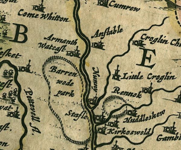
-- Ainstable -- "Anstable" |
|
|
|
-- Armathwaite Place -- "Armanth Watcast" |
|
|
|
-- Baronwood Park -- "Barren wode park" |
|
|
|
-- Croglin Low Hall -- "Little Croglin" |
|
|
|
-- Croglin Water |
|
|
|
-- Eden, River -- "Eden flude" -- "Eden flu."
-- "Eden flud" |
|
|
|
-- Huddlesceugh Hall |
|
|
|
-- Kirkoswald Castle -- "[Kirkoswold]" |
|
|
|
-- Kirkoswald -- "Kirkoswold" |
|
|
|
-- Nunnery -- "Nunny" |
|
|
|
-- Raven Beck |
|
|
|
-- Renwick -- "Rennok" |
|
|
|
-- St John's Church -- "Croglin Church" |
|
|
|
-- Staffield -- "Stafle" |
|
|
civil parishes The area roughly includes parts of parishes:- Glassonby Lazonby Ainstable Cumwhitton Wetheral Cumrew Kirkoswald Hesket |
||
|
|
||
|
|
Lakes Guides menu. | |