 Jansson 1646 NY32


|

|
|
|
gazetteer links places may or may not be labelled on the map |
||

|
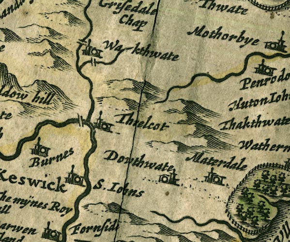
-- Dowthwaitehead -- "Dowthwate" |
|
|
|
-- ford, Wallthwaite |
|
|
|
-- Glenderamackin, River |
|
|
|
-- Lamb Bridge |
|
|
|
-- Matterdale -- "Materdale" |
|
|
|
-- Mosedale Beck |
|
|
|
-- Petteril, River -- "Pettevell fl." |
|
|
|
-- St John's Beck |
|
|
|
-- St John's in the Vale -- "S. Iohns" |
|
|
|
-- Threlkeld Bridge |
|
|
|
-- Threlkeld -- "Threlcot" |
|
|
|
-- Wallthwaite -- "Wakthwate" |
|
|
civil parishes The area roughly includes parts of parishes:- St John's Castlerigg and Wythburn Matterdale Hutton Mungrisdale Threlkeld |
||
|
|
||
|
|
Lakes Guides menu. | |