 Jansson 1646 NY24


|

|
|
|
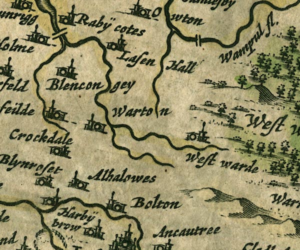
gazetteer links places may or may not be labelled on the map |
||

|
-- Allhallows -- "Alhalowes" |
|
|
|
-- Blencogo -- "Blencongey" |
|
|
|
-- Boltongate -- "Bolton" |
|
|
|
-- bridge, Holme Abbey |
|
|
|
-- bridge, Woodside |
|
|
|
-- Crookdake Hall -- "Crockdake" |
|
|
|
-- Crummock Beck |
|
|
|
-- Harbybrow -- "Harbÿbrow" |
|
|
|
-- Lessonhall -- "Lasen Hall" |
|
|
|
-- Little Waver |
|
|
|
-- Wampool, River -- "Wampul fl." |
|
|
|
-- Waver, River |
|
|
|
-- Waverton -- "Warton" |
|
|
|
-- Westward -- "West warde" |
|
|
|
-- Wiza Beck |
|
|
civil parishes The area roughly includes parts of parishes:- Blennerhasset and Torpenhow Westward Boltons Waverton Wigton Woodside Thursby Caldbeck Ireby Bromfield Allhallows Dundraw |
||
|
|
||
|
|
Lakes Guides menu. | |