 Garnett 1850s-60s NY50


|

|
|
|
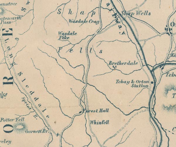
gazetteer links places may or may not be labelled on the map |
||

|
-- Borrow Beck |
|
|
|
-- Bretherdale -- "Bretherdale" |
|
|
|
-- Forest Hall -- "Forest Hall" |
|
|
|
-- Garnett Bridge -- "Garnett Br." |
|
|
|
-- Lancaster and Carlisle Railway -- "Lancaster & Carlisle
Railway" -- "Lancaster & Carlisle Railway" |
|
|
|
-- Kendal to Shap |
|
|
|
-- Shap Fells -- "Shap Fells" |
|
|
|
-- Wasdale Pike -- "Wasdale Pike" |
|
|
|
-- Whinfell -- "Whinfell" |
|
|
civil parishes The area roughly includes parts of parishes:- Shap Rural Whinfell Orton S Tebay Fawcett Forest Longsleddale Grayrigg Strickland Roger Whitwell and Selside Crosby Ravensworth |
||
|
|
||
|
|
Lakes Guides menu. | |